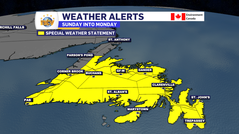

As of just after 6 PM NDT, Hurricane Ernesto was located 400 km southwest of Cape Race and moving toward the northeast at 43 km/h. Maximum sustained winds were 150 km/h, and the central pressure was estimated at 968 hPa.
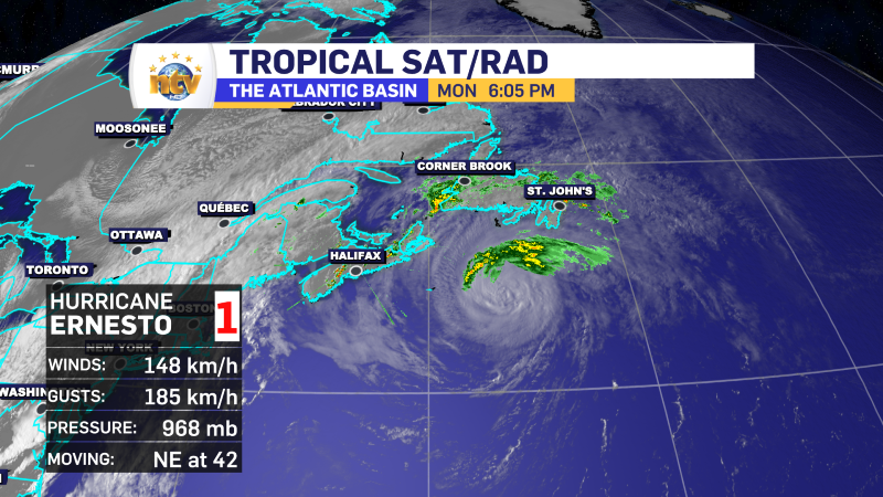
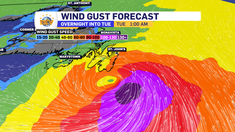
Ernesto will continue on the northeast heading and will pass southeast of the Avalon Peninsula late tonight. This track will keep the hurricane-force wind gusts well offshore. In fact, as of the latest update, Hurricane-foce winds (120+ km/h) only extend outward 75 km from the centre, while tropical storm force winds extend up to 350 km/h from the centre.
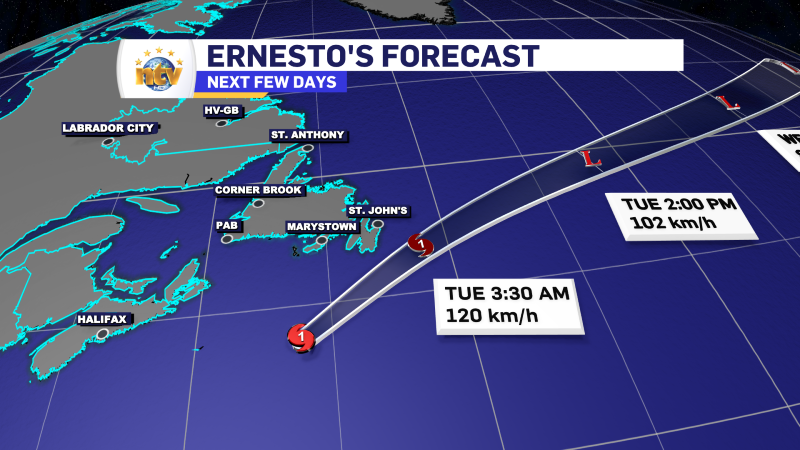
The track and timing will allow Newfoundland to dodge the worst of the storm concerning wind and storm surge. The highest waves will affect the Avalon Peninsula around 3 AM, coinciding with the low tide. In order to get the worst effect of the waves and surge, both the waves and high tide need to be in sync. They are not this go-around. Waves will be in the 2 to 6 metre range overnight before subsiding.

WHAT TO EXPECT FROM ERNESTO
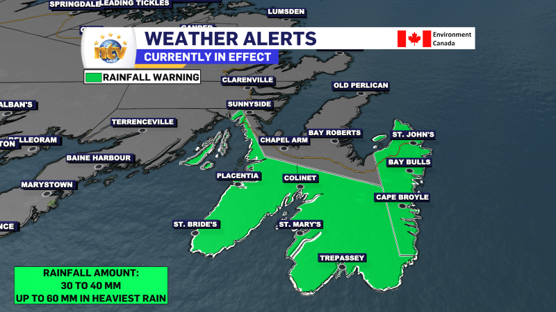
The biggest impact Newfoundland will see from Hurricane Ernesto will be a period of heavy rainfall on the Avalon overnight into early Tuesday. The rain will arrive between 9 and 10 PM and will ease off after 3 AM. Rainfall rates may exceed 25 mm per hour at times in that time frame.
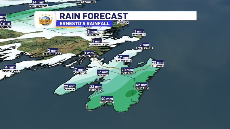
Rainfall amounts may exceed 60 mm on parts of the southeast Avalon. Most other areas of the easternmost Peninsula will see rainfall of 30 to 40 mm. A Rainfall Warning is in effect for all but the Avalon Penisula Northeast.
Wind gusts will peak at 50 to 80 km/h over the East Coast late tonight, which will be in the midnight to 3 AM time frame. Before then and after then, the wind speeds will not be that high. The direction of the strongest winds will be from the east or north.
Ernest will pull away late tonight, setting the stage for a calmer Tuesday across much of the Province. As of now there are no other tropical systems in the Atlantic Basin I’m tracking.
NL Forecast
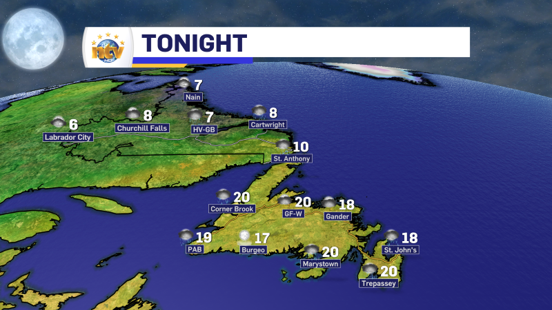
Areas of western Newfoundland will see the rain taper off overnight, while the rain moves into eastern areas. Parts of Labrador, mainly in the southeast, will also see some rain overnight as a cold front moves through. Lows on the Island will be near 20, except near 10 on the Great Northern Peninsula. Labrador will see lows of 6 to 8.
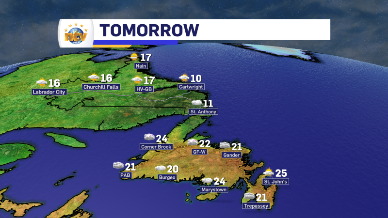
Tuesday will see a sunny day in the Big Land, with highs in the 10 to 16 range. On the Island, highs will be in the upper teens to mid 20s, except teens on the Northern Peninsula. Temperatures will fall for central areas in the afternoon as a cold front moves through. There will be some showers and thunderstorms in the afternoon as well over much of the Island west of the Avalon.
The rest of the week looks unsettled on the Island while the weather in Labrador looks about as good as it gets. THe next chance of organized rain on the Island is Friday. Before that we are looking at more in the way of scattered showers and possible thunderstorms.


