


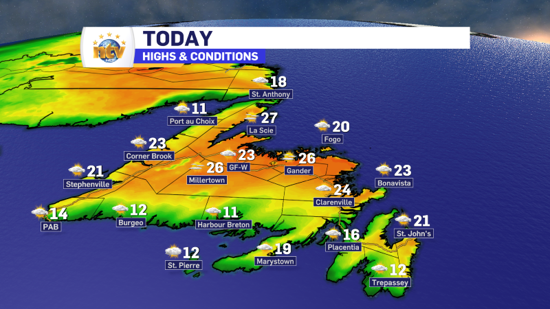
The weather on the Island will be quite nice to close out the week. Many areas will see highs in the lower to middle 20s. The exception will be west and southwest-facing shores where onshore winds will hold temperatures into the middle teens. Expect an abundance of sunshine.
Meanwhile, in Labrador we are waking up to some good news. The TLH, which was closed between Churchill Falls and Labrador City due to a fire, is now open. The RNC tweeted out the update on the road earlier this morning.
Multiple new fires broke out in Labrador West yesterday due to lightning strikes. There were two that I know of that were started near Churchill Falls. An additional fire was ignited in eastern Quebec, south of Labrador City and Wabush. The latest map from the NL Widlfire Dashboard shows where the active fires are located.

The forecast for Labrador today is warmer in some spots and cooler in others. However with that will come some afternoon showers and thunderstorms between the coast and Labrador City and Wabush. Highs will range from the teens to lower and middle 20s. In fact, Upper Lake Melville will end up near the upper 20s this afternoon.
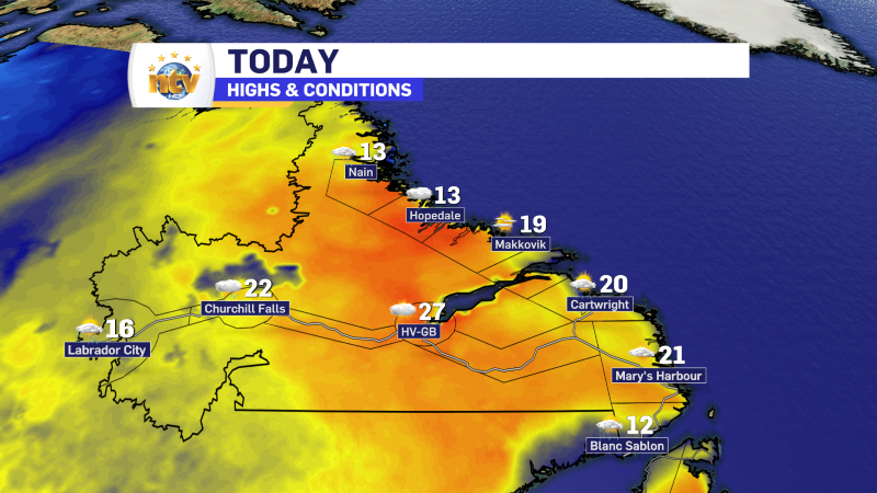
The good news for today is that the fire weather index is much lower than the last few days. It will be highest where it’s warmest, which is to the east of where the new fires were started yesterday.

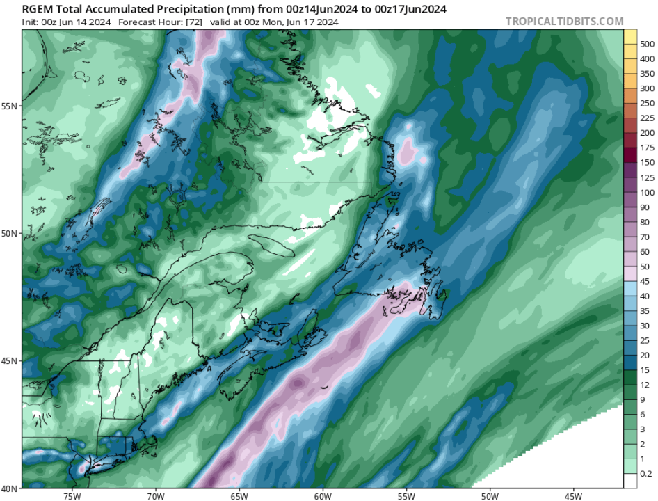
Beyond today, we are looking at the potential of heavy rain over much of the Island from Saturday afternoon through Sunday. As of this morning, it looks like a widespread 15-30 mm is on the way, with amounts near 50 mm possible over parts of the Burin and Avalon Peninsulas. This may change so stay tuned for updates.
-

Hot and humid start to the weekend
The Island will see sunny skies to start today. There are a few fog patches…


