
Post 4 – 6:50 PM NST (5:40 PM AST)
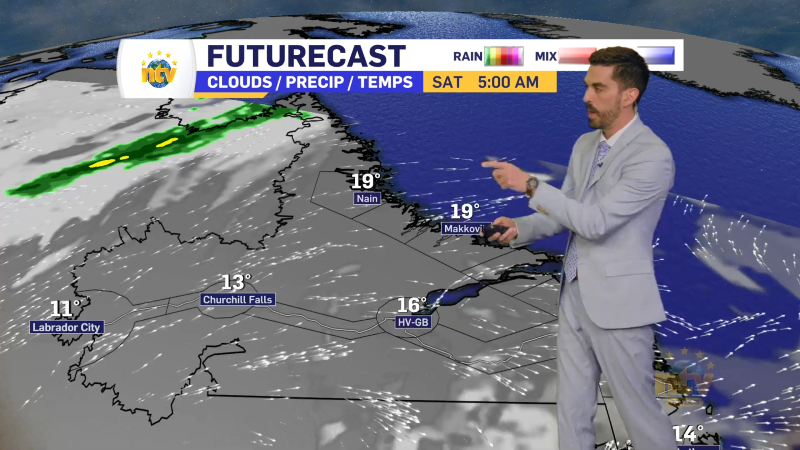
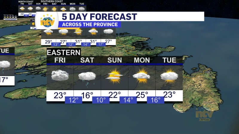
The weather this weekend and next week looks rather uneventful across the Province, with no major weather in play. That being said, some Labrador and northeastern Newfoundland areas will see appreciable snowfall between tonight and early Sunday.
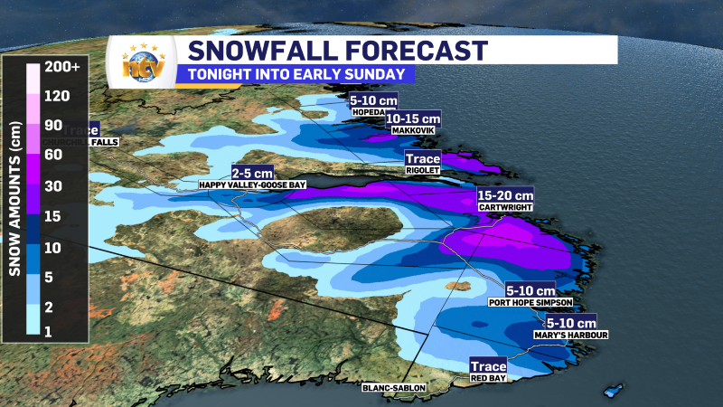
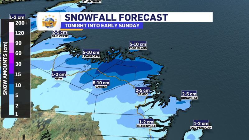
Your full forecast can be found in the video at the top of this post, which will be posted Friday evening. But overall… don’t expect drastic changes compared to the last few days.
Post 3 – 4:25 PM NST (3:55 PM AST)
Radar indicates we are seeing precipitation in the form of rain and snow across eastern areas of the Island this afternoon. Temperatures indicate it’s likely a mix of rain and snow for most areas. Snow is likely sticking in the higher terrain, while the lower elevations are seeing rain or a rain/snow mix.
Post 2 – 1:55 PM NST (1:25 PM AST)
It was a windy night on the GNP and in the southern coastal areas of Labrador. Rodney Barney, a Meteorologist with the ECCC NL Weather Office in Gander listed some peak wind gusts and they are as follows:
- St. Anthony: 118 km/h
- Red Bay: 105 km/h
- Mary’s Harbour: 102 km/h
- Blanc-Sablon: 100 km/h
- Rigolet: 98 km/h
- Ferolle Point: 94 km/h
Post 1 – 6:09 AM NST (5:39 AM AST)
Good Friday morning!
We are waking up to areas of snow across the Island this morning and the road conditions via 511NL.ca show various roads are being reported as snow-covered or partly snow-covered. Routes 510 and 516 in Labrador are marked as ‘travel not advised’ due to snow and poor visibility.


The snow (and rain) will continue across the Province today as moisture streams into Labrador from the North Atlantic and a weak area of low pressure traverses the Island from north to south. Temperatures will be a few degrees below freezing in Labrador and near or a bit above freezing on the Island. Futurecast (below) shows this playing out over the next 24 hours or so.


