Post 3, 6:21 PM NST (5:51 PM AST)
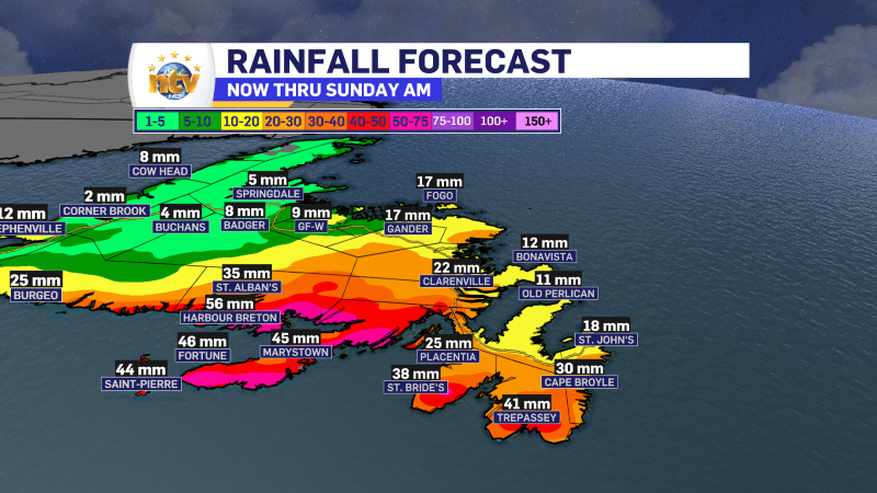
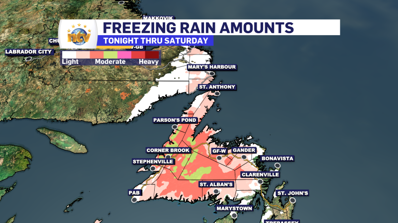
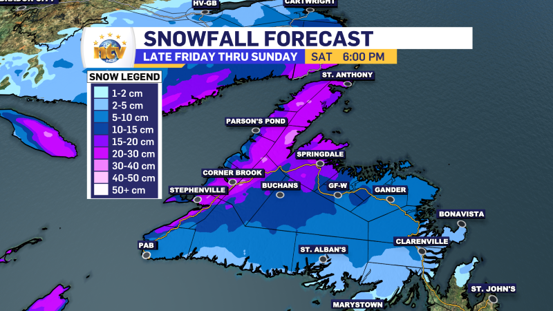
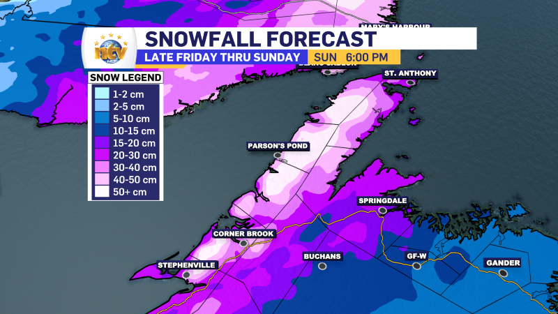
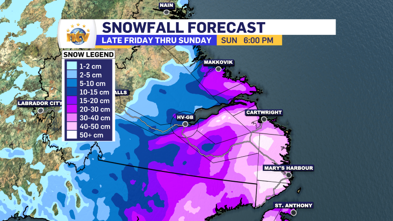
Here is a look at the expected rain, ice, and snow totals from late tonight through Sunday. There are two snowfall maps for Newfoundland. Once shows how much snow will fall by 6 PM Saturday. The second shows how much will fall through 6 PM Sunday. The totals will be higher on the second map due to the onshore snow becoming a factor later on Saturday and Sunday. Snow will be significant from both sides of the storm on the West Coast. Parts of southeast Labrador will pick up more than 40 cm of snow.
POST 2, 4:39 PM NST (4:09 PM AST)
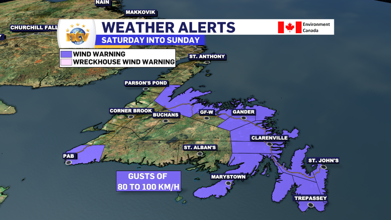
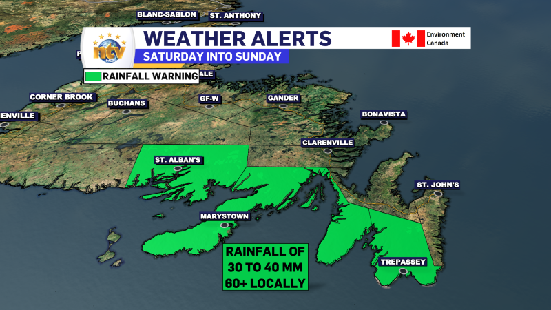
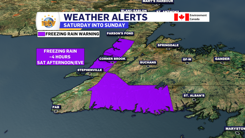
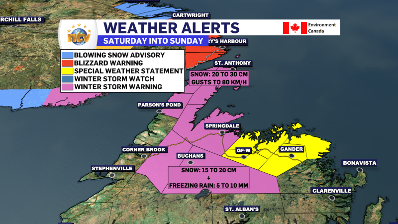
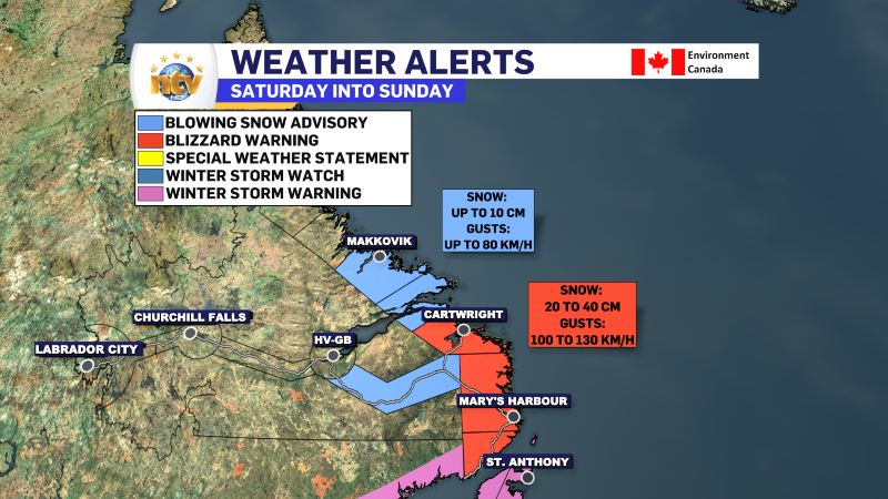
Multiple weather alerts have been issued for Saturday into Sunday across the Province. The images below this text paint the picture. A link to the alerts can be found in my first post of the day.
POST 1, 2:13 PM NST (1:43 PM AST)
The weather across the Province this afternoon is quiet and chilly. An area of high pressure sitting over southern Quebec dominates the region’s weather pattern. You can see this clearly via the clockwise flow of the wind field in the image below.
Temperatures (as of 1:30 PM NST) are running quite a few degrees cooler than yesterday and some flurries are flying over eastern areas of the Island, particularly on the Avalon Peninsula.

Multiple weather alerts are in effect for the weekend because a strong low is going to move through the region. Special Weather Statements and Winter Storm Watches are in effect along with Rainfall, Wind, and Freezing Rain Warnings. I’ll have a detailed post on this within the hour. Details from ECCC can be found here.


