


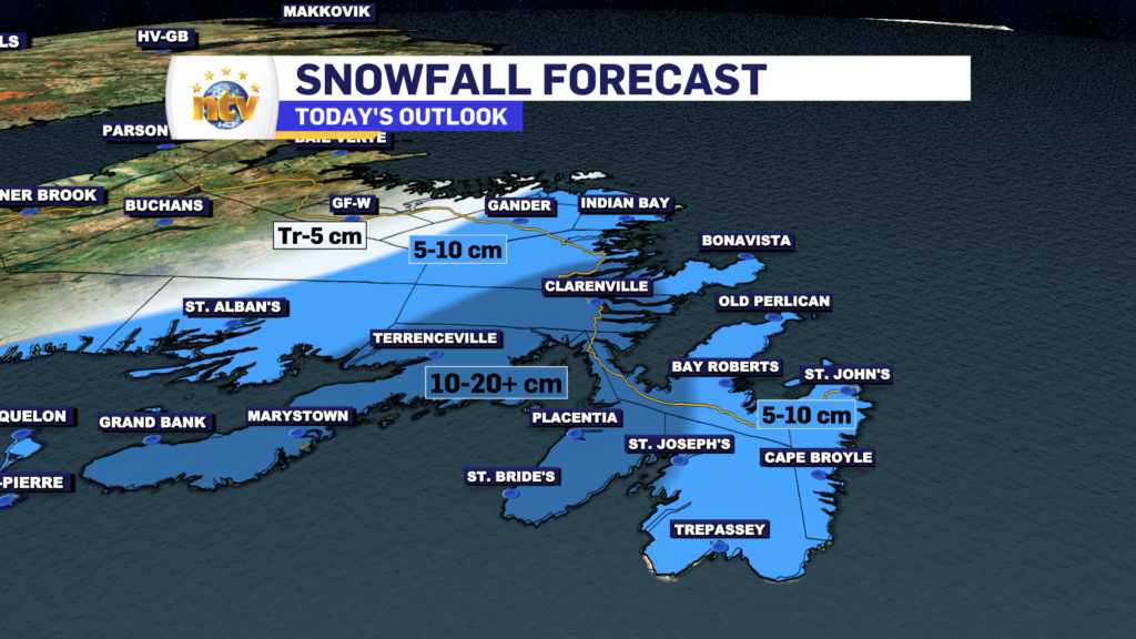
Looking at the latest guidance, it appears there has been a bit of a westward shift in the heaviest snowfall. The St. John’s Metro likely sees less snowfall (10 cm or less) rather than more. Heavier amounts (10-20+ cm) will likely be over the southwestern Avalon Peninsula, the Burin Peninsula, Clarenville, and northwest toward parts of Bonavista Bay. Some areas will see as much as 30 cm.
The snow should be done with, for most areas, between 7 and 9 PM this evening, and then some flurries will develop in the westerly flow.
This is one of those events where small changes in a low’s track can have big differences in the forecast and where the heaviest snow will fall.
-

Hot and humid start to the weekend
The Island will see sunny skies to start today. There are a few fog patches…


