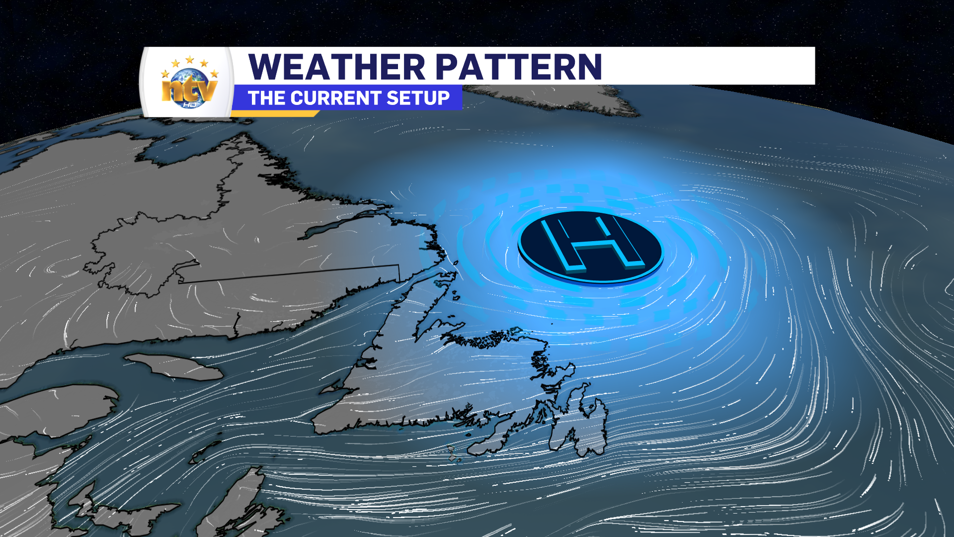
An area of high pressure north of the Island is going to keep the onshore, easterly flow, on the go for the next couple of days. While this will not result in significant weather rolling into the Island, it will keep the skies cloudy, drizzle frequent, and fog possible along and near east-facing shorelines.
Lows will be in the lower to middle teens on the Island overnight, and areas of drizzle will be common for most areas, but it’ll be most prevalent along and near east-facing shores. Fog will also be around too.
Meanwhile, in Labrador, expect partly cloudy skies and lows of 6 to 10 tonight.

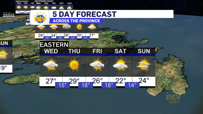
Wednesday will be similar to today across the Island. We can expect more showers, clouds, drizzle, and fog thanks to the onshore flow. Highs will be in the middle to upper teens. There may be some sunny breaks on the West Coast and southwest coast, and the western side of the GNP.
Labrador will see a decent day, with highs in the middle teens under sun and cloud. There will be some showers in the west late in the day.

Looking into Thursday and Friday, the weather generally doesn’t change a whole lot on the Island as the wind direction remains the same. There will be some rain in Labrador on Thursday and potentially again in the west on Friday. Highs remain in the teens and may creep toward the 20s in some areas to close out the work week.
As we look ahead to the weekend, all eyes will shift to Hurricane Lee, which as of this writing, is still a category 3 hurricane about 900 km south of Bermuda.
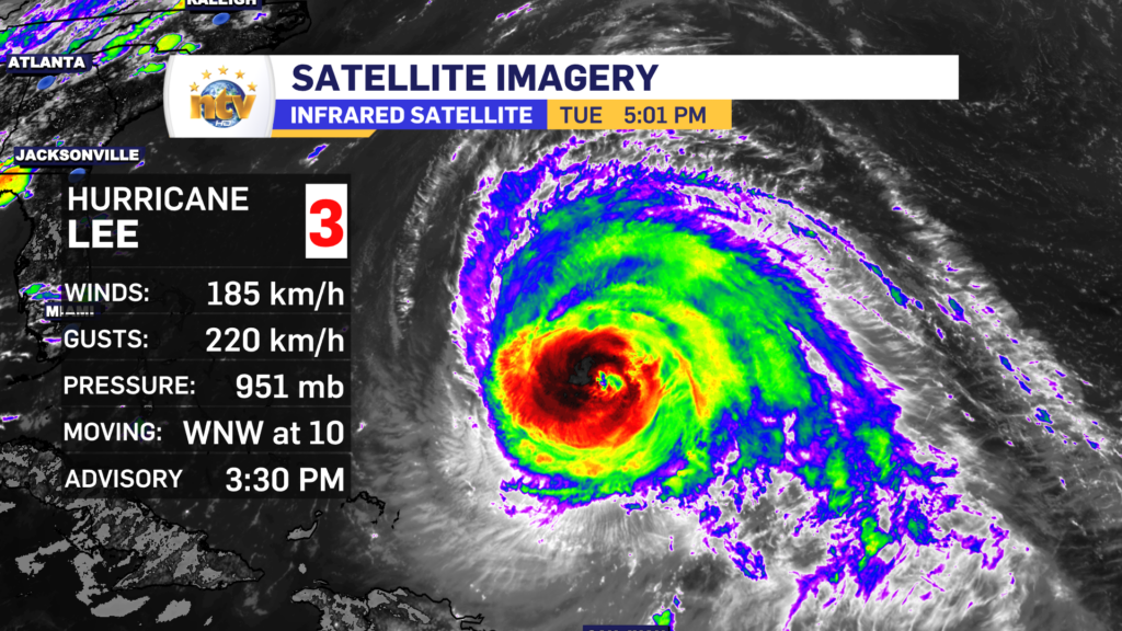
Lee will turn north in the next 24 hours and begin to gain latitude, accelerate in speed, and lose strength as it leaves the warmer waters behind. Current indications are that Lee will track to the north and make landfall late Friday or early Saturday anywhere between Nova Scotia and Maine.

While there is agreement on where the storm is going to go, to a point, we still don’t know where it will go and thus where the highest winds, heaviest rain, and highest waves will be. All of that will determine where the greatest risk for flooding and power outages lies. That will get more clear in the next couple of days.
What I do know is that NL looks to be outside of the direct impacts from the system, for the time being. It does look like we may see some rain and gusty winds from Sunday into Monday and the remnants pass over the Province. However, and again at this time, this should be nothing out of the ordinary for the Province.
Stay tuned for more updates.
-

Unsettled for most of the province today
There will be a risk of some morning showers along the west coast of the…