
The weather across much of the Province will be chilly and calm this week. In fact, it looks like readings through Thursday or Friday are going to be running below normal by a few degrees on the Island and a touch above in Labrador. However, even with that, temperatures will still be topping out below freezing for most of the Big Land.

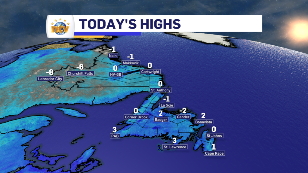
Monday was no slouch in the cold high department, with most areas of the Province reaching near or staying below freezing throughout the day. On the map below, it says St. John’s had a high of 0°, however, that’s not entirely true.

The high at St. John’s peaked today at -0.4°, which is certainly below normal (7°) but nowhere near the all-time lowest high recorded on today’s date.
While being below normal, this isn't even close to the lowest high ever recorded on today's date, which is -3.3° set in 1954. #nlwx https://t.co/HcYccFK3aw
— Eddie Sheerr (@EddieSheerr) November 13, 2023
The rest of this week will be similar to today across the Province. Expect various amounts of sun, but generally mostly cloudy skies. There will be scattered flurries on the West Coast, Northeast Coast and East Coast of the Island through Wednesday. That may change to pockets of freezing drizzle Wednesday night as temperatures warm up aloft just a tad.

The next chance of any significant weather will not arrive until the weekend. And at that point, we’re looking at rain over the Island and the potential of rain and snow in Labrador.

And speaking of that, there was talk of a strong storm possible during the middle part of this week. That storm is still going to happen, but it’s going to be far enough offshore that it will not impact the weather across the Province. If it were closer to the Avalon, this week would’ve looked much different over parts of the Island.


