While Newfoundland sees sun, parts of Labrador experience winter-like snow Thursday

Ryan Harding, NTV Weather Centre
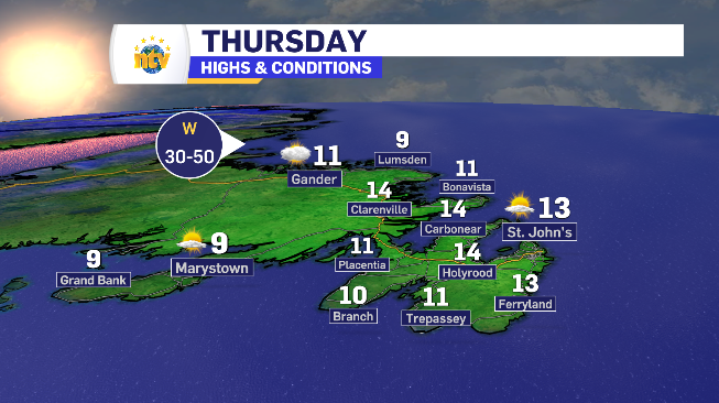
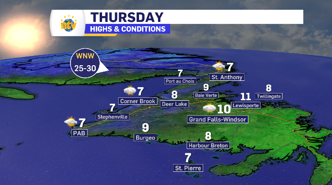
Clearing skies for Newfoundland Thursday, cooler day for West Coast
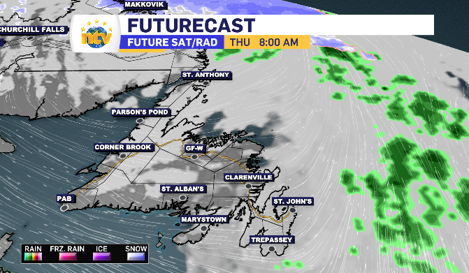
A few clouds linger across the island to start Thursday, pushing clear by the afternoon for a healthy dose of sunshine.
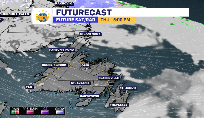
The southeast wind that has been keeping the Avalon cool over the past few days shift southwest before becoming west and north west. This is going to cause a swap in the temperature distribution for Newfoundland Thursday. Since it will result in wind off the water for the West Coast, that region isn’t going to have the same ceiling as the eastern side and eastern facing portions of Newfoundland.
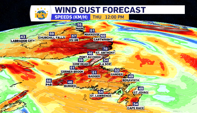
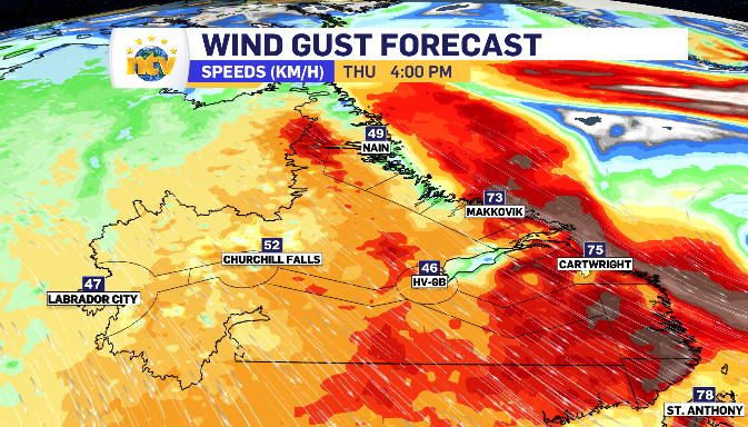
That wind comes with a bit of a pace as well. As the day goes on the speeds increases, topping in Newfoundland in the 50-70km/h range.
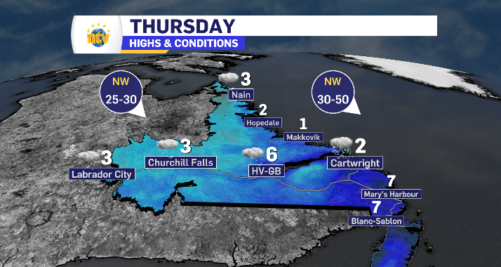
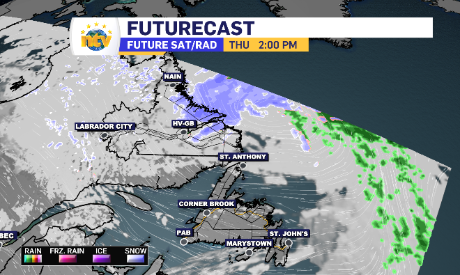
Rain turns to snow, triggering alert for Coastal Labrador into Thursday
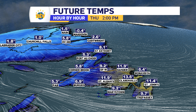
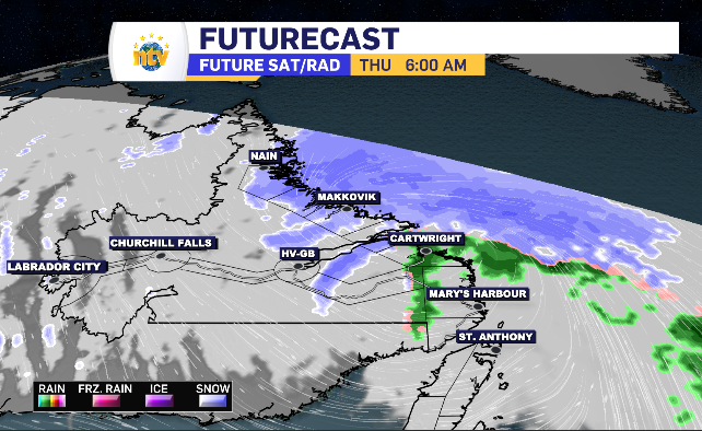
The wind is also expected to pick up across Labrador Thursday with the strongest gusts anticipated along the coastline. With the low-pressure system moving through, the north and northeast wind is going to drop the temperature close to and below the zero mark, allowing rain to transition into snow.
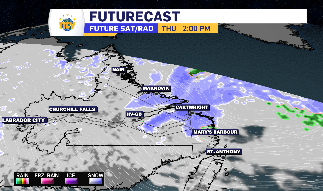
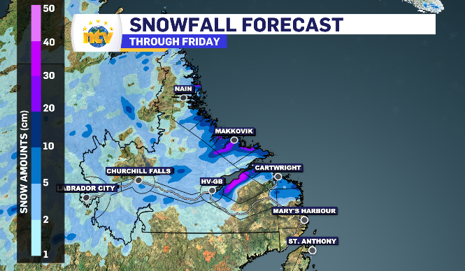
The transition is going to work it’s way down the coastline, with the most time spent under snow coming to the Makkovik region. The anticipated accumulation totals will reflect that.
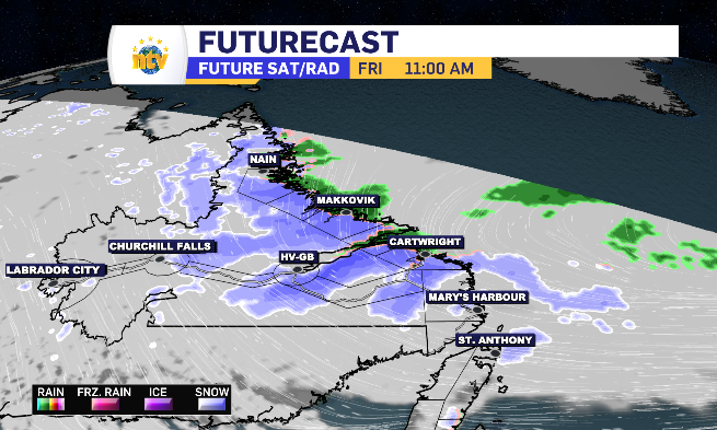
After a quick break late Thursday, the snow returns. This time, transitioning out of snow and into rain as temperatures return above zero for a messy mix.
The wind added with the snow potential has issued a special weather statement from Environment Canada for Natuashish to Postville – Makkovik.
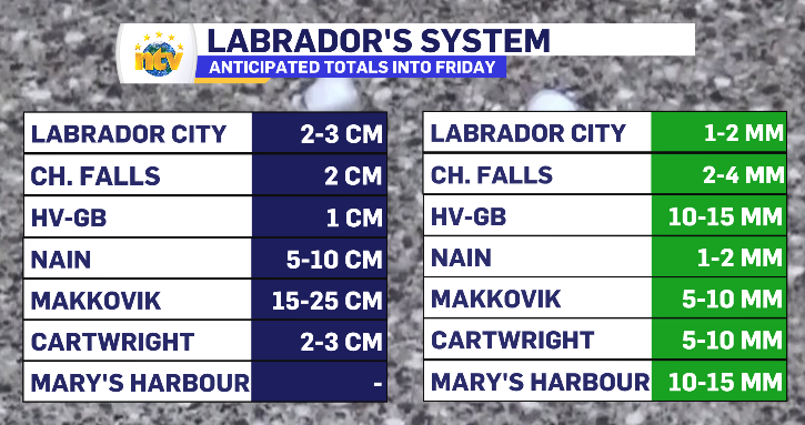
Anticipated totals for Labrador through Friday’s end
Newfoundland and Labrador’s daytime highs for Thursday