Another spring storm brings 20 cm plus to Avalon Friday into Saturday

Ryan Harding, NTV Weather Centre
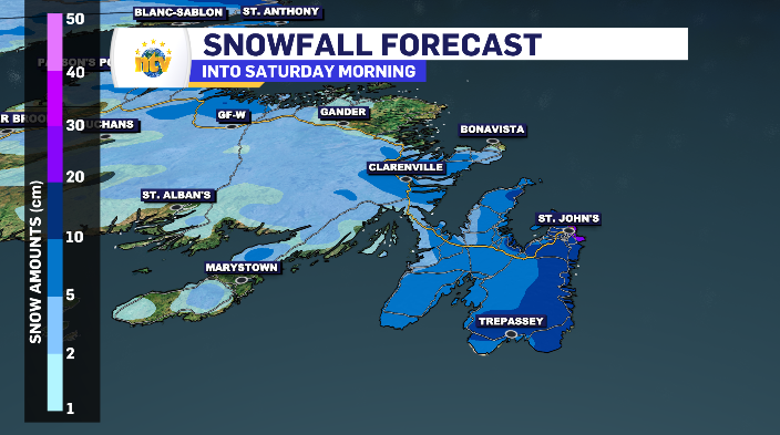
Hopefully we still have our winter tires on. A range of 15-30 cm is possible across the Metro region and Avalon peninsula as a whole Friday through to Saturday morning as another spring low-pressure system drops snow once more as we head into the weekend.
Friday brings spring snow for eastern Newfoundland
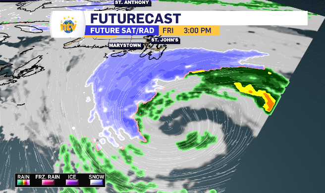
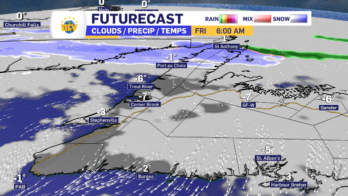
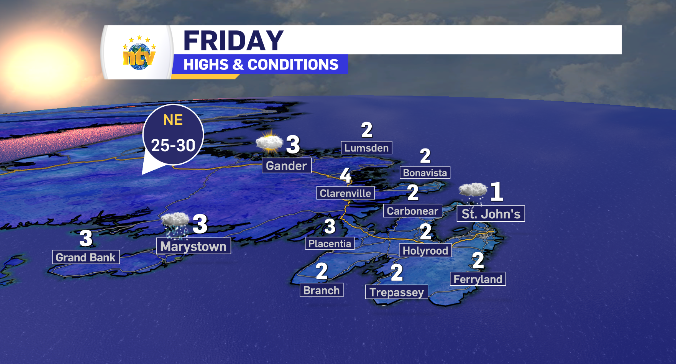
Friday’s system looks to make landfall on the southern portion of the Avalon late Friday morning, moving north into the Metro and CBN region as flurries by late Friday afternoon.
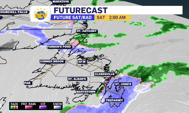
The final totals will be determined by how much time is spent under the higher snowfall rates, closer to the centre of the system. In other words, we’re still watching how this tracks.
With that said, the totals for the eastern side of the Avalon look to fall within the 15-20 cm range, with that total rising slightly with some continued, lighter, snowfall into Saturday morning. The heaviest snowfall rate for the region is forecasted for the overnight.
The wind stays relatively manageable, in the 40-60 km/h range. However, like most low-pressure systems, the wind increases along the Southern Shore and along the Bonavista Peninsula Friday evening to the tune of 70-90 km/h.

More quiet, but still mixed bag for the rest of Newfoundland leading into weekend
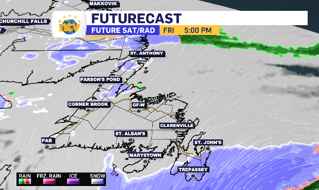
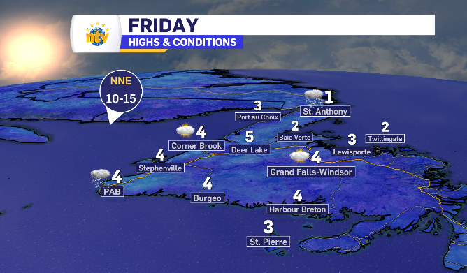
Friday actually starts with some sunny breaks for most of the coastlines and parts of Central Newfoundland Friday. There is some left over snow to get through on the Great Northern Peninsula which carries some freezing rain and rain behind it as temperatures briefly jump above zero throughout the day.
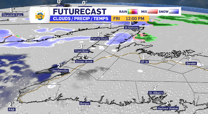
Clouds close in for the island as a whole by the afternoon and light flurries can be expected on and off into Friday afternoon and evening.
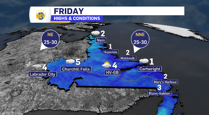
Day time highs for Newfoundland and Labrador Friday
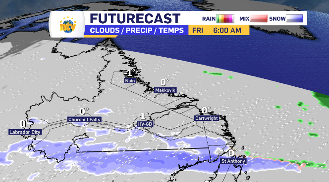
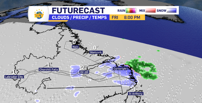
Warming temperatures across Labrador brings moderate mix of conditions Friday
There is some snow to get through first thing Friday morning for the south coast to the tune of 5 cm or so, left over from the overnight. It’s the same snow passing through the Northern Peninsula in Newfoundland. Flurries pass here and there across inland Labrador but as the temperatures rise above zero through the day, there is likely some moments of light rain and drizzle as well.
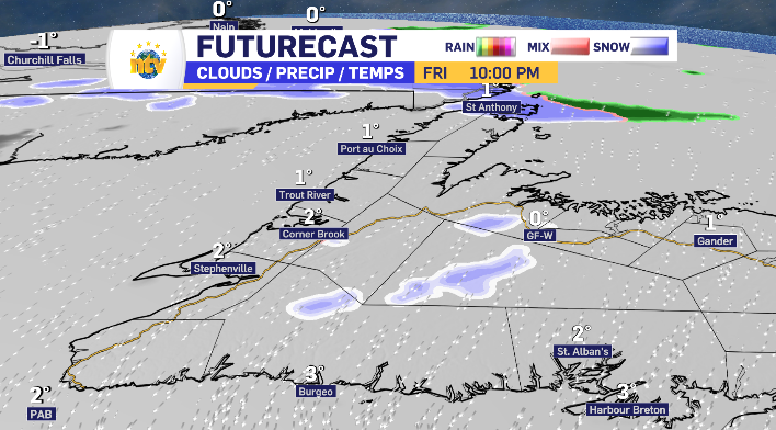
Coastal Labrador has snow making landfall Friday evening, with a transition of rain and freezing rain behind it.
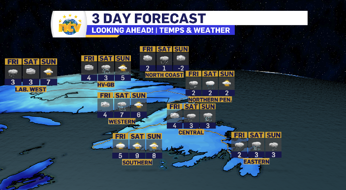
Messy weekend ahead for Newfoundland and Labrador
The weekend brings both snow and rain for most of Newfoundland and Labrador as shown by the three day forecast below.
We’ll have a full weekend look ahead tonight at 5:30 pm on NTV’s First Edition and at 6:00 pm on the NTV Evening Newshour.