Quiet Thursday for most of Newfoundland as snow moves across Labrador

Ryan Harding, NTV Weather Centre
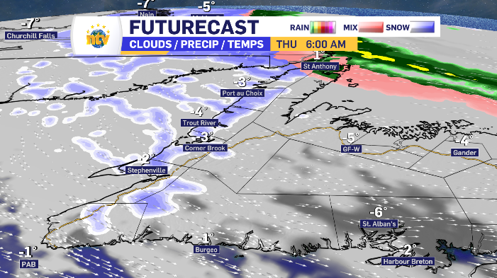
Most of Newfoundland stabilizes Thursday with the exiting low-pressure system. However, flurries hug the west coast while there is a consistent stream of snow moving across the Great Northern Peninsula. All the while, the system that plagued Newfoundland Wednesday, spends Thursday moving its way across Labrador.
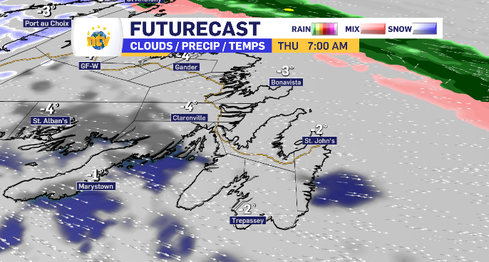
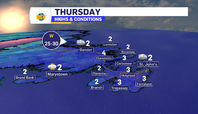
Cloudy with limited sunny breaks for eastern Newfoundland Thursday
The northwest wind that cooled things down Wednesday night shifts west but stays limited in terms of a speed Thursday. This has day time highs back above zero. Cloud looks to have breaks for the southern portion in the morning, with gaps closing into the afternoon for a grey day.
With moisture still in the air, left over from Wednesday’s low-pressure system, brief isolated flurries are possible with little to no accumulation.

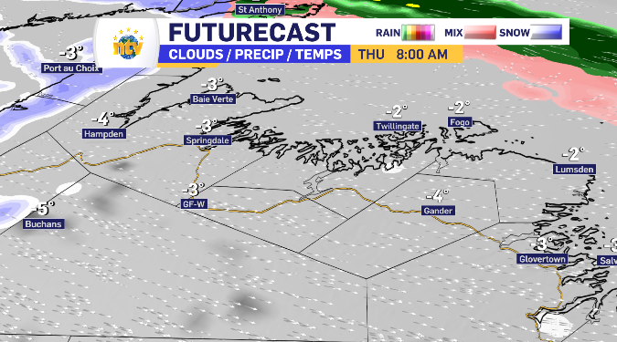
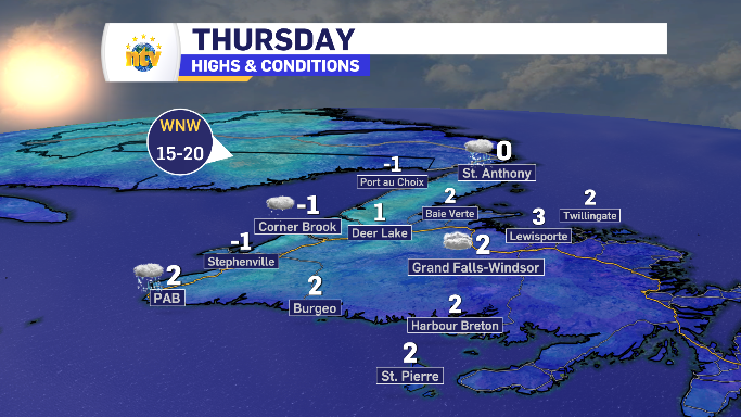
Cloud blankets Central Newfoundland Thursday
Conditions are almost copy and past in Central. The ceiling isn’t quite as high for the day time highs. The cloud sticks early and lingers, isolated brief flurries are again possible with moisture in the air and the clouds to provide the vessel.

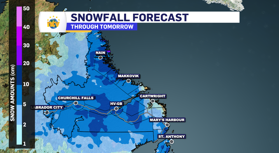
Flurries linger across south and west coast while Northern Peninsula sees more snow accumulation Thursday
Flurries fly early Thursday along the west and south coast, tailing off of the low-pressure system now moving across Labrador. The totals are limited to 2-4 cm, it’s more about consistency than snowfall rate. The day time highs mostly remain below zero as the shift of west wind is off the water, brining cooler air across the west region.
A little more activity and accumulation is likely closer to the closer line, specifically north of Corner Brook in the Trout Rive to Parsons Pond region.
East of Port aux Basque, the flurries look to stay away. There appears to even be an early sunny break across the Connaigre Peninsula.
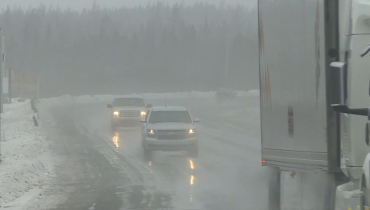
The Northern Peninsula is the unfortunate recipient of a stream of rain, freezing rain and snow that is being directed by some contradicting winds across a fairly isolated region. What starts as a rain and freezing rain mix has a long run way, passing the very north of that region and transitions into snow, dropping another 5-10 cm throughout the late morning, afternoon and into the evening.


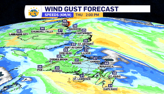
Limited winds across Newfoundland and Labrador Thursday
Though shifting, the winds remain relatively light Thursday. Newfoundland sees an average of 20-40 km/h initially from the northwest, moving west by late morning. These winds reduce even further into the evening. The north coast Labrador leads the way with east winds hitting land at a 40-60 km/h gust rate.

Newfoundland and Labrador’s day time highs for Thursday

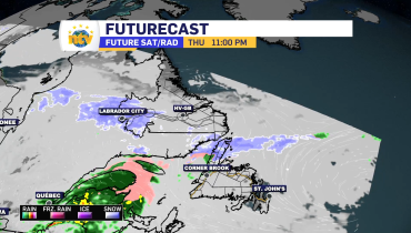
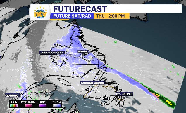
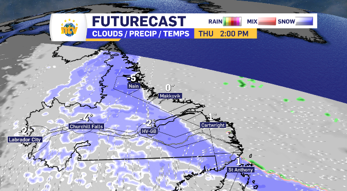
Rain, freezing rain and snow moves across Labrador Thursday
Labrador’s Thursday replicates Newfoundland’s Wednesday. Snow moves inland east to west while rain and freezing rain spends the day traveling along the coast line.
By Thursday morning, the south coast’s snow is forecasted to turn into that wet, freezing mix and continue the trend further north. Nain looks to stay cold enough to see snow start to finish.
As Thursday rolls on, the snow moves through Happy Valley-Goose Bay and into Labrador West and transition into flurries with limited accumulation. Those totals are shown below.

Related Articles