Messy Wednesday mixes snowfall and freezing rain alerts across Newfoundland and Labrador

Ryan Harding, NTV Weather Centre
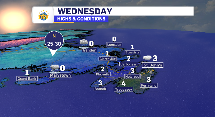
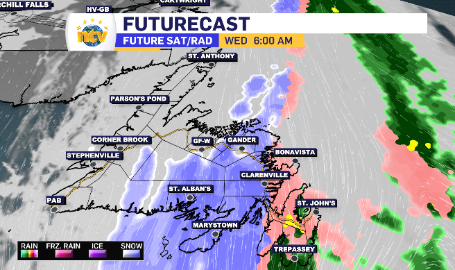
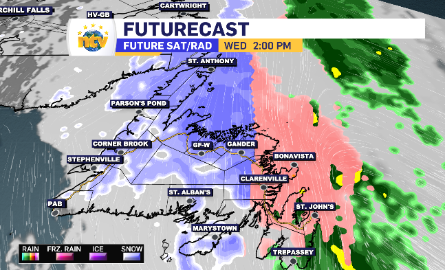
The latest low-pressure system moves in over Newfoundland Wednesday from the south and has the island divided between snow and freezing rain alerts as temperatures dance around the freezing mark.
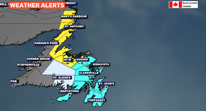
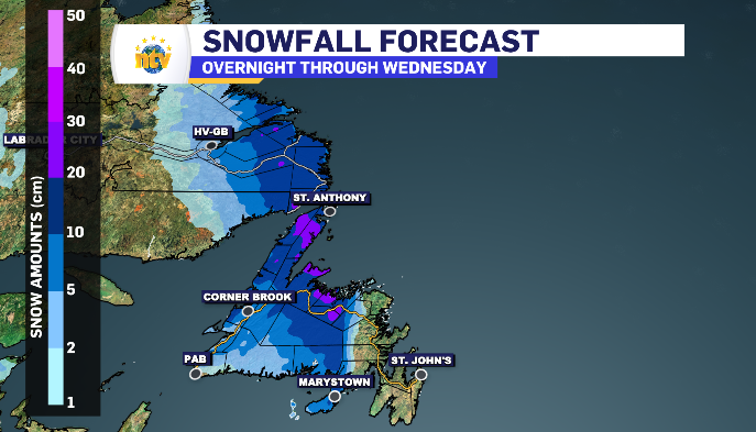
Some areas, like the Burin Peninsula, are looking at moments spent under all three conditions Wednesday. There is a line, somewhat between Grand Falls-Windsor and Gander, that dictates whether the day’s weather will have an emphasis on snow or freezing rain. The day’s ceiling in terms of temperature has a lot to do with which condition will spend the most time over your community.
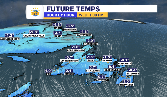
Newfoundland and Labrador daytime highs
Newfoundland divided between snow and freezing rain Wednesday, alerts issued for both
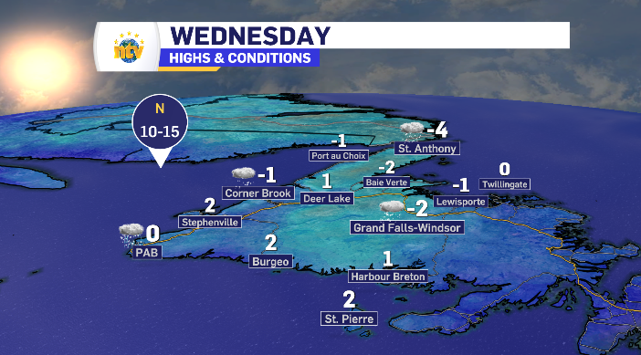
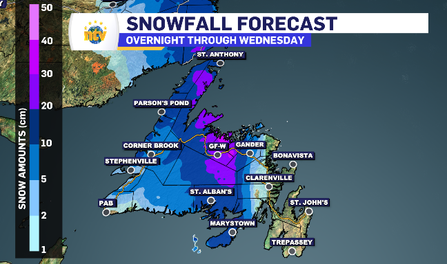
The line that divides the snow and freezing rain isn’t exactly clear cut. At times looking ahead it appears to be between the towns of Grand Falls-Windsor and Gander, while some models showcase Gander finding itself in front of that line. The difference is about 5-10 cm extra. This will depend on the tracking of the system as well as if the temperature can inch closer to the zero degree mark or stays below zero.
Regardless, the system starts as snow on the Burin Peninsula before transitioning, while east of that region, it’s a freezing rain into rain morning into the afternoon.
West and north of Grand Falls-Windsor will exclusively snow with totals ranging from 10-25+ cm.
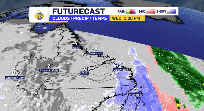
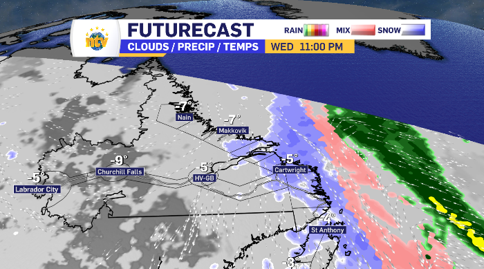
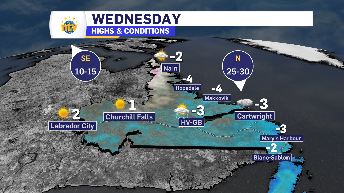
Snow for coastal Labrador Wednesday, Labrador West enjoys sun
It takes longer to reach coastal Labrador, but the snow does make landfall late Wednesday afternoon, with temperatures cold enough to allow for the snowfall. The totals reflect similar to the Great Northern Peninsula, with the coastline having potential to see freezing rain through the evening and overnight.