Light snow moving across Newfoundland Wednesday

Ryan Harding, NTV Weather Centre
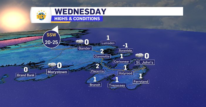
Snow take the Wednesday to move across the island with limited accumulation, however, it does arrive in the Metro region just in time for the commute home.
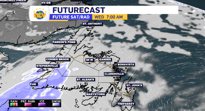
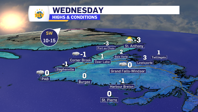
The light snow kicks off along the South Coast first thing Wednesday morning, extending as flurries into parts of the West Coast by sunrise. By late morning, the flurries are looking to stretch through to parts of Central and into the Baie Verte Peninsula while some higher snowfall rates are beginning along the Burin Peninsula.
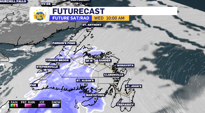
The Avalon, and specifically the Metro region, is held out of the snow until late afternoon. That snow holds a light snowfall rate and lasts for three to four hours, spending the commute home accumulating the 3-5 cm’s.
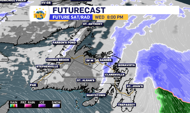
There are a few opportunities across the province, mostly in some higher elevated areas, to push past the 5 cm mark and head closer towards 10 cm. With that said, the majority of the island will experience 5 cm or less.

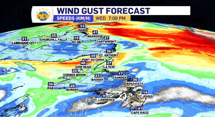
Limited winds accompany the limited snow for Newfoundland Wednesday
All in all the wind won’t be that bad either. As always, the highest wind comes on the back end of the system, with the Bonavista and southern portion of the Avalon Peninsula seeing wind speeds breach the 40 km/h mark. Meanwhile, a similar wind increase is seen along the western wise of the Northern Peninsula.
That wind shifts from the west to a southwest and south wind as it moves across the province, which has temperatures increasing into Thursday and Friday.
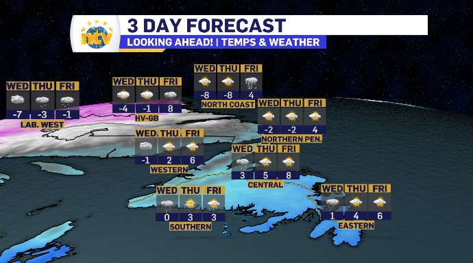
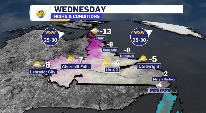
Sun and Cloud continues across Labrador Wednesday
It’s a day of sun and cloud across Labrador as a whole Wednesday, with cloud increasing over Labrador West as the day rolls on.
That incoming cloud does stretch across the Big Land into Thursday which sets the table for some light snow that takes 24 hours to reach coastal Labrador.
Wednesday’s day time highs for Newfoundland and Labrador