Snow returns to Newfoundland Wednesday for another Spring accumulation

Ryan Harding, NTV Weather Centre
Another bought of snow moves over most of the island Wednesday, however, this time around the wind is limited and so too are the final totals, relatively.
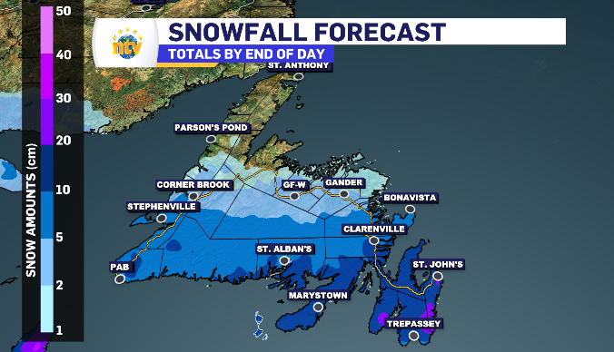
Newfoundland’s snow Wednesday ranges from 5-20 cm
Wednesday’s anticipated totals:
Metro region: 15-20 cm
Southern Avalon: 10-15 cm
Clarenville: 10-15 cm
Bonavista Peninsula: 5-10 cm
Burin Peninsula: 10-20 cm
Connaigre Peninsula: 10-15 cm
South Coast: 10-15 cm
West Coast: 5-10 cm
Grand Falls-Windsor: 5 cm
Gander: 5-10 cm
Kittiwake Coast: 5 cm
Twillingate/Fogo Island: 1-3 cm
Baie Verte Peninsula: 1-3 cm
Wednesday’s highest snowfall totals is forecasted for the southeastern side of the island. the west to east moving system is up against a northeast wind entering over the Avalon, allowing more time spent under the snowfall and insuring the temperatures, mostly, stay below zero.
The exception to the temperature rule is the very southern portion of the Avalon and Burin peninsula where we could see a transition into freezing rain throughout the afternoon, lowering the snowfall total in those regions.
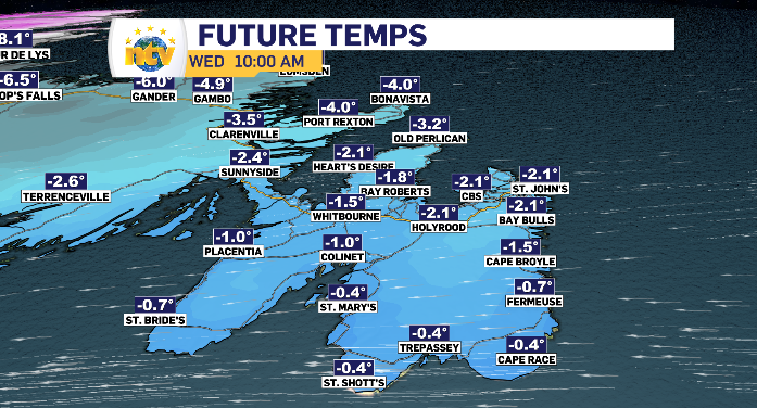
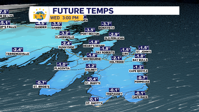
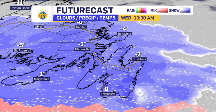
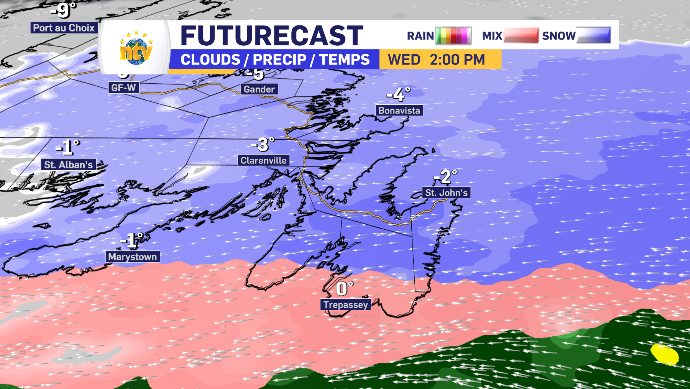
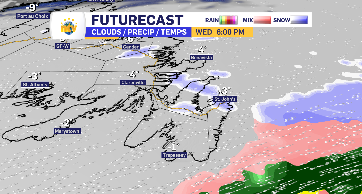
By 10 am Wednesday morning, the Burin, Avalon and Bonavista Peninsula is into the snow with some of the heaviest snowfall rates arriving in the early stages of the snowfall. By early afternoon the transition of freezing rain is expected along the Southern Shore, however, there is an off possibility of this transition remaining offshore. The snow is behind us by the supper hour, simply leaving some final light flurries through the evening.
Snowfall starts along Newfoundland’s south and west coast in Wednesday’s early hours
Flurries in the late overnight hours turns to a higher snowfall rate by sunrise for the south and west coast. An early start means an early finish with flurries putting the final touch on the totals by mid afternoon.
Western Newfoundland is in the 5-10 cm range, while the south coast is facing an added 10-15 cm range.
Central Newfoundland finds it’s self in the 5-10 cm range while spending the day under relatively light snowfall rates. Consistency is the key over heavy snowfall.
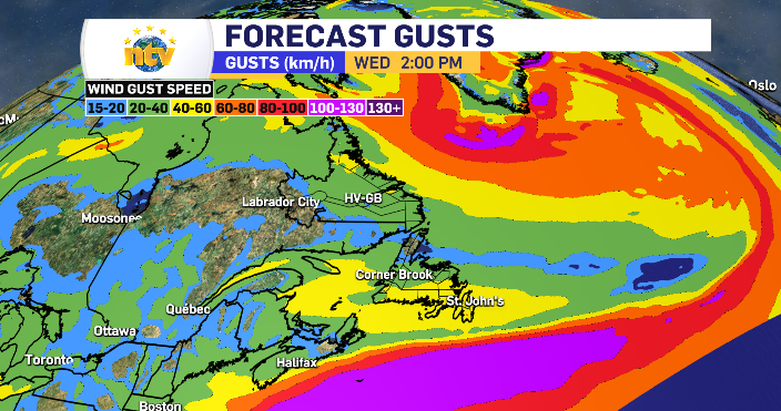
Limited winds this time around for Newfoundland
The latest low-pressure system isn’t bringing the high winds that the province has become accustom to over the past winter season. The south wind comes into contact with the cooler northeast wind offshore, that is where the highest wind will remain. On land, the eastern side of the island is in the 40-60 km/h range, while the west, south coast and central regions are looking at 30-50 km/h
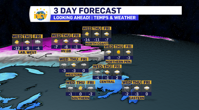
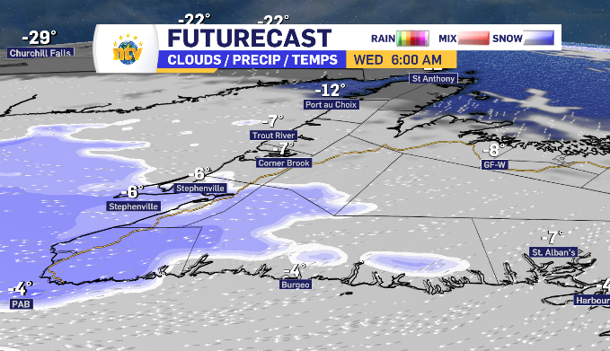
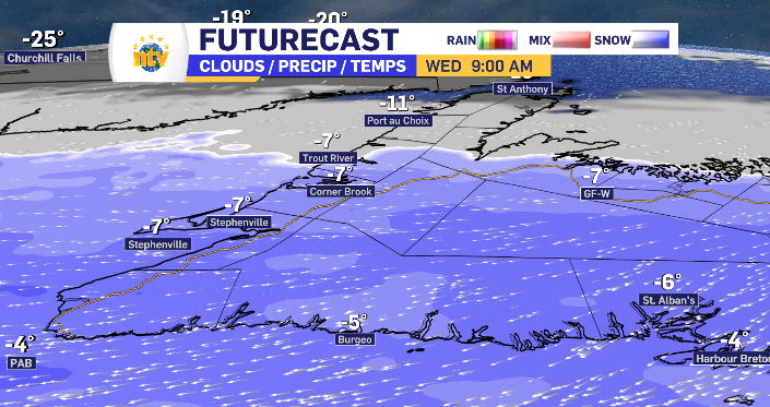
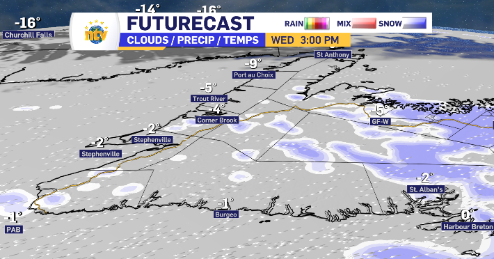
Sun and cloud for Labrador traded for another drop in temperatures
Sunny but cold is what we can expect Wednesday for Labrador and Newfoundland’s Northern Peninsula. Labrador West finds itself under a cold alert with morning windchills potentially reaching the -40 to -45 mark. the day does warm as it rolls on and the limited wind will see the windchills ease with it as well.