Blowing snow, rainfall and wind alerts plague Newfoundland and Labrador Friday

Ryan Harding, NTV Weather Centre
Spring is a season of transition and that is exactly what we’ll see across Newfoundland Friday as Labrador settles in to a more moderate snowfall.
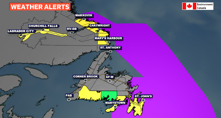
The alerts are on the board reflecting a mixed radar with blowing snow, rainfall and wind warnings issued by Environment Canada. Labrador West as an added cold warning for good measure.
Heavy rain with high winds for Eastern Newfoundland Friday
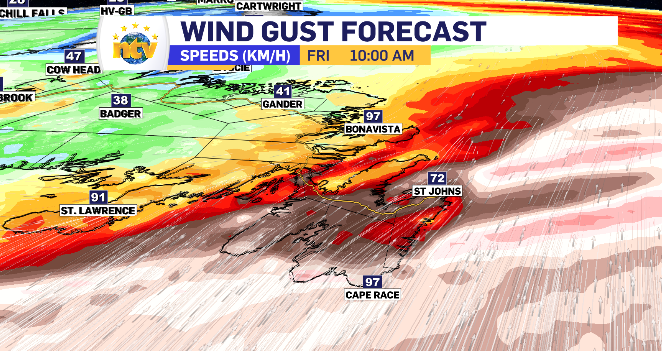
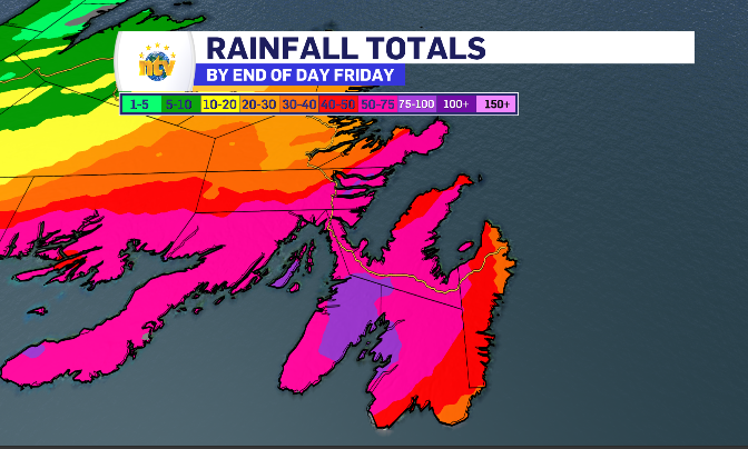
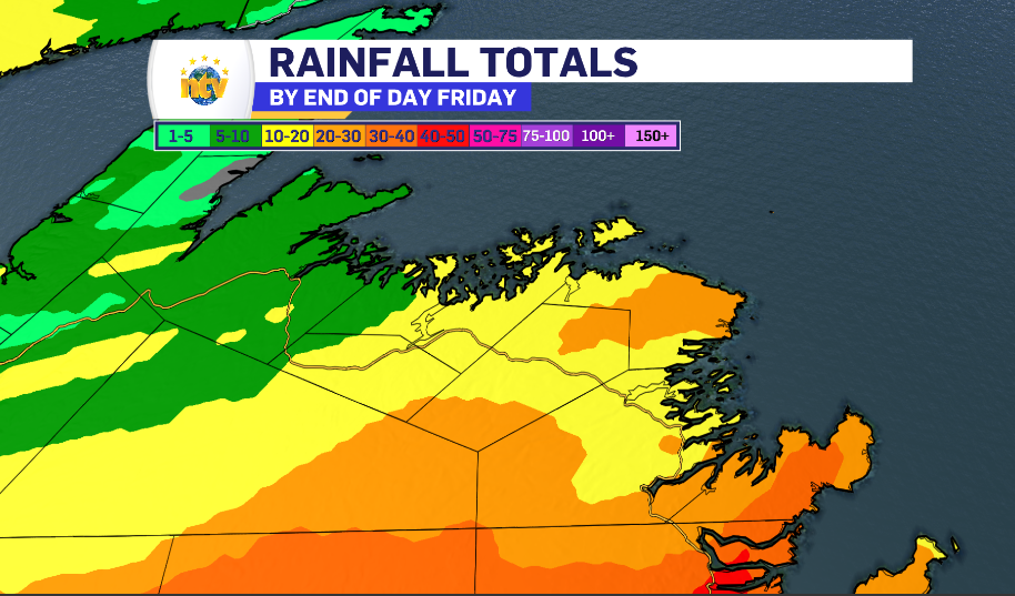
Once it starts raining on the eastern side of the island, it goes consistently into the supper hour, picking up some high totals along the way. The Burin and Avalon peninsula are under a rainfall warning with a range of 30-75 mm.
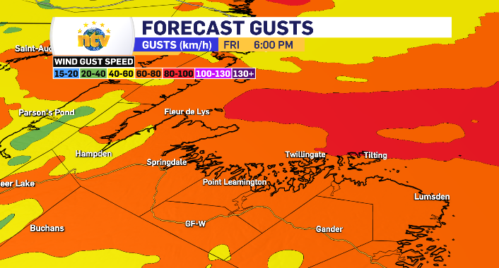
The Metro region is likely going to be on the lower end of that range as well as the lower end of the wind gusts which will range from 80-115 km/h and have the same regions under a wind warning. It’s worth nothing the Bonavista Peninsula will likely toggle on the wind alert as well as the same high end wind is expected by late Friday Morning.
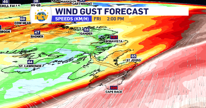
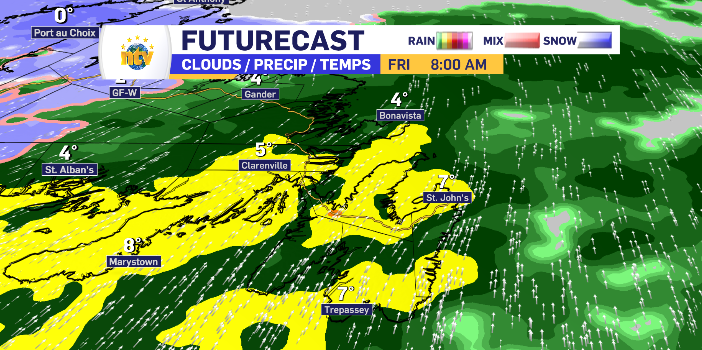
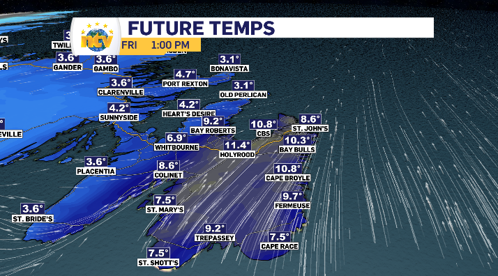
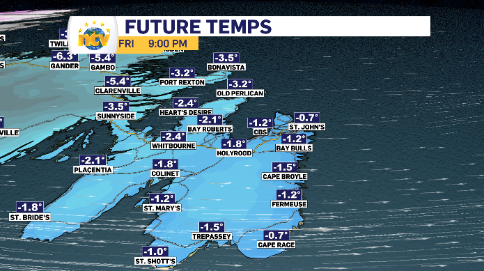
That strong south wind warms things up over the east to double digits for some. However, it is replaced with a cold west wind by sundown resulting in a much cooler evening.
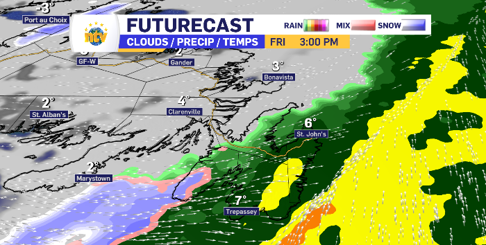
Mostly rain in messy mix for Central Newfoundland Friday
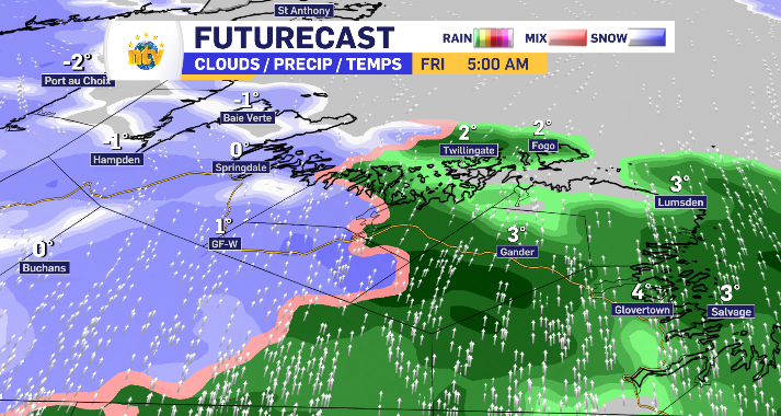
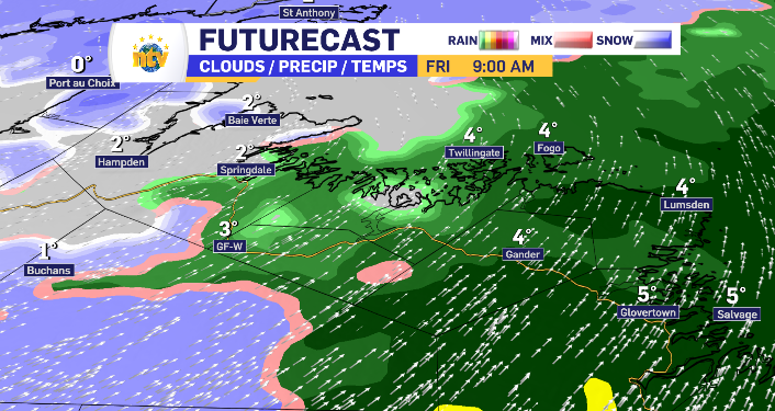
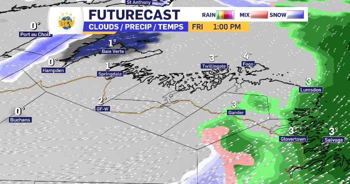
The wind isn’t quite as high, nor are the totals for Central Newfoundland Friday. The temperature does flip flop through out the day with the cool west wind reach the region earlier compared to places further east. The result is is a limited mix for Grand Falls-Windsor, more rain than snow for Gander and increased rainfall for the Kitiwake Coast. No alerts are in place and the rain totals have a wide range from as low as 5 mm to as high as 30 mm. By 2 pm the region as a whole is clear of the precipitation and replaced with a blanket of cloud. The wind here increases as the day rolls on, topping at gusts of 60-70 km/h with Fogo Island having the chance to break 80-90 km/h.
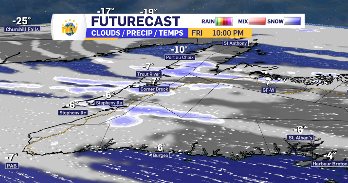
Cooler earlier on West and South Coast results in added snow Friday and Squalls Friday evening
The morning starts damp on the west and south coast, as the temperature drops with the west wind taking over, the morning rain will transition into some snow. There is a break with just cloud at times late morning to the afternoon. By night fall, when the wind picks up, snow squalls are expected from Stephenville to Parsons Pond.
There is both a rainfall and blowing snow warning in place for the Connaigre Peninsula. The majority of the day will be spent under the heavy rain, while some flurries may finish the noon hour with the temperature falling behind the low-pressure system.


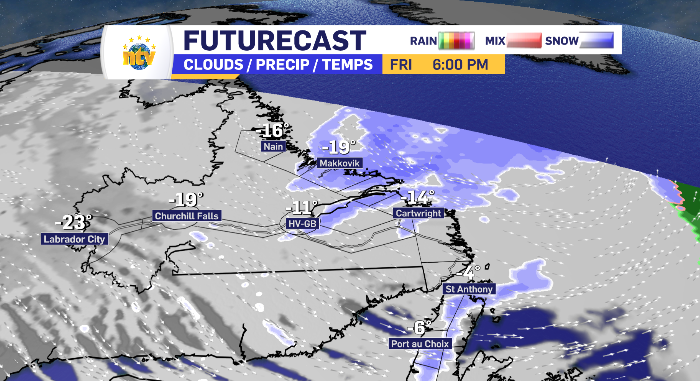
Snow start to finish for Labrador and the Northern Peninsula of Newfoundland Friday
The wind alert is in place for coastal Labrador mixed in with some blowing snow. This is also where you’ll find the highest snowfall totals. The Northern Peninsula shares a forecast with Happy Happy Valley-Goose Bay of a limited snowfall of 5-10 cm and above average winds without blowing over into alert territory.
The snow looks to start later for the south coast of Labrador and the Northern Peninsula while it is a continuation from the overnight for Happy Valley-Goose Bay, moving west to east to the coastline.
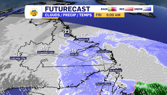

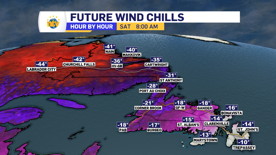
Cold alert for Labrador West
A cold start Friday, to the tune of a -35 windchill, sets in for Labrador West and is what will fuel the entire province’s cool down Friday into Saturday. For Labrador City and Wabush, by Saturday morning that windchill is dropping into the -45 to -50 degree range, hence the cold warning.