Strong winds return carrying snow, freezing rain and significant rainfall across Newfoundland and Labrador Tuesday

Ryan Harding, NTV Weather Centre
The winds are in control for the next 48-hours across Newfoundland and Labrador. As a system moves across the province, the direction of the wind will dictate the diverse temperature range and, so too, the type of precipitation that falls within the system’s time on land.
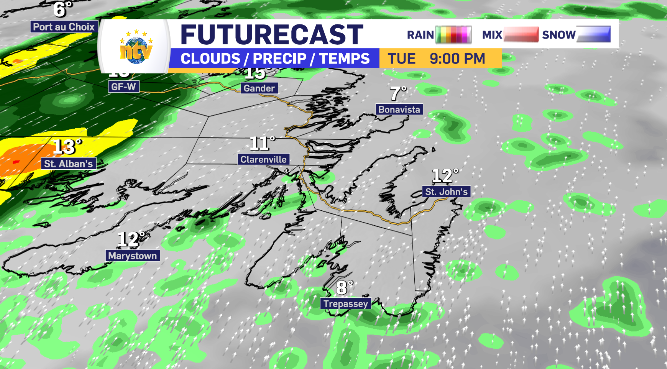
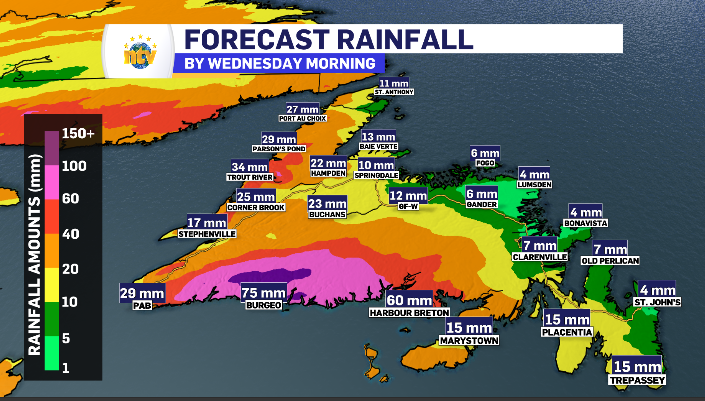
At risk of burying the lead, here is a glance at the rain totals for Newfoundland by end of day Tuesday. Below, we’ll go into further detail.

More wind alerts expected Tuesday across Newfoundland and Labrador
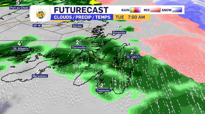
Early alerts on the board are mainly condition-based. Rainfall for the south and west coast of Newfoundland and snowfall mixed with rain alerts for Labrador.
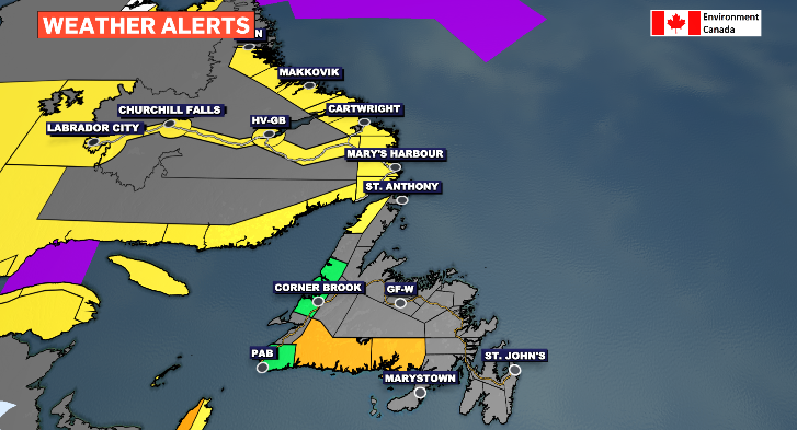
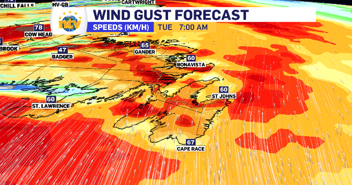
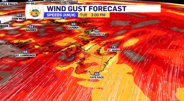
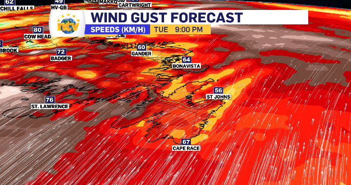
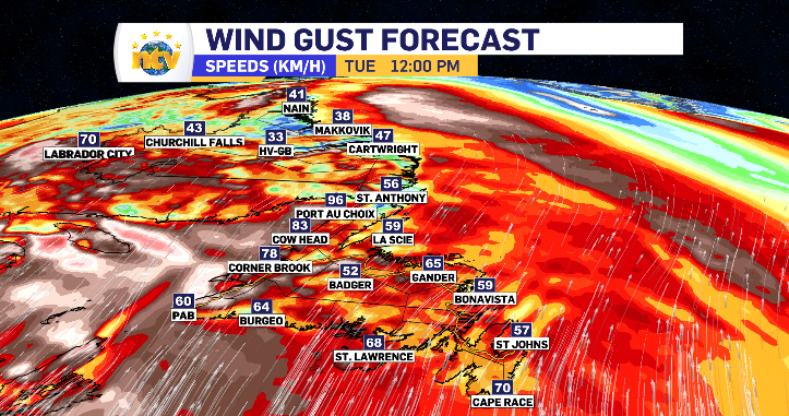
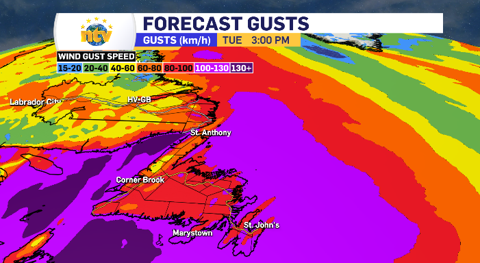
As Tuesday rolls on the wind alerts are likely to toggle on across the province as the wind is anticipated to gust anywhere from 60-110 km/h plus from the south – peaking mid afternoon. There are a number of opportunities to see the gusts breach the 100 km/h mark, specifically along the coastlines.
Rainfall warnings for Newfoundland’s West and South Coast highlight wet and warm Tuesday
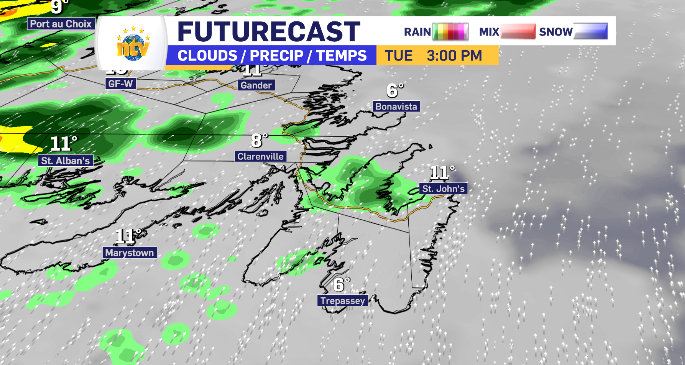
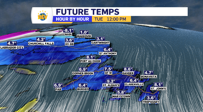
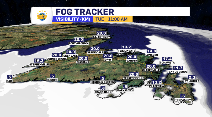
Since the wind is from the south, you can bet temperatures will rise and fog will roll in. By noon, almost the entire province is back into the positive temperatures and Southern Newfoundland is wrapped in fog.
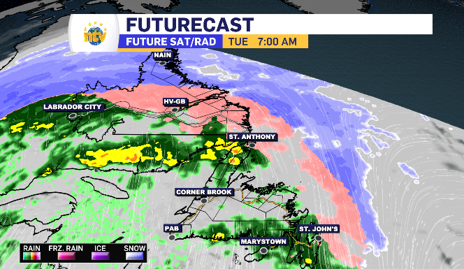
All of that sets the table for the low-pressure moving across. Newfoundland will see varying levels of rain totals while Labrador will be transitioning out of snow into ice pellets, freezing rain and rain as the temperatures warm throughout the morning.
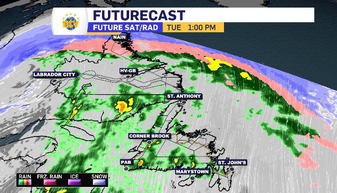
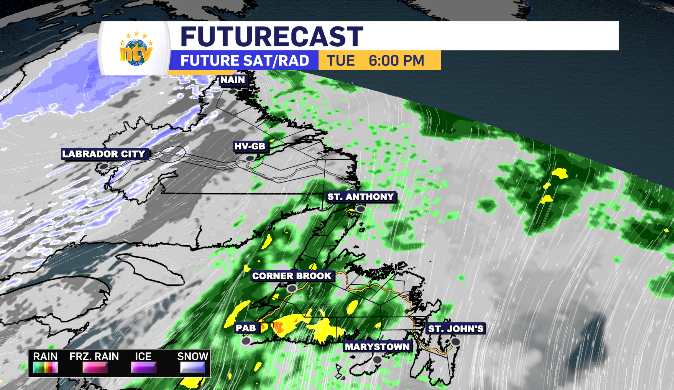
The day is really split into three sentiments. Morning, afternoon and evening. The rain is heavier in the morning and evening with lighter drizzle and fog pushed around in the afternoon.
You can see the freezing rain line move across Labrador, with the wind shifting back west in the evening. This will cool Labrador West down to finish the day with snow squalls.
Tuesday’s rain totals have a wide range across Newfoundland with the highest totals reserved for those areas under the rainfall warnings. The South Coast does have a more consistent rainfall compared to the rest of the island as well as the heaviest moments.
Mainly RDF and wind for Metro region Tuesday
All in all, the system passing through has limited effect on the Metro region. Tuesday brings mainly the familiar rain, drizzle and fog with the wind being the biggest factor. Four to six millimetres is what is expected in terms of rain, with the bulk of that falling during the morning commute before a day of drizzle and fog takes over.