Flurries sprinkle province Wednesday ahead of next low-pressure system
Ryan Harding, NTV Weather Centre
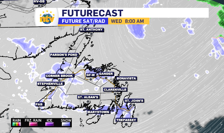
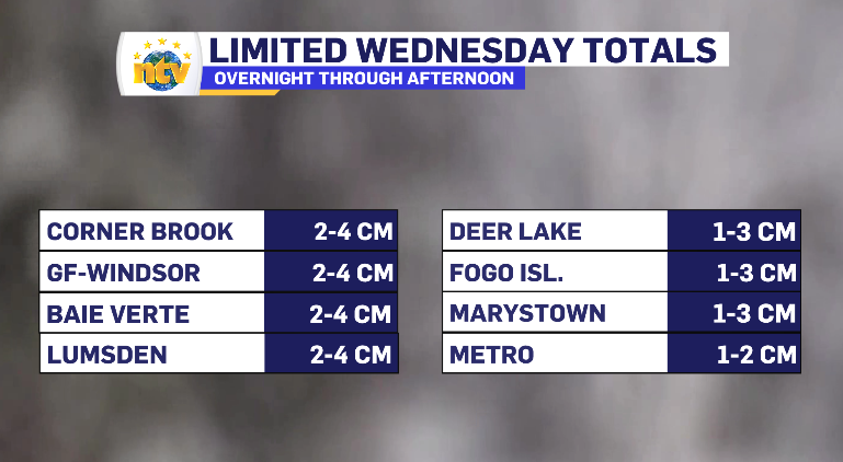
Wednesday brings limited snowfall across the province with flurries popping up here and there. The overnight and morning edition of flurries do come on the back of some high-end wind, however.
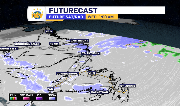
The coastal Labrador snow looks to trickle off through the overnight, while some flurries pass over the South Coast and Burin Peninsula in Newfoundland. The morning commute brings wide-spread flurries, while they look to cluster near Fogo Island by mid afternoon.
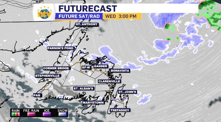
The totals are very limited, solidifying nothing should be more than the snowfall rate that constitutes flurries.
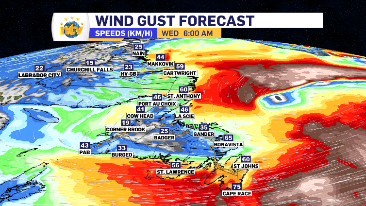
As mentioned, it does come with some wind. The backend of the system that put part of the province into a winter storm alert on Tuesday has winds above average over the north and eastern portions of Newfoundland, specifically early Wednesday morning.
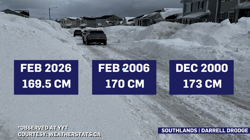
That one to two centimetres anticipated Wednesday in the Metro region is likely going to officially make this February the snowiest in recorded history for the capital city. And with another low-pressure system slated to bring 5-15 cm across the island Thursday, the snowiest recorded month in St. John’s history is another record aiming to be broken this week.