


Heavy snowfall returns to Avalon and beyond with the accompanied wind

Ryan Harding, NTV Weather Centre
Here we go again as winter trudges on. Another potential 50 cm dumping of snow comes across parts of the island in the latest low-pressure system.
The ranges are wide, but in reality, the outcome is likely to reflect those margins across the Avalon specifically. The northern portion of the Avalon through Clarenville and the Bonavista Peninsula are forecasted to tally up the largest totals by end of day Thursday.

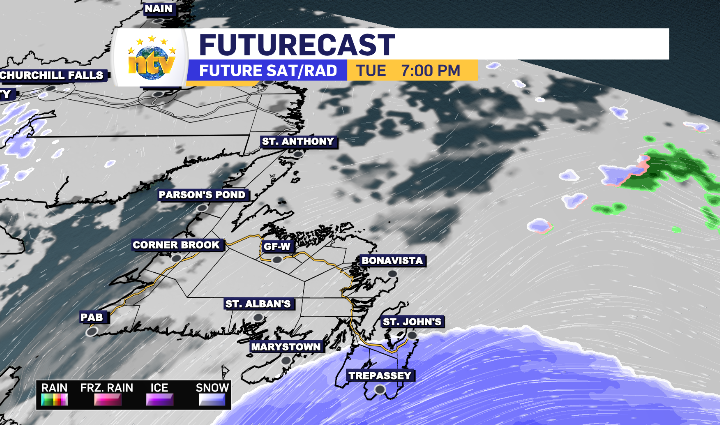
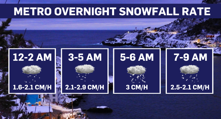
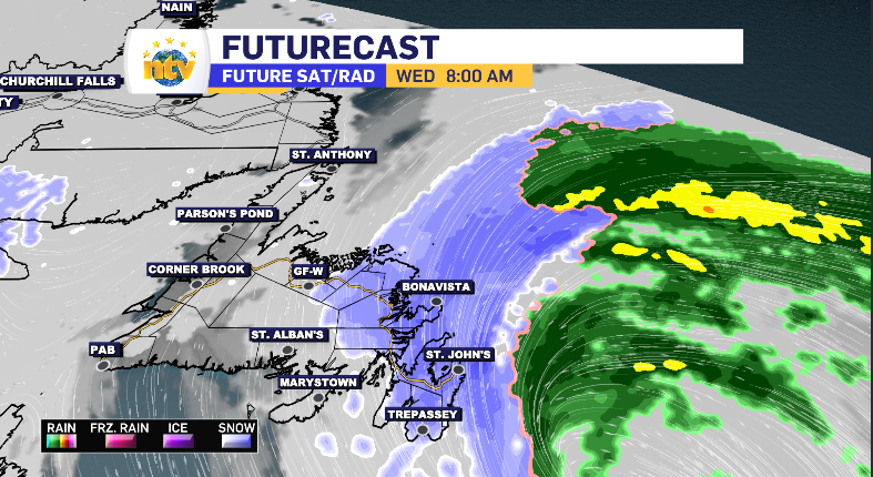
It all kicks off Tuesday evening, making first landfall on the south coast of the Avalon Peninsula. For the Metro region, the heaviest snowfall is reserved for the overnight hours – picking up to snowfall rates over the 3 cm per hour mark.
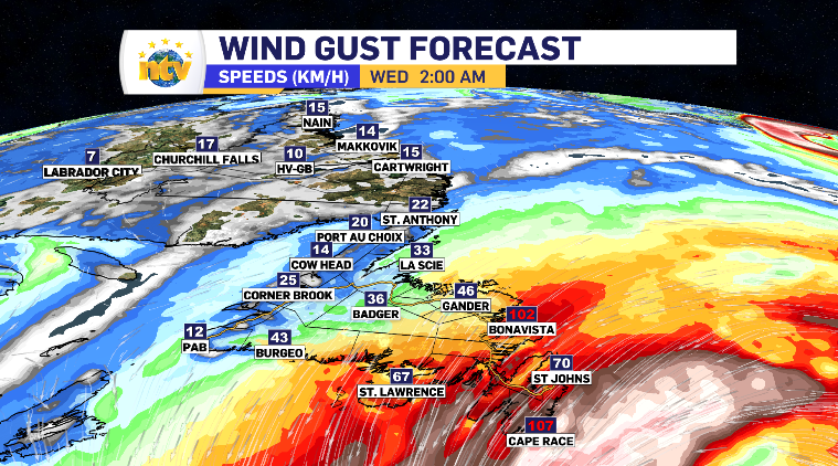
While the snowfall rates are hitting their peak, so to is the wind. The Southern shore along with the Bonavista Peninsula will likely see gusts push over the 110 km/h mark, while the rest of the Avalon’s top gusts are in the 80-90 km/h range. The Burin peninsula trails behind in wind and snowfall totals, while Clarenville is very much in between.
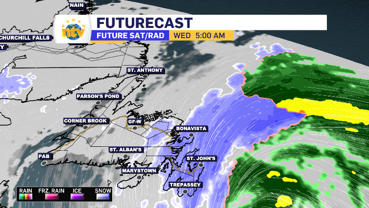
By 8 am Clarenville and Bonavista are entering their heaviest snowfall, while the outer bands are starting to creep across Central, bringing this region’s first look at the system putting a 15-25 cm range in place when it’s all said and done. That is also when you’ll start to see things ease up on the southside of the Avalon.
When it’s all said and done end of day Thursday, the snow is anticipated to have reached across the Baie Verte Peninsula and extending minimal totals to the West Coast with a flurry or two reaching the top of the Northern Peninsula as well. A broad look at the ranges go as follows:
North Avalon: 25-50 cm
South Avalon: 10-30 cm
Burin Peninsula: 5-10 cm
Clarenville Area: 25-35 cm
Bonavista Peninsula: 30-40 cm
Kittiwake Coast: 25-35 cm
Central: 15-25 cm
Fogo/Twillingate: 10-20 cm
Baie Verte Peninsula: 10-15 cm
A more in depth look show pockets of those high ranges possible throughout the northeastern region of the island.
Once again, for the Avalon at least, it looks as though the temperatures are going to dance the zero degree line. This means you can bet its going to be a return of that wet, heavy snow.
It takes until midway through Thursday morning for the system to be cleared off the island, offering opportunities to top up the totals, specifically through the very early morning hours.

You can tell by the 3-day forecast, there’s some snow to pick up into Friday as well. Those totals at this point look pretty limited. But not nothing! We’ll tackle that along the way. Happy snow clearing!