Snow continues across Labrador into Friday while sticking along the West Coast of Newfoundland
Ryan Harding, NTV Weather Centre
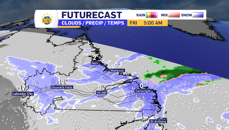
Thursday’s low-pressure system that brought varied levels of snow across the province is in the rearview mirror for most, however, has begun it’s push into coastal Labrador and spins it’s back-end towards Newfoundland’s west coast into Friday.
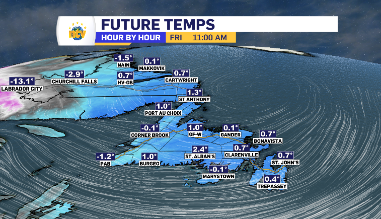
Like a broken record, the temperatures are stuck skipping between -1 and plus 1 for much of the coastline Friday. This means the return of the damp, heavy, snow that Thursday brough.
Harry’s Harbour, Barb Gillard
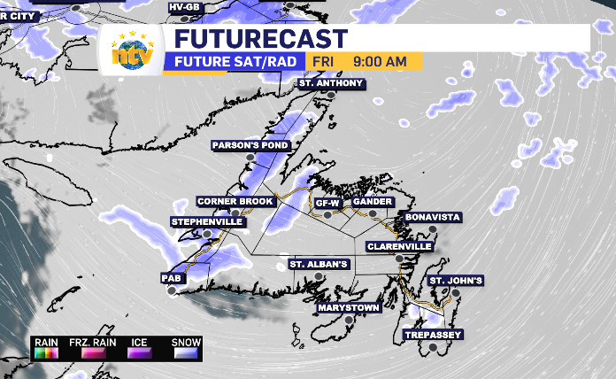
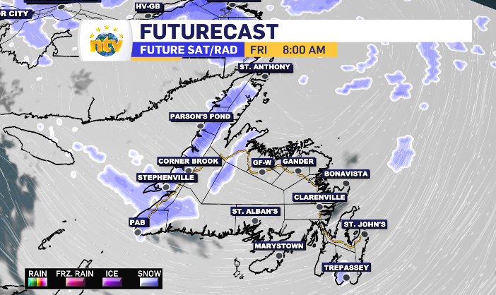
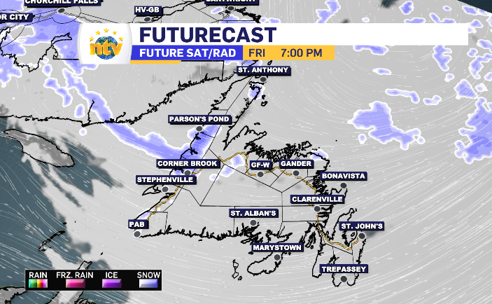
As Friday progresses, the range of the snow is going to shrink, north to south. This leaves the region of Parsons Pond and Corner Brook, and the communities in between, with the highest totals. Those are below. I should add, some higher terrain areas are anticipated to have the opportunity to reach the 20 cm mark.
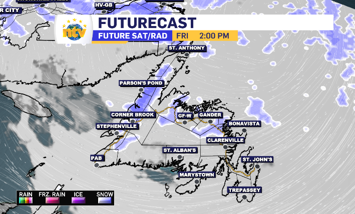

The rest of the island is in for a day of cloud and some fog coming and going along the coastlines. Central Newfoundland does have some light precipitation passing by mid-afternoon. Based on the temperature likely reaching the day-time high of above zero at that point, it’s probably going to show as light wet snow or some freezing rain.
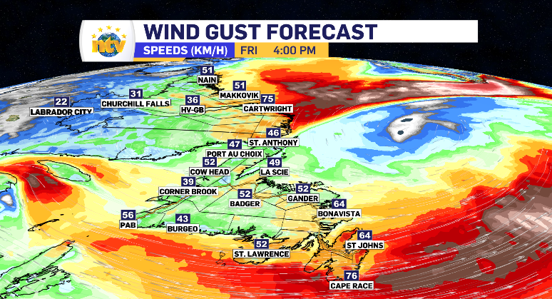
The wind Friday, for Newfoundland, isn’t reserved for just the west coast. In fact, it looks to reach higher peaks for the South Avalon Friday compared to Thursday. Coastal Labrador can expect increased wind throughout the day as well.
Speaking of coastal Labrador, the snowfall alert stays in place with a snowy Friday instore. Some of that is thanks to the low-pressure system pushing up from Newfoundland and some is from snow moving in from the east. The snow does push off the coast and move inland, bringing limited totals and breaking up into Labrador City as flurries at the tail end. Totals can be found below.