


A damp few days ahead
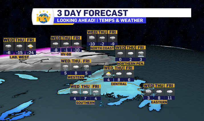
We have a few low-pressure systems passing through to close out the week, none bringing the winds or totals that Monday’s did.
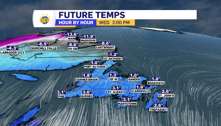
The winds sit in the 20-40 km/h range into Wednesday, however from the south. This is going to fuel a warm up for the island, getting all regions above zero by the afternoon – except for the Northern Peninsula.
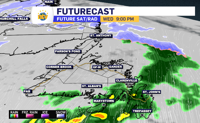
This is going to result in a rainy day for the South Coast, a rainy evening for the Burin Peninsula and Avalon and a light 2-4 cm for the upper portion of the Northern Peninsula. The system makes landfall late Wednesday morning as a brief moment of snow, lasting slightly longer in Corner Brook to Buchans before making the transition to wet snow and eventually rain. Central can anticipate very limited mix of wet snow and rain starting in the afternoon.
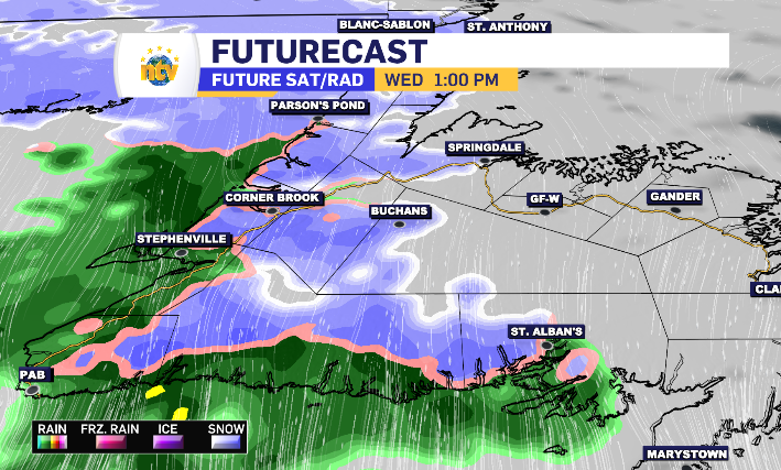
From Port aux Basque to Herabour Breton, rain totals look to fall within the 10-20 mm range, dropping to 10-15 for the Burin Peninsula and bottoming out at 5 mm and less for the Avalon, Clarenville and Bonavista Peninsula.
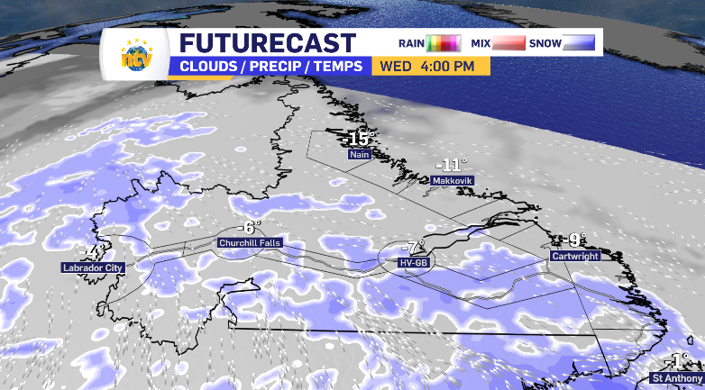
For Labrador, relatively light snow moves west to east throughout Wednesday, starting in Labrador City in the overnight, reaching the coast by late afternoon. Labrador City and Red Bay can anticipate 5 cm, with every region in between penciled in for just 1-3 cm.
That south wind continues to warm up the province into Thursday and Friday, with temperatures breaking the zero mark in parts of Labrador by the end of the week. Metro could even push for the 15 degree mark by Thursday night. This means the system brings rain to a large portion of the province to finish the week. Although, the west wind returns by end of day Friday, adding a messy mix. We’ll have full details as the week unfolds.