


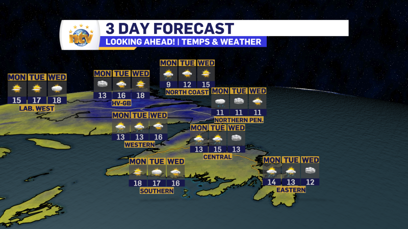
Monday’s forecast brings more of the same across the Province
A cutoff / blocked low in the North Atlantic between Newfoundland and Labrador and Greenland continues to a large fetch of damp northerly flow to a good bit of the Province this morning. We are starting the new week off with the same weather we’ve had for the last few days and I don’t anticipate that to change for the next few days.

This pattern will keep much of coastal Labrador, the northern Pebninsula of Newfoundland, much of central and eastern in the clouds, showers and drizzle today, and really for the next few days. But also like the last few days, it doesn’t mean there will not be sunny breaks– there will be at times.
The best weather in the Province will be over southern areas of the Avalon, the Burin Peninsula, the South Coast, the Southwest Coast, most of the West Coast, and Labrador West. These areas will see a lot of sunshine today (and fo the next few days) as the offshore flow does its thing. It will be the areas that see the warmest temperatures.
The pattern looks to change a little bit toward the end of the week but that may not be a good thing. An area of low pressure may cutoff southeast of the Island, which would bring more easterly flow. That would continue to keep the weather cool but introduce more fog to the forecast. Hopefully that changes.
Have a great Monday!