


Tropical Storm Ernesto to pass southeast of the Avalon Monday night

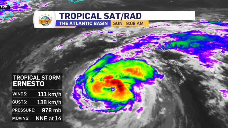
As of 7:30 AM NDT The centre of Tropical Storm Ernesto was located 1,580 km southwest of Cape Race. Maximum sustained winds are 110 km/h and the movement is north at 15 km/h.
The latest forecasts continue to indicate the centre of Ernesto will pass near, or just southeast of Cape Race early Tuesday morning. This means the strongest winds (gusts over 100 km/h) will remain offshore.
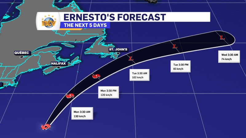
This track will bring a period of heavy rain to the Avalon, Burin and Bonavista Peninsulas between roughly 9 PM Monday night and 3 or 4 AM Tuesday morning. We will also see some breezy conditions, but nothing I would consider out of the ordinary.
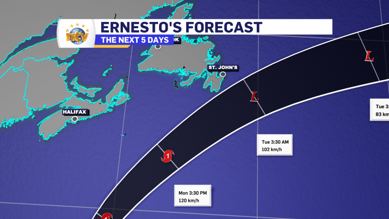
There will also be some storm surge with the high tides Monday night into Tuesday morning along and near south-facing shorelines of the Avalon and Burin Peninsulas, and to an extent the north facing shores as well. I will get more detailed more on this later today or tomorrow.