


Significant winter storm expected late week; Special Weather Statement issued by Environment Canada
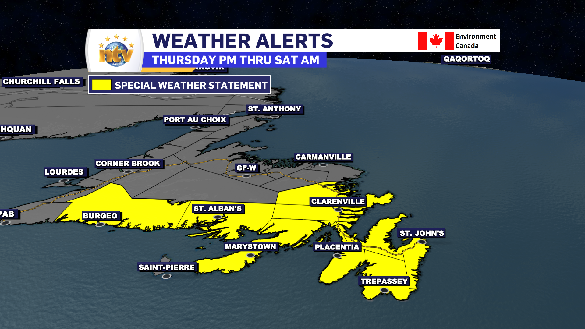
The Environment and Climate Change Canada Weather Office in Gander has issued a Special Weather Statement for the following areas from Thursday afternoon through Saturday morning:
- The Avalon Peninsula North
- The Avalon Peninsula Southeast
- St. John’s & vicinity
- The Avalon Peninsula Southwest
- The Burin Peninsula
- Connagire
- Burgeo – Ramea
- The Bonavista Peninsula
- Clarenville & vicinity
- Terra Nova
Current details: A significant and long duration winter storm is expected.
Locations: most of southern and eastern Newfoundland including St. John’s and vicinity.
Time span: Thursday afternoon until Saturday morning.
Total snowfall: While it is too early to give specifics on amounts and locations of highest amounts, there is potential for some areas to receive in excess of 50 cm of snow over the duration of the event. Not all areas in this statement can expect these extreme amounts but should prepare for the potential.
Remarks: While the certainty of a significant winter storm for most of southern and eastern Newfoundland is becoming higher, the confidence of what areas will receive the highest snowfall accumulations is still low at this time. There is a chance a good portion of the Burin and southern Avalon Peninsulas will see a significant period of freezing rain or ice pellets overnight Thursday into Friday which will have an impact on the snowfall accumulations in these areas. The highest snowfall will be just north of wherever this transition from ice pellets to snow sets up. Either situation would still pose hazardous winter weather conditions.
More details will follow in subsequent updates as this system takes shape and forecast conditions become more certain.