5 THINGS TO KNOW ABOUT THE FORECAST
- The weekend looks quiet, with just a few flurries or showers here or there
- Saturday looks breezy to downright windy, with gusts from the west as high as 80 for much of NL and even higher for the coast of Labrador
- Sunday will be sunny
- A big warmup arrives Monday, with highs across the Province rising above freezing by several degrees
- Rain will fall over much of Newfoundland and Labrador late Monday into Tuesday
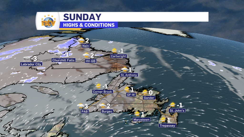
Sunday’s Forecast
Mostly sunny across the Province. Highs of -1 to -3. Wind speeds will be lighter, with only 30 or 40 km/h gusts.
Next Week’s Outlook
An unusually strong area of high pressure in the central Atlantic will set up shop early next week. This will put the Province into broad southerly flow and send a shot of unseasonably warm air into the region.
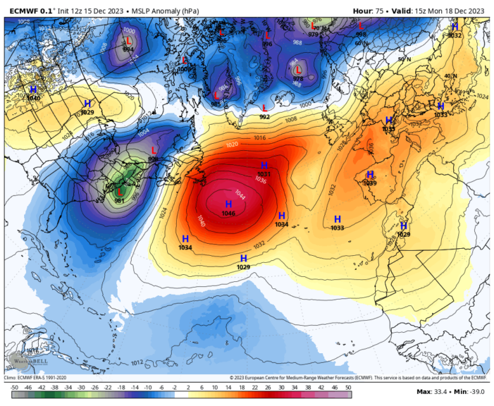
Temperatures for many areas during the early part of next week will be nearly 20° above normal in parts of Labrador and 10° above normal on parts of the Island! The map below illustrates that well.
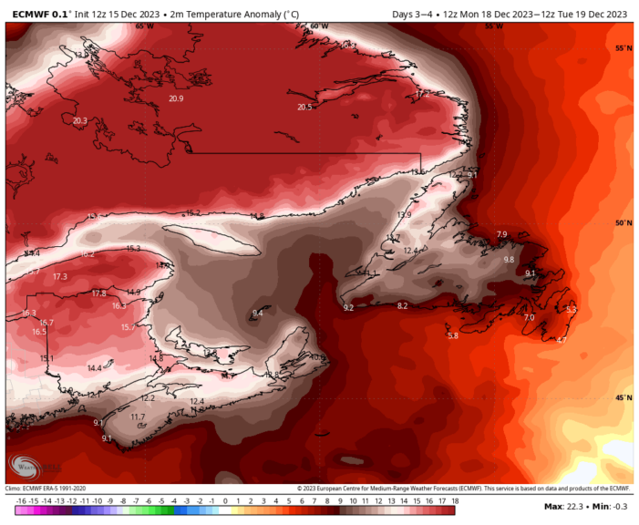
Temperatures that are far above normal will translate into highs on the Island and parts of Labrador near 10°C. This unusual warmth will break records for many areas of the province. On the Island, the thaw will last most of the week, in Labrador, it will last until Tuesday in the west and beyond Wednesday in the east. That’s illustrated well below by each temperature graph. Click on each to expand.
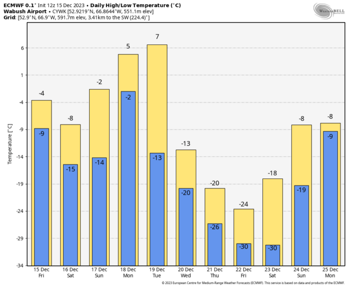
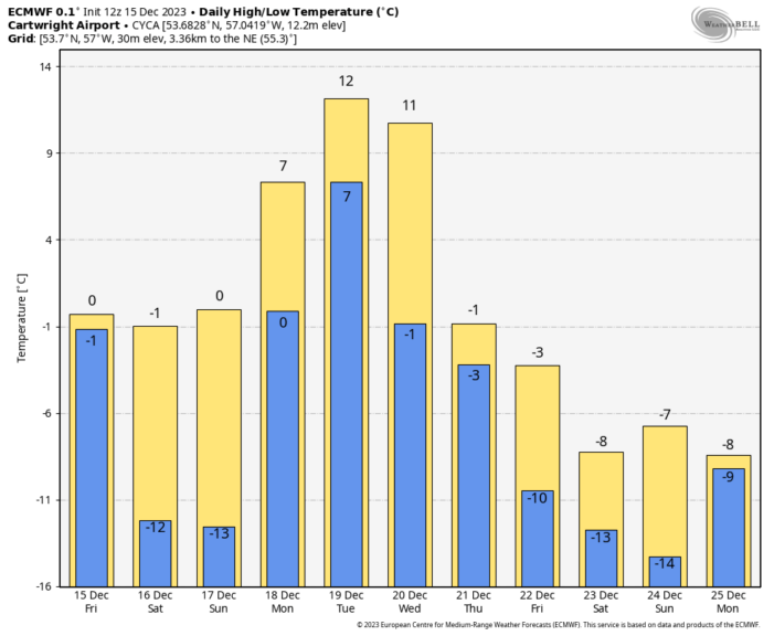
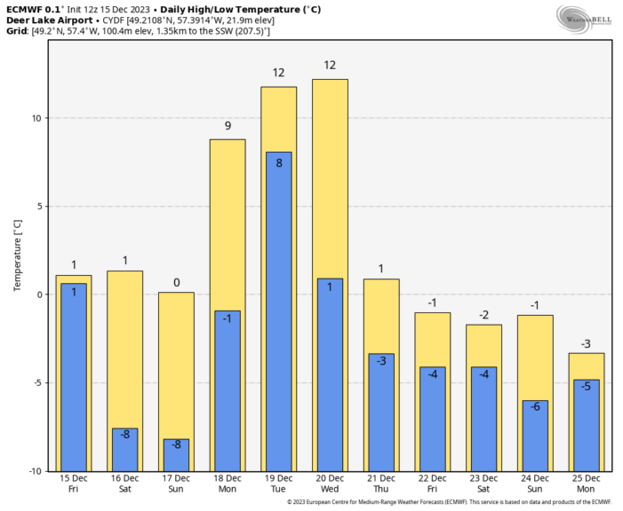
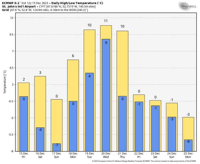
Rain will accompany this late Monday through part of Tuesday as a strong area of low pressure moves through Labrador. Rainw will also fall over central and western Newfoundland Tuesday into Wednesday. Rainfall in parts of southern Newfoundland will be significant and may exceed 60 mm along and just inland from the South Coast. Rainfall Warnings will be issued for large parts of the Province during the time frame.
Colder air slowly returns later in the week, as will the chance for wintery weather over parts of the Island as we approach Christmas. Stay tuned for details on that.


