


Newfoundland Forecast
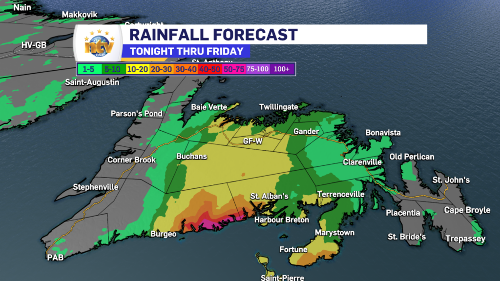
Radar shows an area of rain has arrived over southern sections of the Island, and stretches from near Burgeo to the western side of the Burin Peninsula. Inside this large area of rain are pockets of heavy rainfall. This may make driving and/or traveling difficult in the affected areas for a few hours this morning. The latest Doppler radar imagery shows this well.
Future radar shows this area of rain lifting northward through the day, and moving into central and possibly the northeast coast later this morning or by the afternoon.
Rainfall amounts for some areas will be in excess of 50 mm, mainly south, while areas farther north will see less in the way of rainfall.
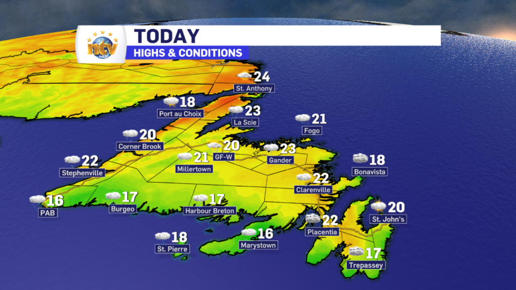
Areas of the West Coast, the East Coast, and the Great Northern Peninsula will largely miss this rain. However southern areas will likely see drizzle, clouds, and fog patches. Highs will be into the teens and 20s across the Island today.
Looking ahead to the weekend, we will see less in the way of widespread rain, but showers will remain in play for the Central, interior, and western sections of the Island. Eastern areas look to remain primarily dry. Temperatures will be in the mid to upper 20s north and upper teens south. Southern areas will remain in onshore flow, so fog and drizzle will persist.
Labrador’s Forecast
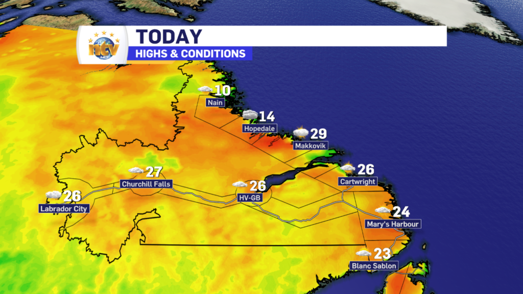
Friday will see dry conditions across the Big Land, with highs in the 20s. The exception will on the North Coast, where the onshore flow will drive temps into the lower teens for highs.
The weekend, and into next week, will see more of the same with respect to temperatures. And at the moment there look to be no major weather makers. However, there will be isolated to scattered afternoon showers and thunderstorms. These storms have the potential to spark new fires from dry lightning strikes. That’s something we will have to keep a close eye on over the next several days.
FIND YOUR LATEST FORECAST, AND USE OUR NEW INTERACTIVE RADAR!
-
NTV Weather Update | February 12, 2025
A potent winter storm will bring snow and wind to much of the Province beginning…
-

Special Weather Statements are in effect for late Thursday into Friday as wintry weather is expected across the Island
A Special Weather Statement has been issued for the following areas, highlighting winter weather late…
-
NTV Weather Update | February 11, 2025
Today’s Forecast The weather across the Province today will be cold and quiet compared to…
