AS OF 7:15 AM ON DECEMBER 9, 2023 THESE ALERTS HAVE BEEN ENDED
The Environment and Climate Change Canada Weather Office in Gander has issued multiple winter weather alerts across the Province. Winter Storm Warnings are in effect for Labrador’s middle and north coast, along with parts of Newfoundland’s West Coast. Winter Storm Warnings are issued when multiple types of severe winter weather are expected.
You can find your latest alerts by clicking this link, meanwhile here are the alerts of 7 AM NST Friday morning (December 8, 2023)
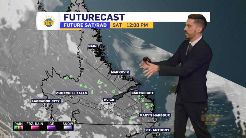
Winter Storm Warning from Postivlle-Makkovik to Nain and vicinity
Hazardous winter conditions are anticipated in northern Labrador from Natuashish to Makkovik, with an additional 15 to 20 cm of snowfall expected. Maximum northwesterly wind gusts of 80 km/h are forecasted, reaching up to 100 km/h in the Hopedale area. The conditions are expected to persist until tonight.
There is a possibility of rain mixing with snow along parts of the coast as temperatures approach zero, with visibility beginning to improve tonight as snow transitions to flurries and winds ease. Visibility may be significantly reduced to near zero at times due to heavy snow and blowing snow.
As a precaution, non-essential travel is advised to be postponed until conditions improve. Winter storm warnings are issued in situations where multiple severe winter weather events are expected to occur simultaneously.
Winter Storm Warning for the West Coast; from Corner Brook and vicinity to Parson’s Pond – Hawke’s Bay
Wwinter storm conditions are forecasted with expected snowfall ranging from 8 to 12 cm in most areas and up to 20 to 30 cm in higher terrain.
Maximum wind gusts of 60 km/h or stronger are anticipated in locations including Corner Brook, Gros Morne, and Parson’s Pond – Hawkes Bay, lasting into tonight.
The Long Range Mountains are expected to experience heavy snow, making travel dangerous. Coastal areas may see improvement as temperatures rise and precipitation turns to rain, but winter storm conditions may persist in the Long Range Mountains.
Visibility may be severely reduced, and non-essential travel is advised to be postponed. Winter storm warnings are issued due to the combination of severe winter weather types.