Good Wednesday morning!
A cold front moved through the Province on Tuesday and behind it, we’ve got a very fall-like air mass working its way in. As of 6:30 AM NDT temperatures across the Province are generally in the lower to middle single digits. Northerly winds have taken over behind the front and an area of high pressure is located over western Labrador and eastern Quebec.
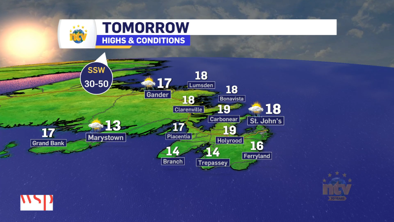
The weather across the Province today will generally be partly cloudy, a tad breezy and cool. Highs will only be in the mid-single digits to about 13º or 14º. While most areas will see the wind speeds coming down throughout the day, eastern areas may see it creep up a bit as the pressure gradient between an offshore low and the Quebec/Labrador high tightens a bit.
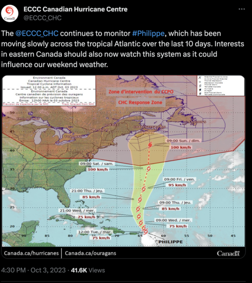
We will see a gradual return to warmer temperatures tomorrow and Friday. And then our attention will turn to Tropical Storm Philipe which looks like it may impact the weather across the Maritime Provinces later this weekend (Sunday). While it looks like impacts to NL will be limited, this still needs to be watched closely. Still a little early to get into impacts, but assuming the track is toward NS, the normal tropical influences will be felt; wind, rain, and high seas.