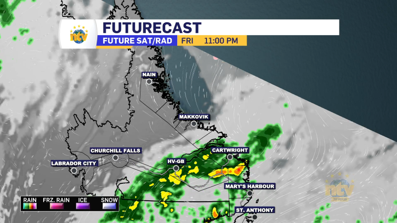
Wednesday starts dry, reasonably sunny, and warm; however, an area of low pressure will approach from the south in the late afternoon or early evening and spread rain into southern and eastern Newfoundland.

The rain will spread north overnight and fall heavily across much of the Island and southeast Labrador. Amounts will be in the 10 to 40 mm range, with the highest amounts found along the South Coast and Burin Peninsula.
The rain will end on the Island early Thursday morning and in Labrador by midday Thursday. Skies will clear quickly on the Island behind the departing rain and Thursday looks like a fairly decent day behind the rain.
THE FORECAST
Newfoundland
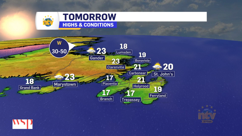
Wednesday: Sun and cloud in the morning give way to increasing cloud in the afternoon. Rain arrives on the South Coast, the Burin Peninsula and the southern Avalon late in the afternoon and across the rest of the Island Wednesday night. Highs in the upper teens to lower 20s, except teens in south. Areas of fog will be found south and east Wednesday night.
Thursday: Morning showers for much of the Island taper off before lunch time. The exception will be on the West Coast and Northern Peninsula where the showers will end by early afternoon. Highs reach the upper teens to lower 20s.
Friday and Saturday: Dry and sunny with highs in the teens and 20s.
Sunday: Chance of rain. Highs in the mid to upper teens.
Labrador’s Forecast
Wednesday: Sunny with highs in the lower to middle 20s.
Thursday: Scattered showers and cooler. Highs in the middle teens.
Friday: Partly to mostly cloudy. Highs on the coast near 10, and near 18 in the west.
Saturday and Sunday: Quiet and mostly cloudy. Highs in the teens.