


Winter storm alerts shift across island into Labrador Tuesday

Ryan Harding, NTV Weather Centre
After the second winter storm dropping 50-80 cm over the Avalon in the span of a week, more snow is slated for Tuesday. This system has winter storm alerts toggled on across portions of the province, however, a measurable amount of snow is expected island wide and into central Labrador.

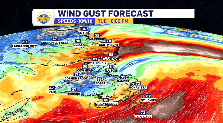
The regions in yellow indicate the Environment Canada issued yellow winter storm alert. Those areas are on the docket for 15-25 cm, with a few pockets finding the potential to push into the 30 cm range. Along with it, winds from 60-100 km/h. The highest winds are expected in the over night in Port aux Basques. A close second goes to the Avalon and coastal Labrador on the back end of the system Tuesday evening and into the overnight.

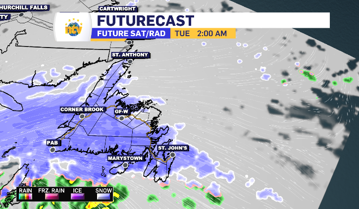
The system’s snow looks to make landfall on the southern portion of the island late Monday night, working up into Newfoundland throughout the overnight and Labrador into early Tuesday morning.


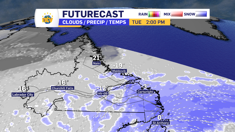
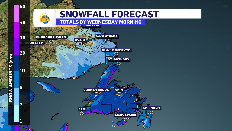
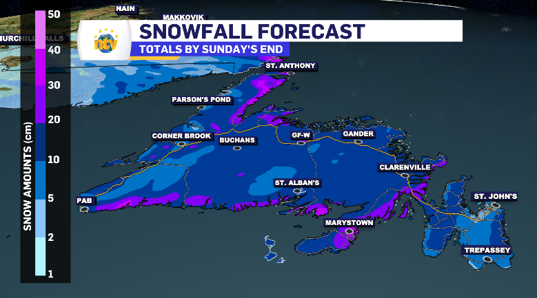
The totals are relatively limited on the Avalon, in large part, due to a warming south wind that brings the temperature above zero early Tuesday morning, transitioning the snow into rain. A trend that will be match later on the South Coast, Burin Peninsula and the rest of eastern Newfoundland and later into parts of Central. The final totals for the province are below, with the Metro area average close to 10 cm.
The rain looks to make its transition between 5-8 am across the Avalon. It shouldn’t be enough to put a dent in the snow, just enough to make conditions icy and gross, truthfully. That rain drizzles it’s away across the southern and eastern side of the island late morning into the afternoon, before a second dose of snow hits the South Coast.


