Island-wide snow arrives Wednesday morning, rain trickles into afternoon across Avalon
Ryan Harding, NTV Weather Centre
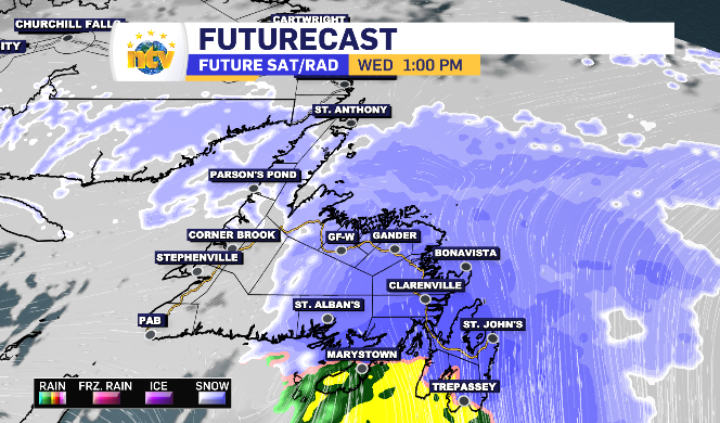
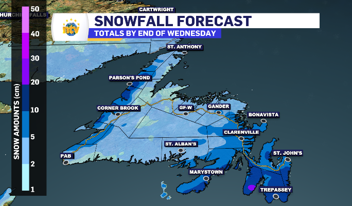
Wednesday brings a mix across the Avalon while the rest of the island is looking at a morning and afternoon of snow. In fact, Newfoundland saw a similar day to this the last time snow touched down with a 5-10 cm range across the island.
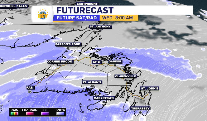
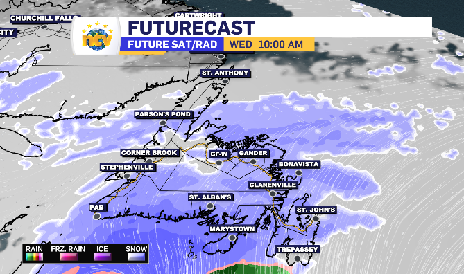
By 8 am snow has creeped into the South Coast, Burin Peninsula and southern portion of the Avalon while lingering overnight flurries leave the West Coast and northern portion of the island.
The system brings an island-wide average of 5-10 cm with a few pockets holding the potential to add a few extra.
By 10 am, the snow is forecasted to reach the Metro region, Clarenville, Central and beyond. However, the highest snowfall rate is going to be tight against the transition line. between noon and 2 pm, the south and east side of Newfoundland will be in the 2 cm per hour rate, just as temperatures are rising above zero allow that snow to finish along the Avalon as rain.
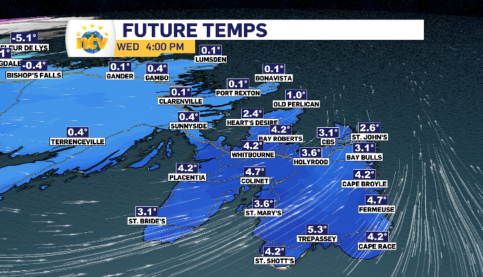
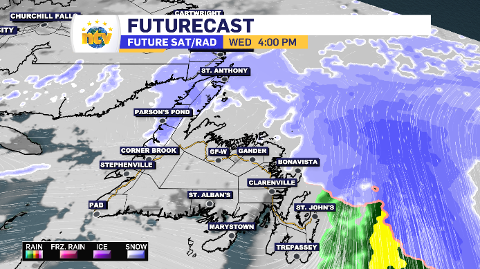
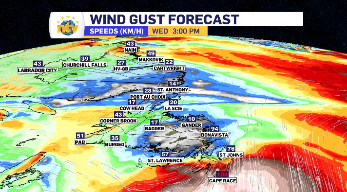
The rain on the Avalon brings a range of 3-10 mm with the highest totals reserved for the southern portion. That rain comes on the back end of the system which is bringing the highest wind totals to the same regions as the wet mix. Again, the rest of the island can anticipate 5-10 cm, with the Northern Peninsula and south coast of Labrador on for the slightly less 2-4 cm.
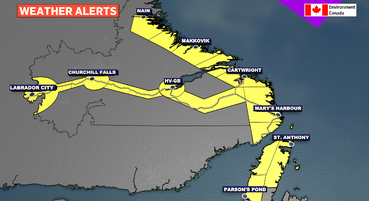
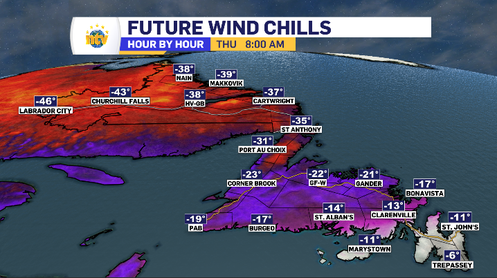
Outside of the south coast of Labrador, the rest of the Big Land will see increasing cloud cover throughout Wednesday. In the evening, that arctic air cold front seeps back across, dropping temperatures and toggling on the cold alert from Environment Canada for Wednesday night and Thursday morning.