Clearing skies delayed for Eastern Newfoundland for back to school Wednesday

Ryan Harding, NTV Weather Centre
Sun starts early for Western Newfoundland Wednesday, clearing east as afternoon turns into evening
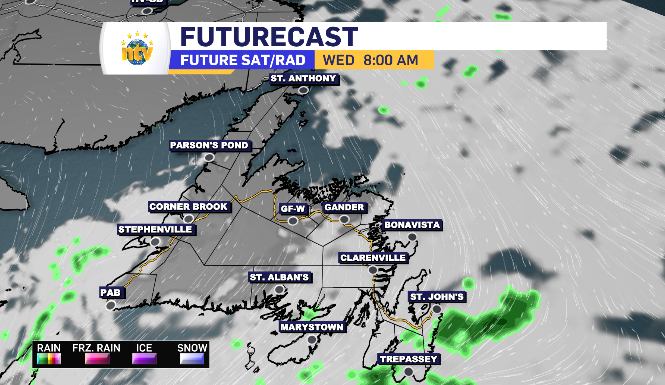
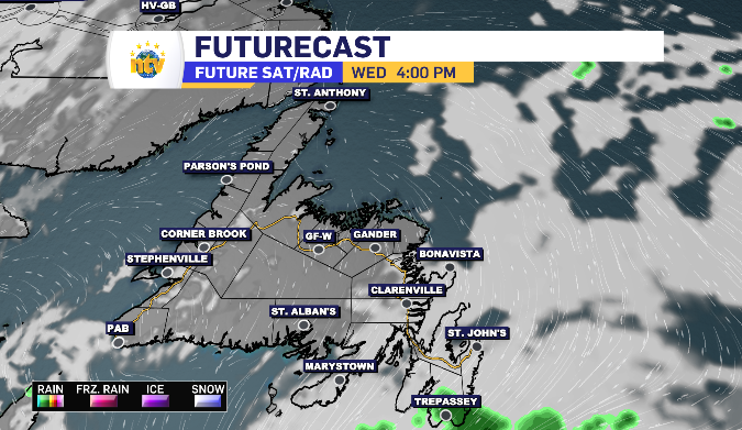
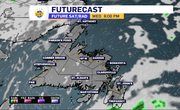
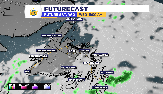
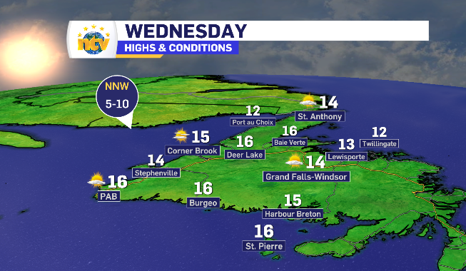
For the western side of the island, Wednesday start with the sun breaking through, clearing further as the day unfolds.
As the morning rolls on, Central Newfoundland joins in, while the eastern side of the island is delayed and under a blanket of cloud for most of the day.
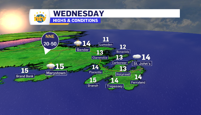
In fact, the Avalon will likely see prolonged periods of drizzle Wednesday morning, will light rain hanging over the southern shore for a large part of Wednesday, seeing 3-5 mm in total.
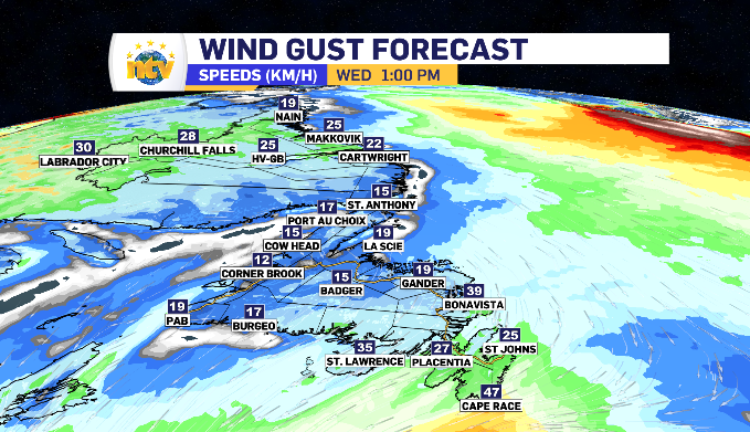
The wind comes from the north Wednesday. That is going to limit the daytime highs from the low to mid teens, with the highest totals found on the south-facing side. The wind stays light for most, with the Bonavista Peninsula and Southern Shore seeing gusts reach 30-50 km/h.
Newfoundland and Labrador daytime highs for Wednesday
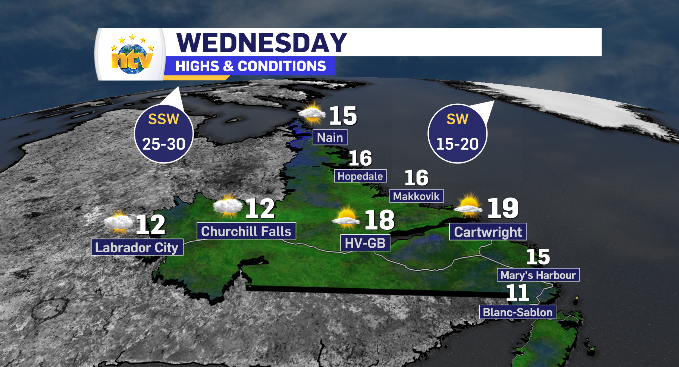
Increasing cloud across Labrador brings late showers for some Wednesday
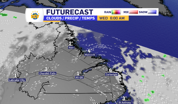
Skies start wide open across Labrador Wednesday, however, cool with the single-digit overnight lows lingering into the morning.
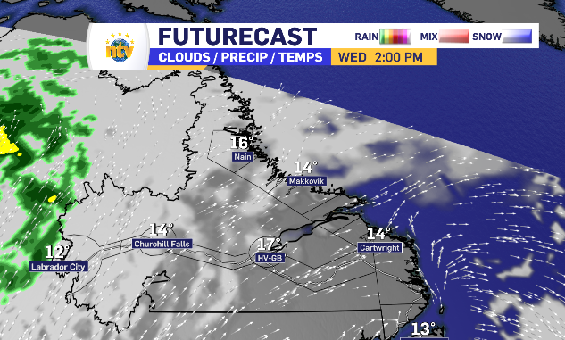
Throughout the day, cloud cover enters Labrador through the west and spends the day moving east.
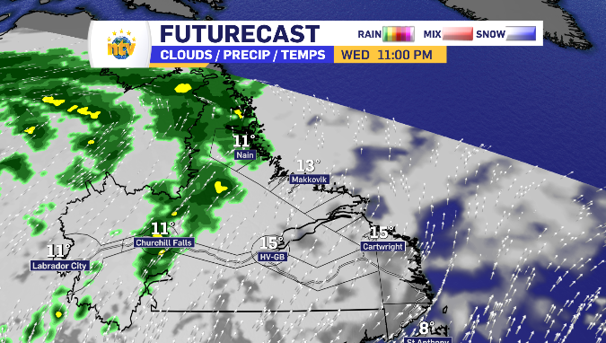
The wind shifts southwest as the day rolls on, warming things into the teens. However, showers arrive in Labrador West late Wednesday afternoon and show up along the north coast leading into the overnight hours.
Labrador City to Churchill Falls is looking at a 2-4 mm range while Nain is likely to pick up 5 mm.