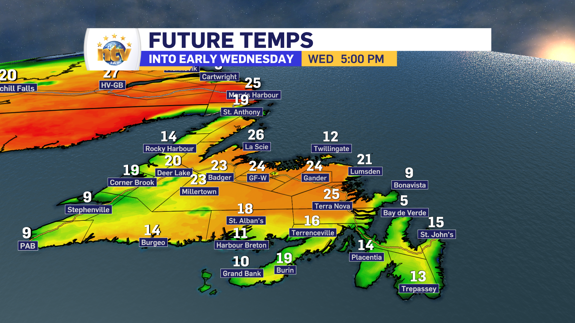
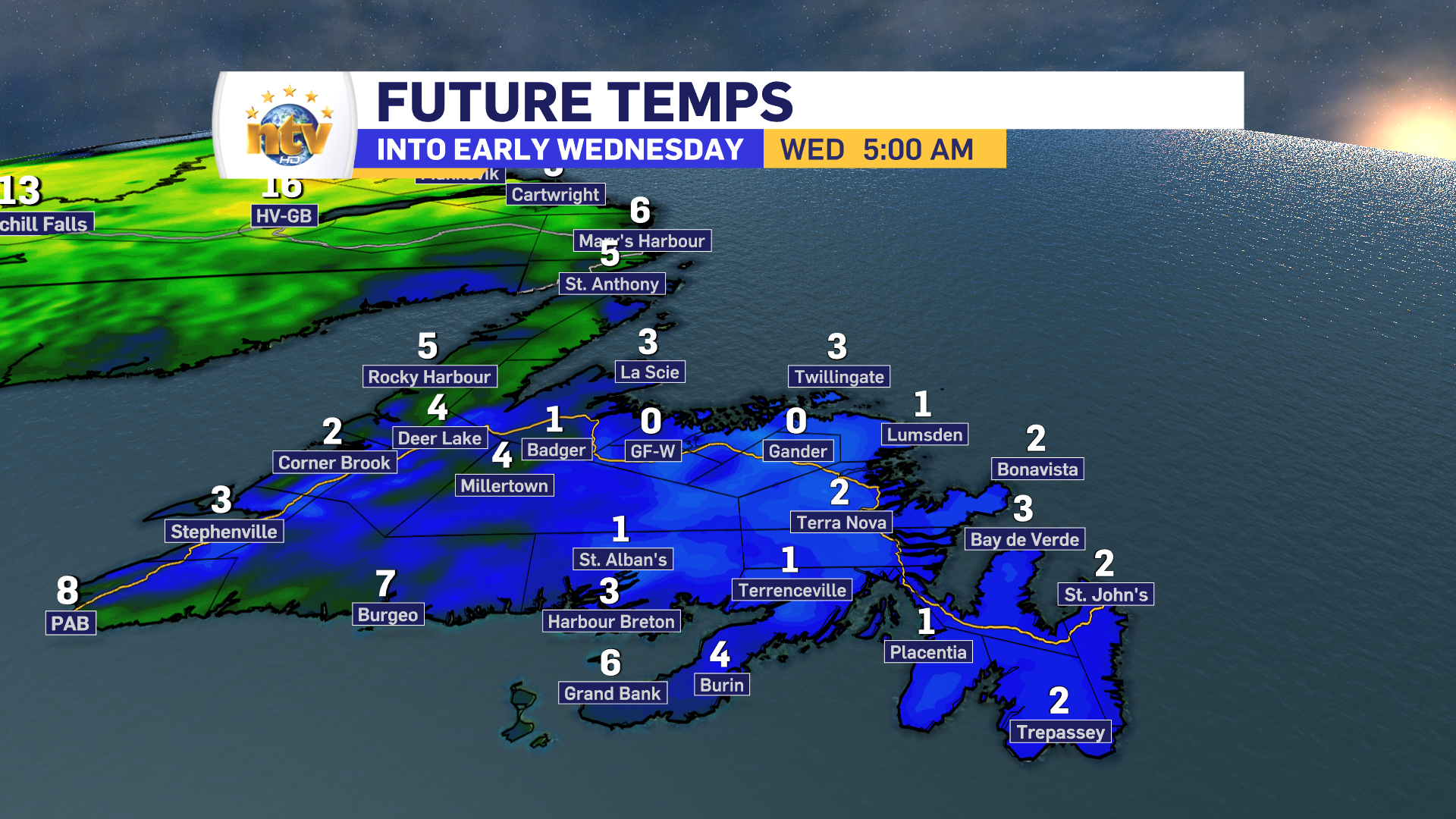
We are finally getting into a warmer weather pattern, which will allow more seasonable air to flood across the Province. This can already be seen in Labrador, where temperatures today have soared into the middle and upper 20s! Those readings will become more widespread tomorrow, however before we get to Wednesday we have to get through tonight. Tonight will feature a chilly night across much of the Island, where lows will fall into the single digits. In fact, west of the Avalon, readings may dip near or below freezing. Because of that, ECCC NL has issued a Frost Advisory for a large area, which doesn’t include the easternmost Peninsula.

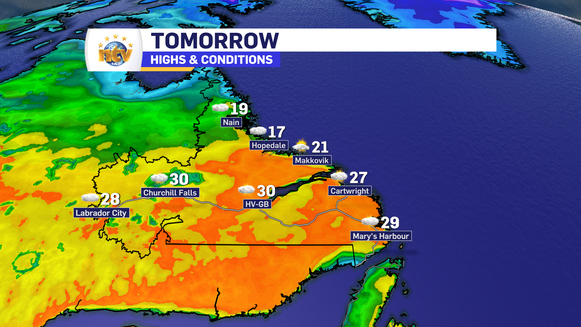
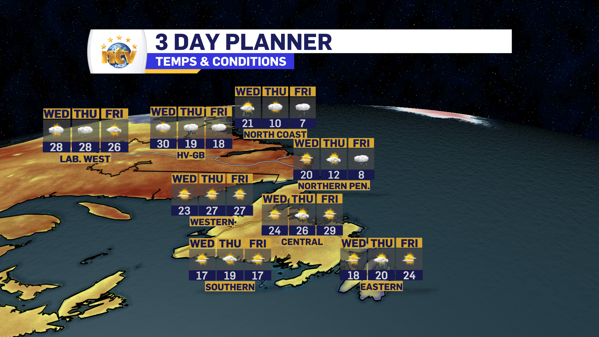
However, after the cold start, wall-to-wall sunshine across the Island will warm things up nicely. Many areas in central and northeastern Newfoundland will soar into the 20s Wednesday afternoon. Southern, western, and eastern areas will be a tad cooler, with highs in the middle to upper teens.

Labrador will see highs on Wednesday into the middle and upper 20s, with some areas reaching 30! Perhaps a few records will fall?
It also looks like St. John’s will hit its first 20° day Thursday or Friday. Right now, I’m thinking it will be Thursday but that will depend on when we get a shift to northerly winds. If that shift happens later in the day, the chance will be higher. If it happens earlier, we won’t get to 20.
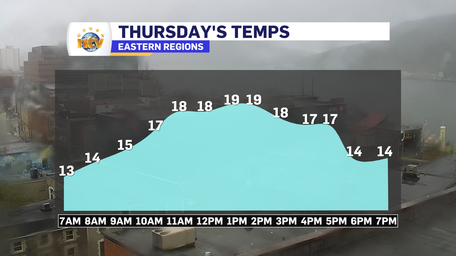

And if we don’t get there Thursday, we definitely will on Friday. There is even a slight chance we get there tomorrow, but I’m not betting my cards on that one.
Have a great night!
Eddie


