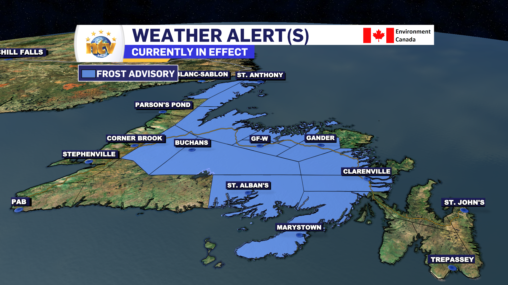
We are starting off the day with some clouds and lingering showers across a good bit of Central and eastern Newfoundland this morning. Radar indicates light showers are on the go from near Birchy Bay to the Avalon. These showers will become less widespread this morning and should end during the afternoon.
The weather across the Island will vary today but generally expect sunshine for the West, South, and Southwest Coasts and Burin Peninsula. Areas to the east will see cloudy skies this morning, but through Central skies will gradually clear from west to east throughout the day. Some areas of the Avalon may see some sunshine later today or this evening, but it does look like we’ve got another day of cloud cover to contend with before we see the sun and warmer temperatures tomorrow.
Labrador will see highs in the 20s in the west to single digits on the coast. A wide range thanks to onshore winds near the water.
Tonight will see clear skies envelop a wide area of the Island and a Frost Advisory is now in effect for much of the Island west of the Avalon Peninsula for lows -1 to +2. Temperatures on the Avalon will likely be a bit higher, and a Frost Advisory has yet to be issued by ECCC NL for that location.
Wednesday looks quite nice across much of the Province, with highs on the Island reaching the teens and 20s. The same will be said for Labrador, but expect some late showers and thunderstorms across the Big Land as a cold front sweeps in from Quebec.
On the Avalon, temperatures tomorrow will vary widely. Locations near the coast will have trouble getting out of the lower teens, but inland locations will see highs in the mid to upper teens to dare I say 20. I do not think YYT will hit 20 tomorrow, so the streak will continue.
Have a great day!
Eddie
-

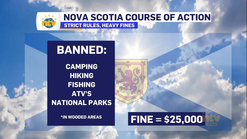
Hot and dry weather continues
Sunny skies are expected right across the province today. There will be some areas of…
-
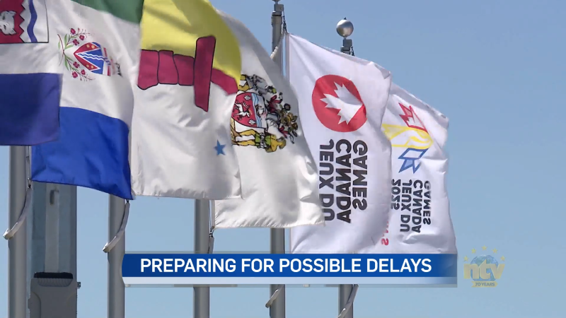
Canada Games officials monitoring air quality for athletes amid wildfires
In just a few days, thousands of athletes will descend on the metro St. John’s…