Newfoundland’s Forecast
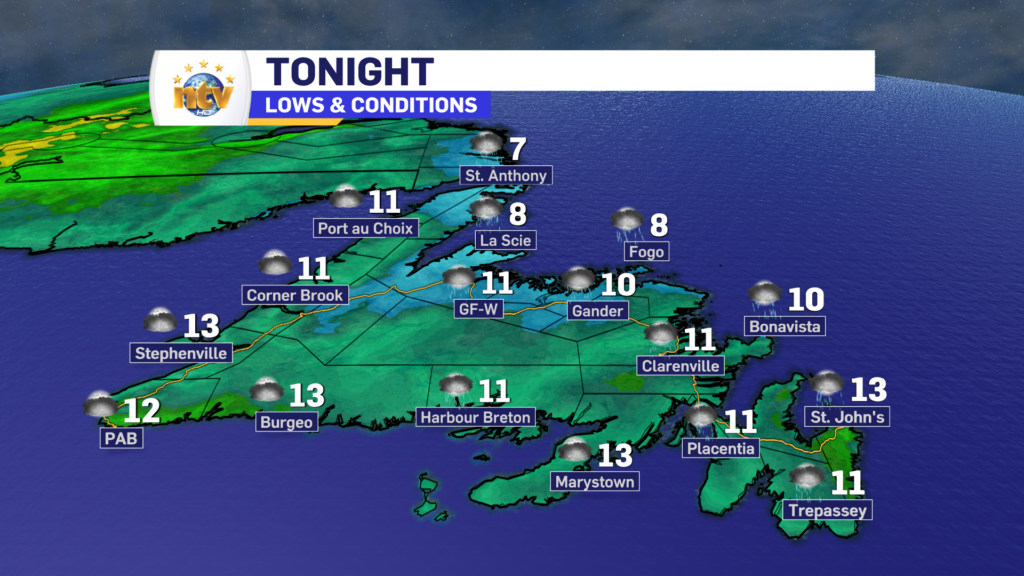
The clouds and showers will hang around much of the Island overnight. The best chance of showers overnight will be through central and along the northeast coast. There will also be some fog in those areas as well. Temperatures will range from the single digits in the north to the teens in the south and southeast.
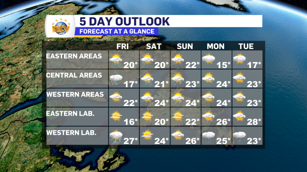
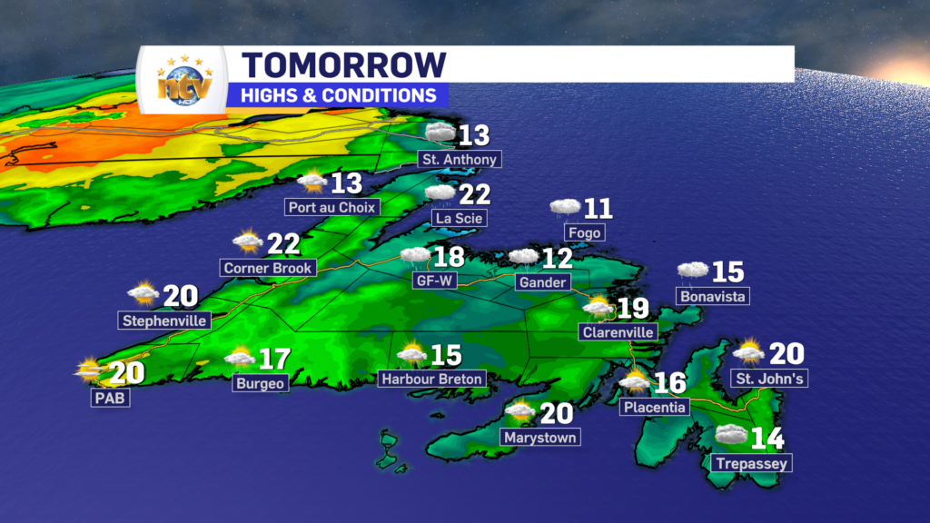
Friday will see cloudy to mainly cloudy skies across much of the Island to start the day, along with scattered showers. Skies across much of the region will try and clear from west to east during the afternoon. The best chance of showers will again be thru Central and northeastern Newfoundland. Highs will range from the lower teens in the north to near 20 in the south.
As of now, the weekend looks to remain the same as the last few days. Mainly cloudy with scattered showers for most areas. The showers will develop over interior Newfoundland and drift east and southeast through the day.
Labrador’s Forecast
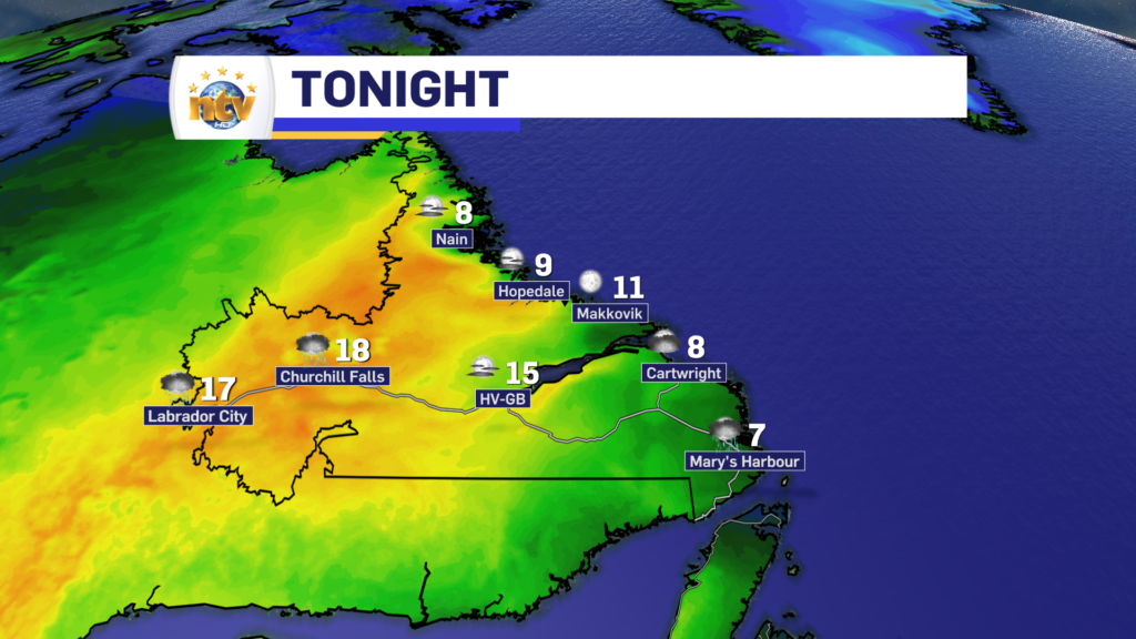
Labrador will see a few lingering showers tonight, but otherwise, it should be fairly quiet. Lows will range from the single digits on the coast to the middle and upper teens in the west.
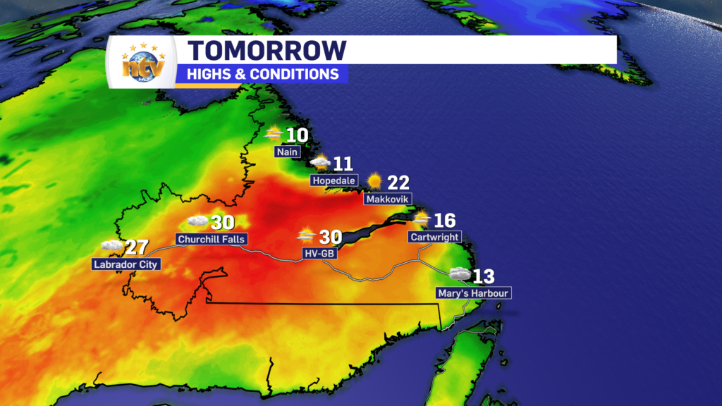
Friday will see a dry start to the day across the Big Land, and it will be another hot one. Especially in the West, where highs will be in the upper 20s to lower 30s. It will be cooler along the coast
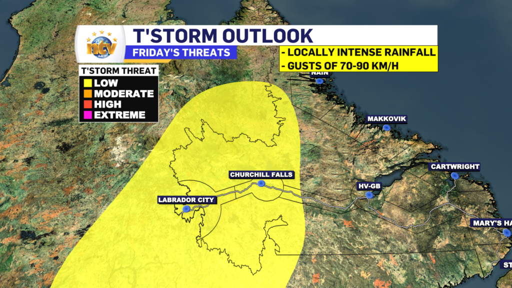
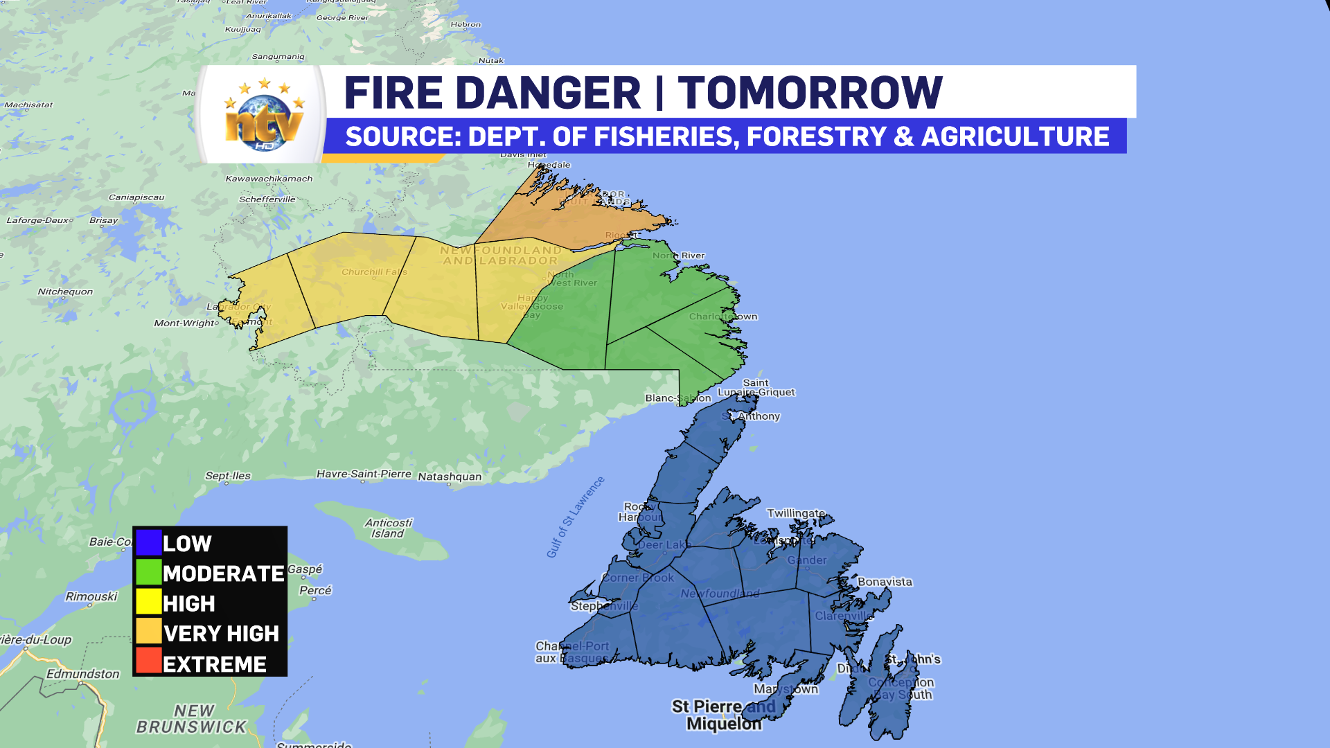
There is a high chance of some afternoon thunderstorms in Labrador West. Any storms that develop will produce locally heavy rainfall and the potential wind gusts to 90 km/h. The best chance of seeing those storms is highlighted in the map below. The areas in yellow are what I’m talking about.
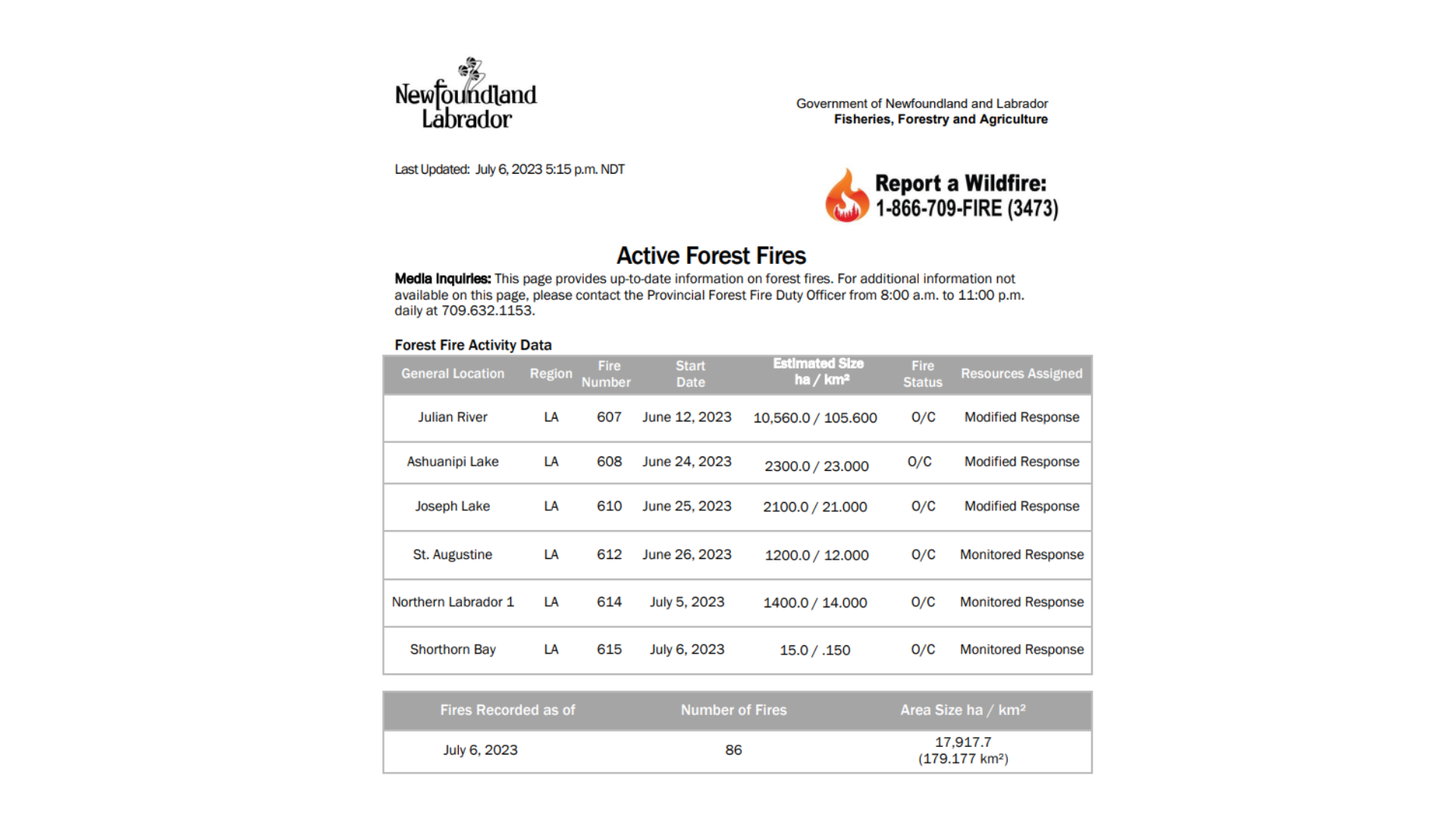
There are currently 5 active fires in Labrador, and there may be more after the next couple of days due to dry lightning strikes. Dry lightning strikes can be a very common starter of wildfires in remote areas of the country.
-

Hot and dry weather continues
Sunny skies are expected right across the province today. There will be some areas of…
-

Canada Games officials monitoring air quality for athletes amid wildfires
In just a few days, thousands of athletes will descend on the metro St. John’s…