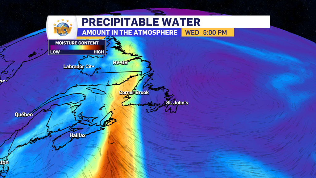

The weather pattern shifted overnight, which is a good thing for eastern sections of the Island, and a soggy thing for southwestern and western areas. Much drier air will move into eastern areas, which will allow for some clearing skies overnight and some sun tomorrow, while at the same time, more humid air pushes into western and southwest areas. The moist air will set the stage for some heavy rainfall on the southwest coast.
A Rainfall Warning has been issued for the Channel-Port aux Basques area and is now in effect into Thursday.

Rainfall amounts on the Southwest coast, over the next day or so, will be significant. Upwards of 80 mm looks to fall over some areas. Localized flooding is possible. Remember, you cannot tell how deep water is just by looking at it. If you come to a flooded roadway or washout, please do not proceed through it. The mantra I’ve used throughout my career is, “Turn around, down drown.”

Areas north of the southwest coast will not see near as much rainfall, however, some areas of the West Coast, and Port au Port Peninsula will see rainfall in the 15-30 mm range between later tonight and later Wednesday evening or early Thursday morning. This rain is needed as the ground in a lot of that area is quite dry.

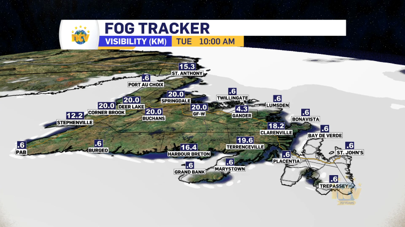
Wednesday will see the rain on the southwest coast of the Island, pushing its way up toward the West Coast, however, the rest of the Island will remain generally dry. Sadly, dense fog is going to make a return to the South Coast and southern shorelines and it will remain there for the next several days.


TO GET THE 7-DAY FORECAST FOR YOUR LOCATION, VISIT THE WEATHER PAGE AND USE THE SEARCH BAR! 🙂