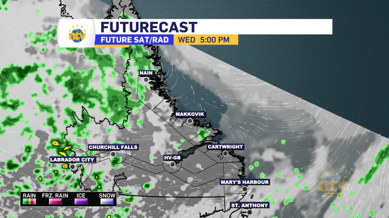
An area of low pressure will pass southeast of the Avalon Peninsula Friday afternoon and evening. The exact track of this low remains uncertain, which means forecast confidence in snowfall isn’t as high as it usually would be in this time frame.
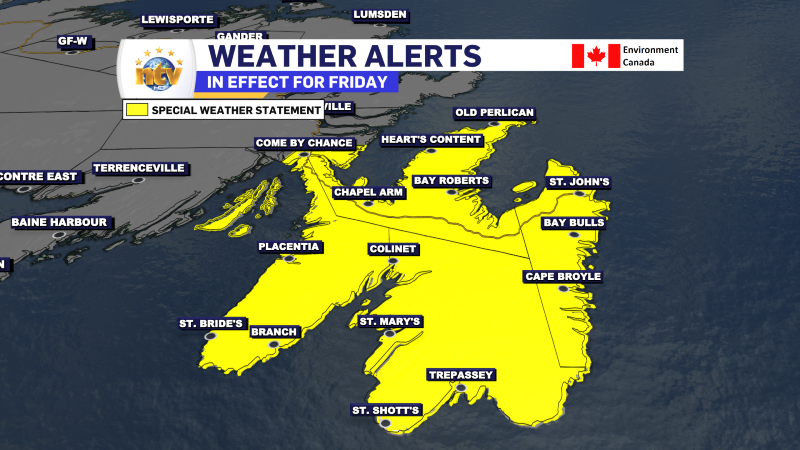
The Environment and Climate Change Canada Weather Office in Gander has issued a Special Weather Statement for Friday for the following areas:
- The Avalon Peninsula Southeast
- The Avalon Peninsula Southwest
- The Avalon Peninsula North
- St. John’s and vicinity
Snow is expected to begin around midday Friday and persist into the evening. Fresh snowfall, combined with strong north to northeast winds will cause reduced visilbity in blowing snow, especially over exposed areas.
According to the weather statement, the ECCC NL Weather Office in Gander states that 10 to 20 cm is in the forecast, with higher amounts over southeastern areas of the Avalon Peninsula. There is some uncertainty in the storm’s track, which could result in higher totals if the storm moves a bit closer to the Island. The opposite holds as well. This detail should become clear in the next 24 to 36 hours.
On top of that, maximum wind gusts will be 60 to 80 km/h, strongest along the coast.
Similar storms in the past have caused hazardous driving, cancellation of scheduled activities and disruptions to transportation services.
Forecast updates to come.
-
Unsettled for most of the province today
A mix of sun and cloud is anticipated across the Avalon Peninsula. Elsewhere, there is…
-
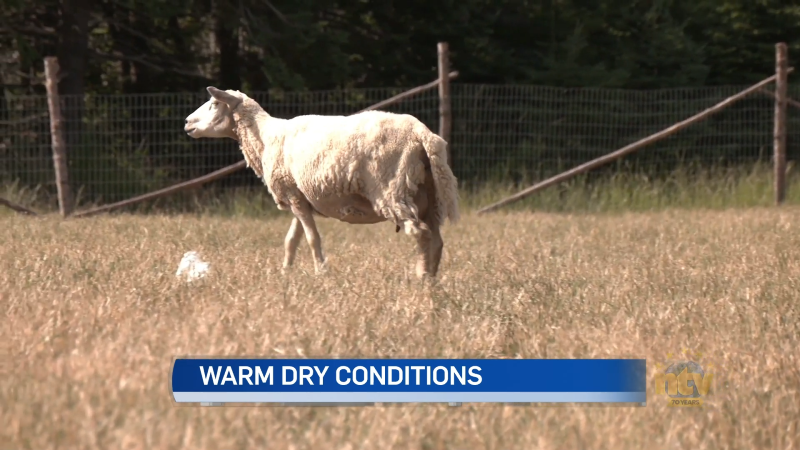
Coastal communities not able to escape hot, dry weather
Hot and dry conditions are taking their toll across the country. Even coastal communities in…