Friday afternoon update #1 | 1:21 PM NDT
Snow continues to fly over much of the Island. Totals from Gander to St. John’s are in the 7 to 10 cm range. Both Rodney Barney and Kelly Butt has measured similar amounts thus far.
While the snow is piling up on the grass and untreated surfaces, it is not sticking to many area roads. The reason is April’s high sun angle. Even though it’s cloudy, enough solar radiation comes through the clouds to keep paved surfaces near or above freezing, which melts the snow on contact. This is the case unless the snow is heavy, at which point it will start to stick.
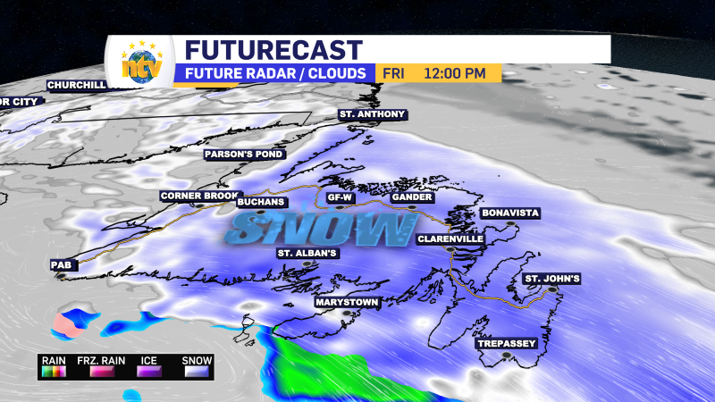
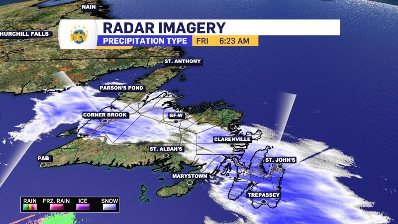
Friday morning update | 6:16 AM NDT
Snow has arrived across the Island, and at this early hour, we are on snow-covered roads from coast to coast. Radar shows where the snow is currently flying.
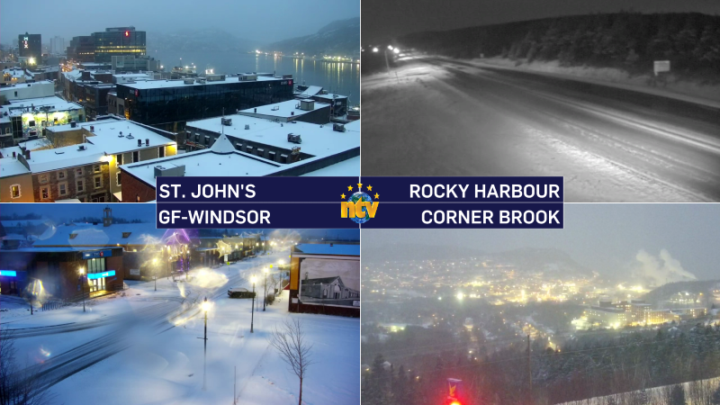
Some webcams show wintry driving conditions in various areas of the Island. Once the sun rises we should see travel conditions improve. The sun angle is relatively high this time of year, and unless the snow is falling with moderate to high intensity, roads will be more wet and slushy than white.
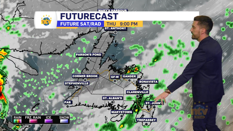
Thursday Evening Update
A weak area of low pressure will pass south of Newfoundland between late Thursday night and Friday. With plenty of cold air in place, snow will fly over much of the region during that time frame. While the amounts will not be overly significant, they will be enough to make for wintry travel and could result in flight delays from Deer Lake, Gander, and St. John’s.
If you’d like more details on the forecast, please watch the video at the top of the page. That’s my forecast from Thursday’s Evening News Hour.
Have a great evening!
Eddie