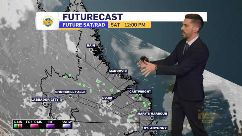
The snow across eastern Newfoundland will slowly end overnight from west to east. The heaviest snow will be over the Avalon, while areas to the west will see much lighter amounts. The reason for this is the low-pressure centre driving the snow has tracked about 30 to 40 km to the east. The Burin and Bonavista PEninsulas are about that wide, so the snow was forecast to be there is out over the bay(s) instead. Future Radar shows the snow pulling away from eastern areas quite well. Future Radar also shows the wind speeds and notices how the ramp up this evening. That will drive some areas of blowing and drifting snow and that will cause reduced visibility in many locations. Even after the snow has stopped, due to blowing and drifting snow.
Snowfall toatls will still be highest on the Avlaon, where 15 to 30 cm will fall for most areas by the time we are all said and done. Areas to the west will generally see less than 10 cm, and the drop between 10 cm and nothing will be quite sharp. Overall the forecast worked out well for the Avlaon, but not great to the west.

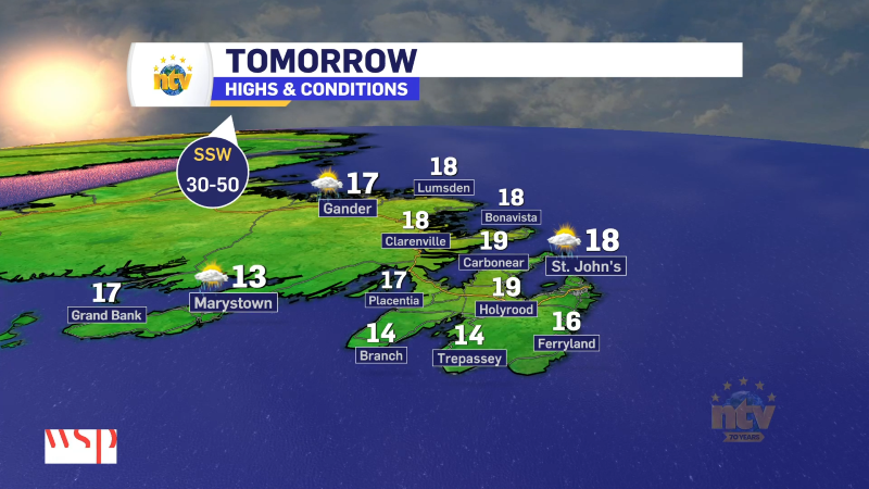
Behind this low, arctic air will settle into the Province for the weekend. That will drive temperatures into the minus teens and 20s for much of the Province by Saturday evening, and wind chills will be even lower. You’ll notice the arctic air moving in tomorrow because temperatures for many areas of the Island will actually fall during the day. Winds will also gust to 60 or 70 km/h, dropping wind chills to the -20s on the Island.

The cooldown will be reflected well via wind chills. As you can see in the video below they will generally tumble during the day tomorrow, ending up in the minus 20s for much of the Island, and -30s in Labrador during the afternoon and evening hours of Saturday.
While Sunday will not be much warmer, it will not be as windy. And beyond that, the weather looks fairly quiet for much of next week with the next chance of rain and snow arriving after Wednesday.