After the nicest day across the Island in about a week, showers make a return tonight and Thursday as a weak area of low-pressure swings in from the Maritime Provinces. The showers will arrive on the Southwest Coast this evening and spread north and east from there overnight. Arriving in Western, Central, and Eastern regions well after midnight. Lows of 5 to 10 across the Island, with areas of coastal fog likely in the east and northeast.
Labrador will see scattered showers and areas of rain in the north and west overnight. With the heaviest rain falling north of the populated centers in the west. Lows of 2 to 15 across the Big Land. The coolest readings will be found on the North Coast, and the warmest in the West.

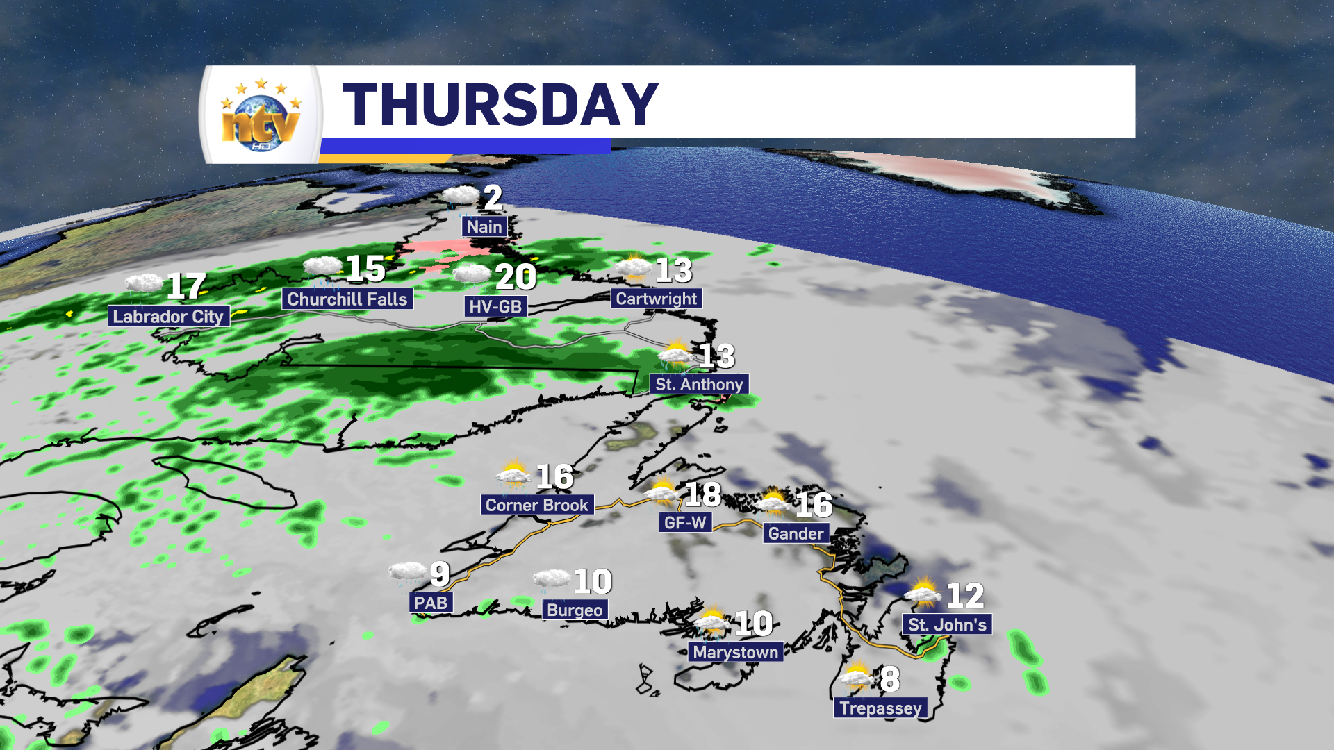
Thursday will see generally cloudy skies across the Island, with scattered showers. The showers will be most prevalent in the south, central, west, and the GNP. In the east and southeast, the showers will be less widespread, but definitely possible. Temperatures will be cooler, with highs of 10 to 18. Coolest readings will be found in the southeast, where winds will be onshore.
Labrador will see highs along the coast in the single digits with widespread showers. And perhaps even some wet snow north of Makkovik. Periods of rain will become widespread across much of the region by evening. Highs inland and in the west will be into the middle to upper teens.
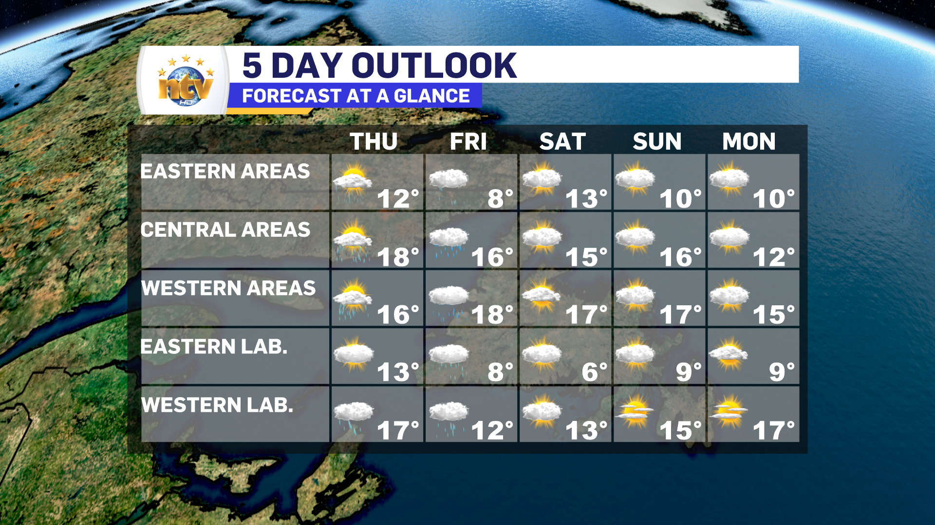
Rain returns to the Island Friday night and will continue for most areas through the day. The exception will be in the east, where the rain will end in the morning. Rain will taper to showers a bit later Central and West. More rain and showers will also continue into the Big Land on Friday. Temperatures will again be below normal, across the board.
The weekend will see improving weather across most of the Province, but temperatures will remain on the cooler side of things. At this time, other than showers, no major weather makers are on the way for the weekend.
-

Hot and dry weather continues
Sunny skies are expected right across the province today. There will be some areas of…
-
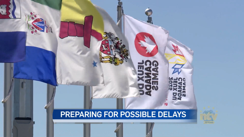
Canada Games officials monitoring air quality for athletes amid wildfires
In just a few days, thousands of athletes will descend on the metro St. John’s…