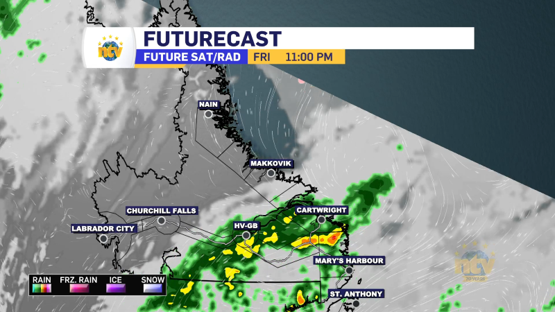
Pulses of heavy rain will move over eastern Newfoundland between Monday and midday Wednesday from an extremely slow-moving weather system. The rain will be heaviest between Tuesday and Wednesday, with the bulk of the rain falling in that time frame. Total rainfall amounts over the Avalon and Burin Peninsulas will likely be in the 50 to 100 mm range in this time frame. The highest amounts will likely fall over the southeastern Avalon Peninsula.

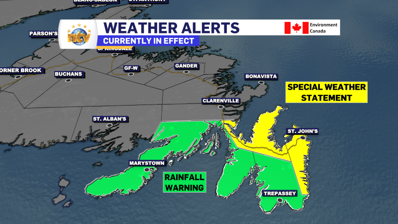
Ahead of the expected heavy rainfall, the Environment and Climate Change Canada Weather Office in Gander has issued a Rainfall Warning and a Special Weather Statement for the region. The Rainfall Warning is in effect for Avalon Peninsula Southeast, the Avalon Peninsula Southeast, and the Burin Peninsula. A Special Weather Statement remains in effect for the Avalon Peninsula North and St. John’s and vicinity.
Both statements suggest 50 to 100 mm of rain will fall and that similar events have lead to Similar events in the past have led to:
- localized flooding, especially in locations with poor drainage
- elevated water levels in creeks and streams, at times following over the banks
- water pooling on roads and erosion of road shoulders
There is a good chance the Special Weather Statement will be upgraded to a rainfall warning later Monday afternoon or early Tuesday morning.
I’ll be following the developments closely and will have frequent updates over the next couple of days.