Good morning! It’s April 1st, 2025, and this forecast is no April Fools joke!
Today’s Synopsis
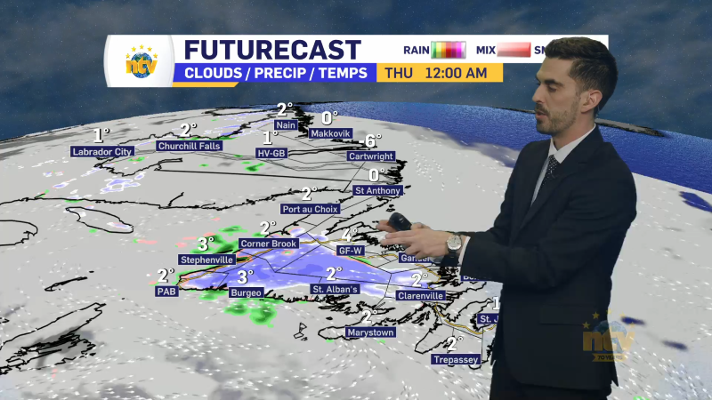
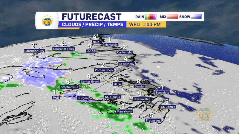
An area of low pressure will move through the Lower North Shore of Quebec and the Straits of Labrador today and tonight. The track of this low will send a surge of warm air over much of the Island. This will result in unseasonably warm temperatures and areas of heavy rainfall. Meanwhile, Labrador will see significant snowfall today, tonight and even into tomorrow. Granted the snow tomorrow will be along the coast.
Post 4 – 6:38 PM NDT (6:08 PM ADT)
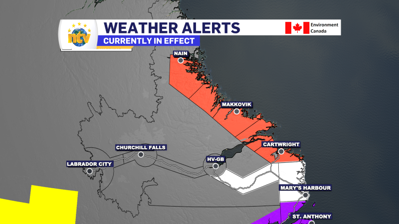
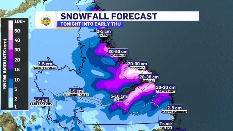
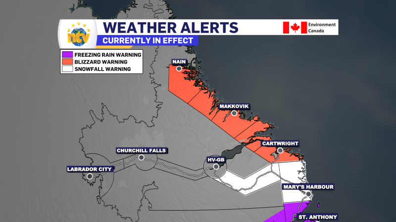
A blizzard warning is in effect for coastal Labrador from late tonight through late Wednesday. Heavy snowfall and high wind speeds are expected, with snowfall as high as 40 cm in some areas.
Meanwhile, wind speeds will gust as high as 120 km/h along the mid-coast thanks to a sting jet on the western, or back, side of the low that will migrate into the North Atlantic during the day.
In weather terms, a sting refers to the “sting jet” — a narrow, fast-moving stream of wind that descends from a storm system, often on the southern side of a rapidly deepening low-pressure system. It can cause sudden, damaging wind gusts at the surface, like a sting from the storm.
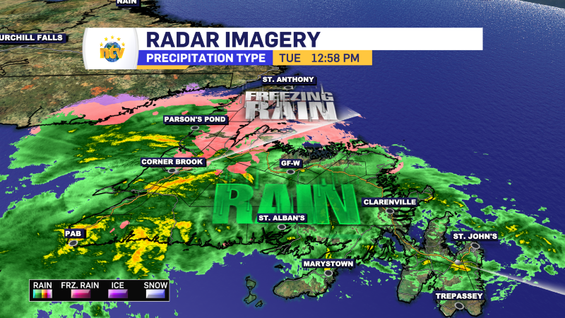
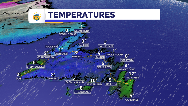
Post 3 – 12:59 PM NDT (12:29 PM ADT)
Rain and freezing rain are falling over much of the Island at this hour. Temperatures are also moderating in many areas, but are currently warmest on the Avalon, where St. John’s is reporting 12°!
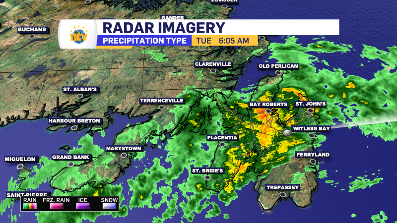
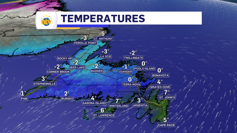
Post 2 – 6:05 AM NDT (5:35 AM ADT)
Temperatures have risen sharply over eastern areas of the Island, while the warm front has yet to life over many areas central and west. We are also looking at pockets of heavy rain over the Avalon and Burin Peninsulas at this early hour.
Post 1 – 5:55 AM NDT (5:25 ADT)
The Freezing Rain Warnings for Newfoundland have been mainly ended due to the threat passing. The exception area the Northern Peninsula and southern Labrador, where those alerts remain in effect as freezing rain is expected this afternoon.
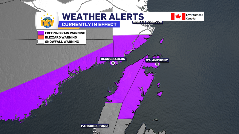
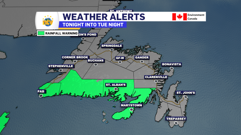
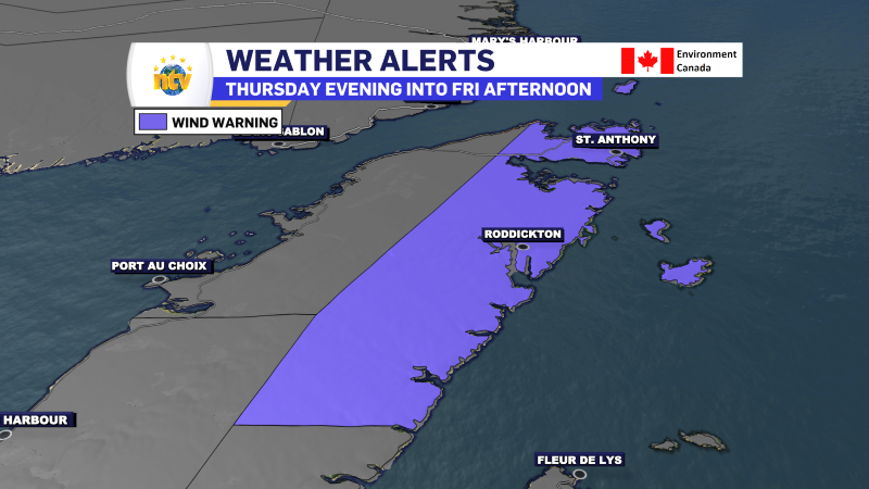
The Rainfall Warning remains in effect for the southern areas of the Island. A Wind Warning is also now in effect for the Northern Peninsula East for Wednesday afternoon and night.
A Blizzard Warning is now in effect for coastal Labrador from overnight into Wednesday evening for up to 30 cm of snow (stated in the alert). I do think some areas will see locally higher amounts. Wind gusts will be as high as 120 km/h, which may cause damage to some structures.
-

NTV Weather Update | April 21, 2025
Ryan Harding has your forecast from Monday’s NTV Evening Newshour.