


Cleanup continues in metro following multi-day winter storm
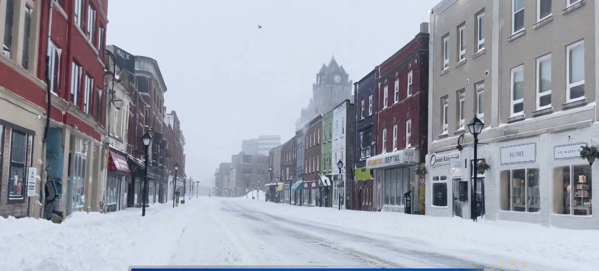
It’s the biggest snowfall since Snowmageddon.
In excess of 50 cm fell on St. John’s since late Tuesday, with reports over over 70 cm in Paradise.
According to NTV’s Ryan Harding, over 300 cm has fallen this winter in Eastern Newfoundland. The number is much higher in the Gander area.
The city held a press conference late Thursday to update on storm maintenance, noting workers are hoping to have a grip on cleanup by late this afternoon.
Here’s a look at the next few days across the province.
ST. JOHN’S/BONAVISTA
Today: Cloudy. Becoming a mix of sun and cloud this morning. Wind west 30 km/h gusting to 50. High minus 1. Wind chill near minus 12. UV index 1 or low.
Tonight: Partly cloudy with 40 percent chance of flurries. Wind west 20 km/h becoming southwest 30 gusting to 50 overnight. Low minus 8. Wind chill minus 9 this evening and minus 17 overnight.
Saturday: A mix of sun and cloud. Becoming cloudy in the afternoon with 60 percent chance of flurries late in the afternoon. Wind west 20 km/h gusting to 40 becoming light in the morning. High minus 4. Wind chill minus 15 in the morning and minus 9 in the afternoon. UV index 2 or low.
SOUTH COAST
Today: Mainly cloudy with 40 percent chance of flurries. Wind west 30 km/h gusting to 50. High minus 2. Wind chill near minus 10. UV index 1 or low.
Tonight: Partly cloudy. Wind west 30 km/h gusting to 50 becoming northwest 20 gusting to 40 near midnight. Low minus 9 except minus 16 inland. Wind chill minus 18 this evening.
Saturday: Mainly sunny. Increasing cloudiness in the afternoon then 40 percent chance of flurries late in the afternoon. Wind west 20 km/h becoming light in the morning. Wind becoming north 20 gusting to 40 in the afternoon. High zero. Wind chill minus 15 in the morning. UV index 1 or low.
CENTRAL
Today: A mix of sun and cloud. Becoming cloudy this afternoon. Wind west 30 km/h gusting to 50. High minus 1. Wind chill minus 16 this morning and minus 8 this afternoon. UV index 1 or low.
Tonight: Partly cloudy. Wind west 30 km/h gusting to 50. Low minus 15. Wind chill minus 8 this evening and minus 26 overnight.
Saturday: Cloudy. Snow beginning in the morning. Amount 2 cm. Wind becoming northeast 20 km/h gusting to 40 in the afternoon. High minus 1. Wind chill minus 23 in the morning and minus 7 in the afternoon.
WEST COAST
Today: Flurries. Amount 2 cm. Wind west 20 km/h. High minus 3. Wind chill near minus 12. UV index 1 or low.
Tonight: A few flurries ending late this evening then mainly cloudy with 40 percent chance of flurries. Wind west 20 km/h becoming light near midnight. Low minus 10. Wind chill near minus 17.
Saturday: Cloudy. Snow beginning in the morning. Blowing snow over exposed areas late in the afternoon. Amount 2 to 4 cm. Wind becoming north 20 km/h gusting to 40 near noon then northeast 40 gusting to 60. High minus 1. Wind chill minus 14 in the morning and minus 8 in the afternoon.
NORTHERN PENINSULA
Today: Cloudy with 60 percent chance of flurries. Periods of snow north of Hare Bay late this afternoon. Amount 2 cm north of Hare Bay. Wind west 20 km/h gusting to 40. Temperature steady near minus 4. Wind chill near minus 12. UV index 1 or low.
Tonight: Snow at times heavy. Blowing snow over exposed areas this evening and after midnight. Amount 15 cm except 5 cm south of Hare Bay. Wind west 30 km/h gusting to 50 becoming north 20 gusting to 40 overnight. Low minus 6. Wind chill minus 14 this evening and minus 9 overnight.
Saturday: Snow and blowing snow. Amount 5 to 10 cm except 15 cm inland and over higher terrain. Wind north 50 km/h gusting to 70 becoming northeast 70 gusting to 90 near noon. High minus 1. Wind chill near minus 12.
HAPPY VALLEY/GOOSE BAY
Today: Periods of snow. Amount 2 to 4 cm. Wind becoming north 20 km/h gusting to 40 this afternoon. High minus 5. Wind chill minus 22 this morning and minus 12 this afternoon.
Tonight: Periods of snow ending near midnight then cloudy with 40 percent chance of flurries. Amount 5 cm. Wind north 20 km/h gusting to 40. Temperature steady near minus 4. Wind chill near minus 12.
Saturday: Cloudy with 60 percent chance of flurries in the morning then a mix of sun and cloud. Blowing snow over exposed areas in the morning. Wind north 30 km/h gusting to 50. Temperature steady near minus 4. Wind chill near minus 16. UV index 1 or low.