Multiple record and monthly highs were set throughout the Big Land Saturday, and numerous locations throughout the Province reached the lower 20s under bright sunshine and surprisingly light wind speeds. Rodney Barney, a Meteorologist with the Environment and Climate Change Canada Weather Office in Gander (ECCC NL) highlighted this with a tweet.
Warm Saturday much of #NLwx. Coastal Labrador setting more October monthly record highs:
— Rodney Barney (@rcbstormpost) October 7, 2023
26.1°C at Mary's Hr (old 22.5°; Oct 4, 2005 – data since 1983).
23.9°C at Nain (old 20.2°; Oct 12, 2019 – data since 1984).
23.4°C at Makkovik (old 22.7°, Oct 6, 2023 – data since 1983). pic.twitter.com/PiXAKnhz5J
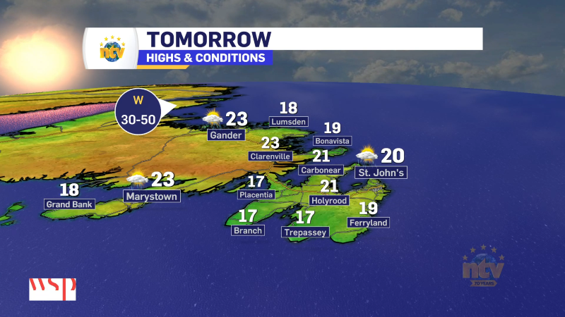
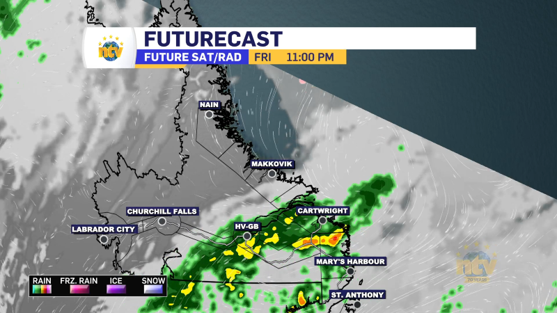
Sunday will see the remnants of Philippe push westward into Quebec. This will generally keep the weather across NL calm, although showers will push into Labrador West this afternoon, along with southwestern Newfoundland. Temperatures today will be warm, but shouldn’t be as warm as yesterday for most areas. We can thank that to clouds scooting into Labrador, limiting highs to the upper teens to about 20, and not so much over 20.
On the Island today, we should see more sunshine over a large part of that didn’t see it yesterday. In fact, oddly enough, skies will clear from east to west today and even the Avalon should see some sunshine by later this morning. The west and southwest coast may be hard-pressed to break into the sun, however, as the cloud over this area is more related to Philippe. Speaking of Philippe, this morning Marine Atlantic Crossings are cancelled. Be sure to check with them for the evening sailings!
Futurecast, below, should time out the clouds, showers, and temperatures across the Province for our Sunday and Monday.
Have a Happy Thanksgiving!