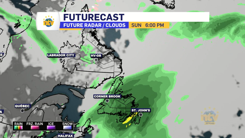
An area of low pressure working through the Gulf of St. Lawrence this evening is pushing rain across the Island and a large part of southeastern Labrador. The rain will continue to work in as the night progresses and will become heavy at times for many areas as that happens. Rainfall Warnings are in effect for much of southern Newfoundland and parts of southeastern Labrador.

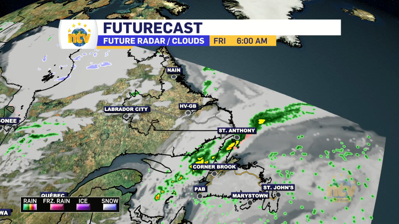
The rain will continue through tonight and much of Thursday in southeast Labrador. On the Island, the rain will end from west to east as the day goes on, however, showers and light will persist on the West Coast. Meanwhile, the Avalon and Burin Peninsulas will see extremely heavy rainfall rates Thursday morning, before that eases, and eventually ends, in the afternoon.
Rainfall amounts will be highest over southern parts of the Island and southeast Labrador, where a widespread 50-100 mm is in the forecast. Generally, amounts will be under 50 mm as one moves away from those locations.
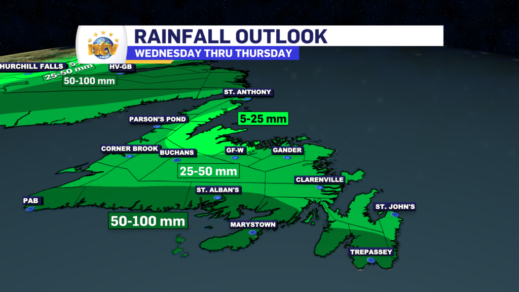
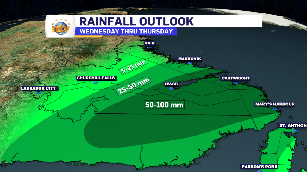
This amount of rain will certainly lead to some localized flooding, but I’m not expecting to see widespread flooding and washouts unless the amounts are significantly higher than forecast. Which is certainly possible in some areas, given the setup.
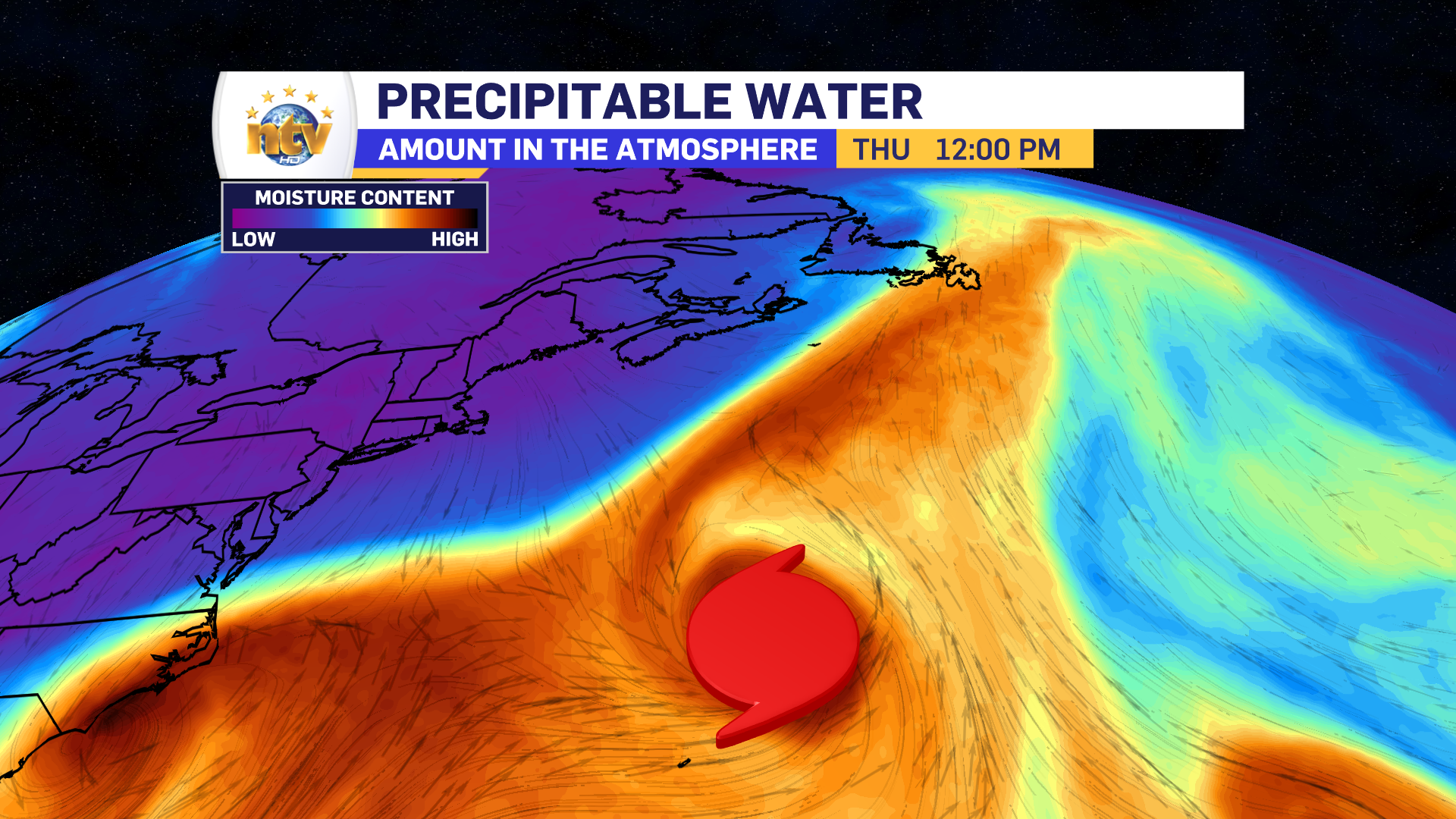
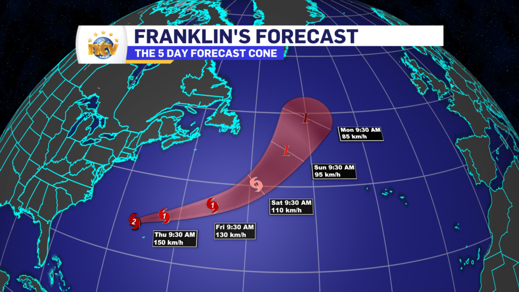
The reason the rainfall rates are going to be high is because the area of low pressure moving through the Gulf is going to pick up some tropical moisture from Hurricane Franklin. And while Franklin is going to remain well to our south, its moisture will not.
The image below shows atmospheric moisture, and notice that fetch of brighter colours directed right into the Province. That’s the moisture feed from Franklin getting pulled into the area. This will slowly move east on Thursday, and be replaced by a crisp, fall-like airmass for Friday.

In addition to the rainfall, we are going to see some fairly high early-season wind gusts over parts of the West Coast and Southern Labrador tomorrow. Gusts in some areas will be near, or just higher than, 100 km/h for a period of hours on Thursday. The map below shows the highest expected wind speeds over the next 24 hours, and again, most of that will happen during the day tomorrow.

Note the two high spots, which are from near Cartwright to Battle Harbour in Labrador (on the coast) and north of Bonne Bay on the Island. These are the areas that may see gusts nearing 100 km/h on Thursday. Outside of that, expect the more standard gusts to 50 to 70 km/h later tonight and Thursday.
These winds are not to do with Franklin, but with the separate system bringing the rainfall.
Lows tonight dip to near 20 on the Island and highs tomorrow will sit near 20. In Labrador lows tonight will be in the 5 to 7 range, with highs near 11 tomorrow.


