Forecast Discussion
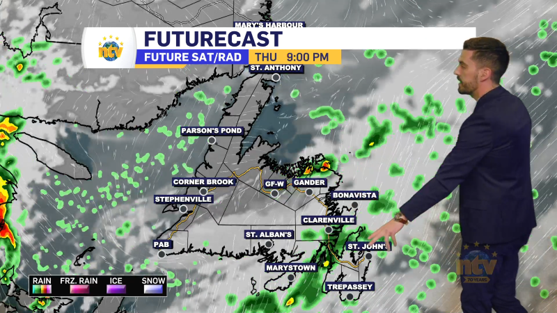
A weak area of low pressure will develop over the Lower North Shore of Quebec and swing into Labrador this weekend. This low will drive rain, and even wet snow, across the Province between tonight and late Sunday. Once into next week, we will be in a relatively unsettled weather pattern, but the systems look to be transient, meaning they will move through the region quickly. And once past this weekend, there doesn’t look to be much in the way of significant precipitation events as I look into next week.

Rain will arrive on the Island Saturday afternoon on the West and Southwest Coast and Saturday night just about everywhere else. Rain will end Sunday morning, from west to east, but showers will linger into the afternoon. Parts of Central and northeast coast may also see a period of rain Sunday afternoon. Rainfall amounts look to be light to moderate, but some areas will pick up 20-30 mm of much-needed rainfall in that time frame.

Rain and wet snow will also fall in Labrador between Saturday afternoon and Sunday morning. Some higher elevations of interior Labrador, and even on the coast, will pick up 15-30 cm of wet snowfall. Lower elevations will likely see some mix of rain and snow, as temperatures will borderline from Saturday afternoon into Sunday.

Newfoundland’s Weekend Forecast
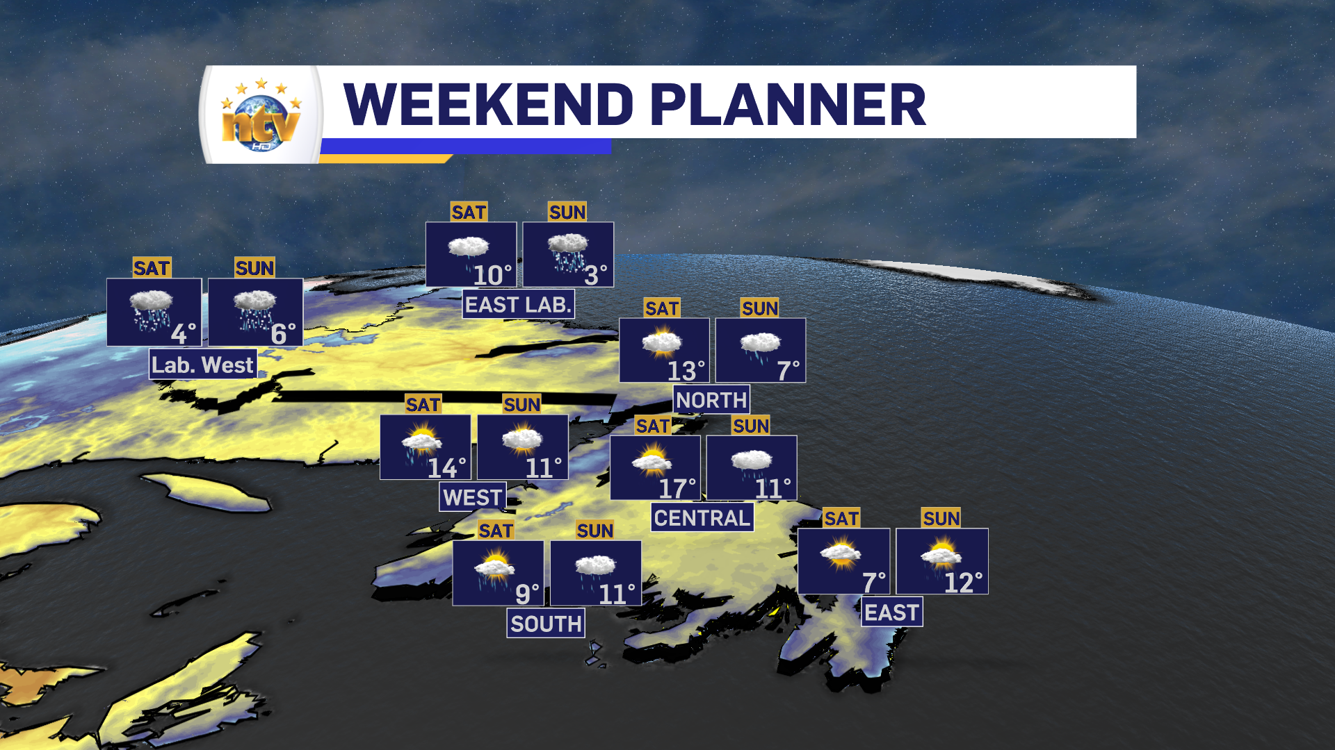
Friday night: Mostly clear and chilly. Lows near 0, except closer to 5 on the West Coast and South Coast
Saturday: Clouds are on the increase after a sunny start. Rain arrives West and Southwest during the afternoon. Highs near 10 east, 17 central, and 14 on the West Coast. The South Coast will see highs of 5 to 10. Locally cooler temps will be found in areas of onshore southerlies.
Saturday Night: Rain. Lows of 2 to 5.
Sunday: Rain ends for eastern areas in the morning. Risk of showers across the board, and a chance of rain in the afternoon for Central and the northeast coast. Mostly cloudy. Highs around 10.
Labrador’s Weekend Forecast
Friday night: Increasing cloud. Rain and wet snow arrive in the west after midnight. Lows of 0 to 7.
Saturday: Periods of rain and snow. Snow will be heavy at times in the higher elevations of northern and western Labrador. Travel conditions will be impacted for some areas, along with air travel to the coast. Highs of 4 in the west to 10 on parts of the coast.
Saturday Night: Periods of rain and snow. Lows of -2 to 2.
Sunday: Periods of rain and snow. Highs of 3 to 6.
Long Range Forecast
Next week will see various amounts of sun on the Island with scattered showers on the West Coast. Highs remain in the teens and lows in the single digits. Labrador will see areas of showers and flurries, with highs in the lower to mid, single digits.