My forecast from Tuesday’s NTV Evening News Hour will be attached to this post this evening
POST 3 | 6:43 PM NST (6:13 PM AST)
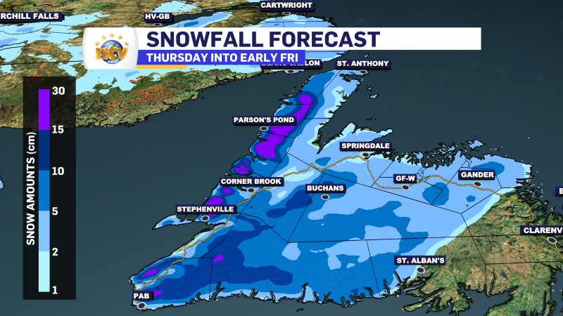
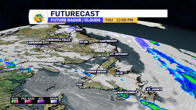
Rain across the Island will wind down overnight or early Wednesday morning. The next weather-maker moves in Thursday, which will bring a combo of rain and snow to the Island. As of now, snowfall looks minimal, with amounts of 5 to 15 cm expected. The higher amounts will be found int he higher terrain.
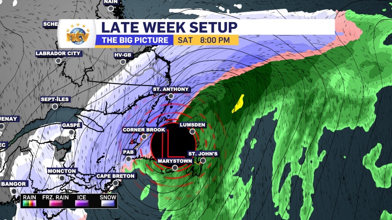
Friday looks quiet, initially but then a more potent storm begins to take aim at the region. Rain, snow, ice, and wind will move through NL between later Friday and Saturday. As it stands now, eastern areas will see rain, central will see some combo of snow to ice and possibly rain, and the West Coast and GNP will see snow, along with southeast Labrador. While it’s too early to get specific amounts of snow, it looks potentially significant for areas that stay snowy.
POST 2 | 4:42 PM NST (4:12 PM AST)
Prospects of a white Christmas are not great on the Avalon…
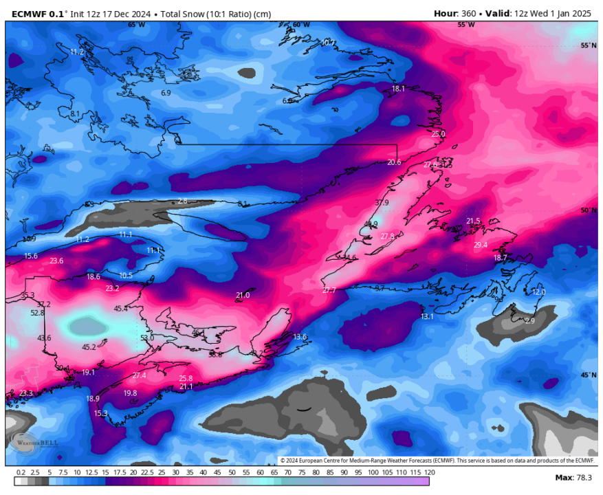
Here is the snowfall forecast for the next 15 days. While some areas of central and western Newfoundland and the GNP look to pick up a fair bit, much of Labraodor and southeastern Newfoundland look primarily left out.
Keep in mind this could change… but we do not look to be heading into an overly snowy weather pattern in the medium to long range.
POST 1 | 6:23 AM NST (4:53 AM AST)
FIRST… TODAY’S FORECAST
Quiet weather today across the Island initially, but rain will arrive on the west and southwest coast this afternoon and spread north and east this evening and overnight. Meanwhile… snow will spread into Labrador West this morning and spread east throughout the day. The snow will ease off overnight with most areas seeing 5 to 10 cm. There will be lesser amounts in the southeast, where rain will prevent snow from accumulating.
LOOK AT EARLY AM WEATHER
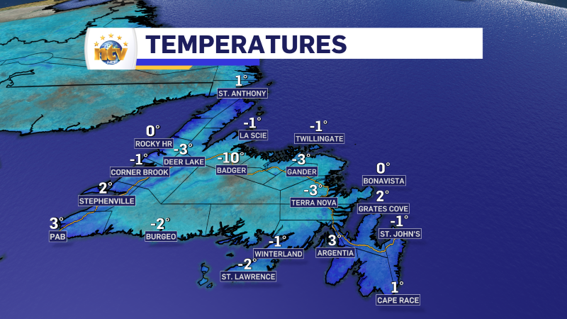
The weather across the Island is starting off on the quiet and calm side this morning, with just various amounts of cloud cover and some reasonably cool temperatures for the time of today. Here are some readings as of 5:30 AM NST.
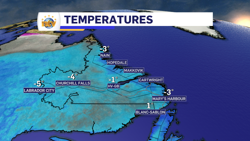
Meanwhile, in Labrador, temperatures are a bit cooler but still well above where they should be for the time of year. The coolest readings are in the west, where its a “mild” -5º in Labrador City and Wabush as of 5 AM AST.
Snow is expected to move throughout the Big Land today, and road conditions on 511nl.ca show the TLH from Wabush through most of the Churchill Valley as being partly covered with snow. Webcams in the area aren’t showing a lot, but it should show snow on the roads once the day breaks. The images below should be automatically updated to the latest image from the respective webcam.
Wabush
Churchill Falls
Happy Valley-Goose Bay
Crook’s Lake
-
NTV Weather Update | May 14, 2025
Victoria Day Long Weekend Forecast: Tame Start, But Some Twists Ahead As we approach the…