Post 3 – 6:46 PM NST (6:16 PM AST)
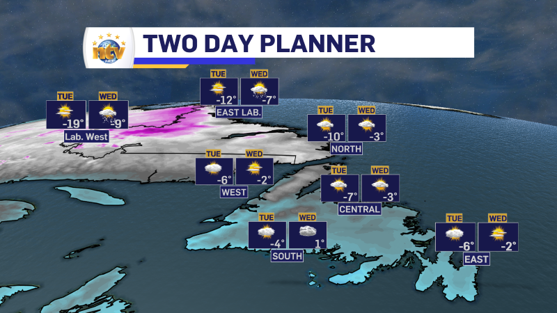
The weather over the next couple of days looks generally quiet and kind of cold across the Province. The only weather in the forecast is some flurries and/or pockets of light snow on the West and Southwest Coast tonight and tomorrow. Christmas Day looks excellent!
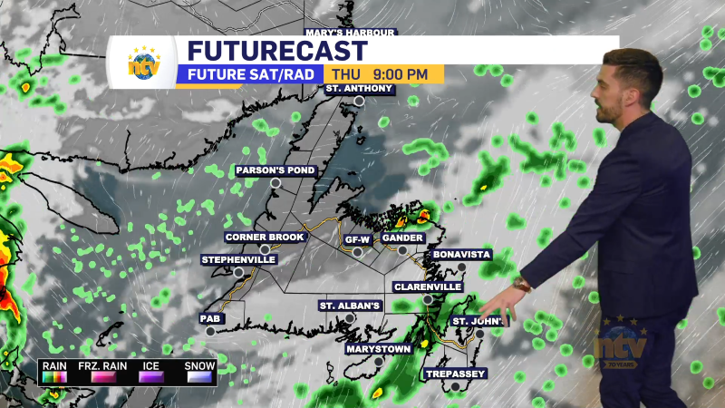
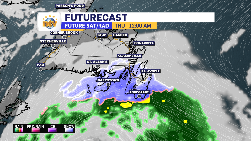
The next weather-maker looks to roll in on Boxing Day, primarily affecting eastern Newfoundland with snow and rain. As of this evening, snow will develop over the Avalon early Thursday morning and change to rain at some point before noon. Snowfall amounts look uncertain, but this is a setup that typically doesn’t yield much.
Stay tuned for details on this one and have a great Christmas!
Post 2 – 12:23 PM NST (11:53 AM AST)
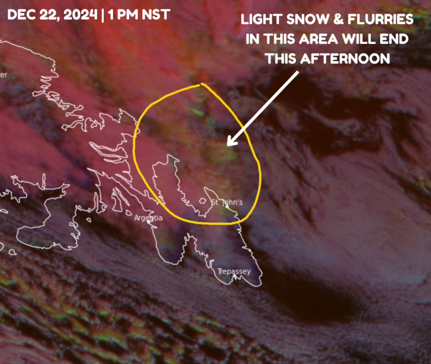
An area of light to moderate snow seems to be rolling down parts of the northeast coast and northern areas of the Avalon this afternoon. Morning guidance suggests this may very well continue into the afternoon. Area that remain in persistent snow will probably end up with a few centimetres. The farther north you, the better the chance of seeing some accumulation.

Post 1 – 6:50 AM NST (6:20 AM AST)
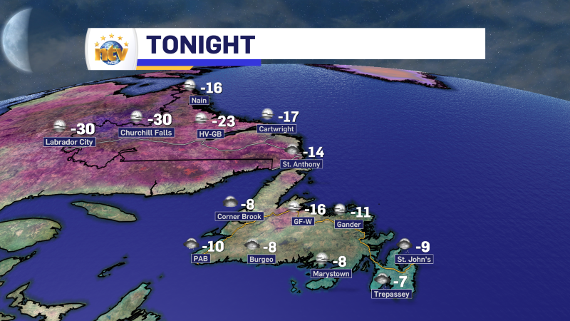
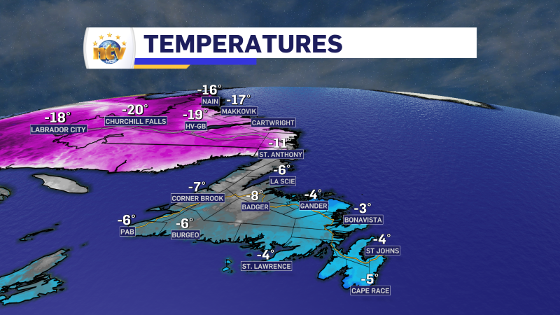
We are starting off the day with some chilly temperatures across the region. Temperatures on the Island from the minus single digits to about -10ºC; meanwhile, the Big Land is seeing readings into the minus teens to near -20ºC.
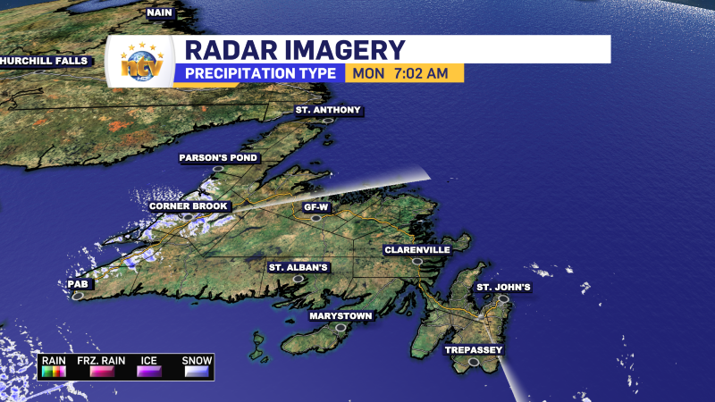
We are also seeing a few flurries over the Island this morning. Both radars are showing them and there are likely areas outside of where the radar can “see” that are also seeing some. Remember snow means slow and to brush off your windows before heading out for the day.
Temperatures today will not move upwards a whole lot, but other than the flurries, the weather across the Province looks very quiet today. In fact, for most of the wee,k the weather seems quiet.