Thursday’s Forecast
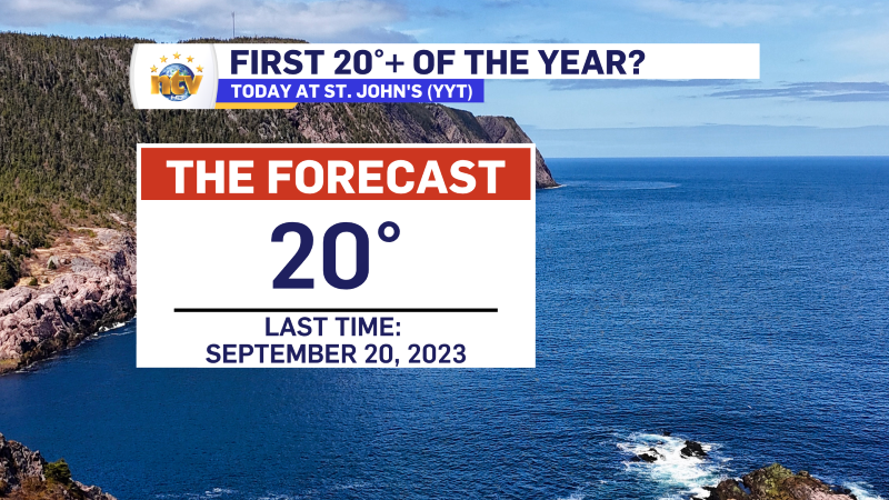
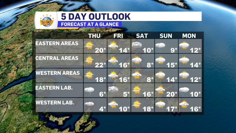
It’s been 252 days since St. John’s International Airport reported a high of 20° or more. It’s looking quite likely that streak will end Thursday! High temperatures in the Metro should creep into the lower 20s under bright sunshine and light to moderate southwest winds.
The rest of the Island will be similar, with sunshine and highs in the upper teens to lower 20s. It will be cooler on parts of the Northern Peninsula and in areas of onshore, west and southwest winds. These areas will see highs in the lower to middle teens.
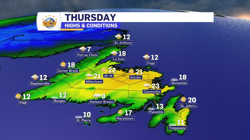
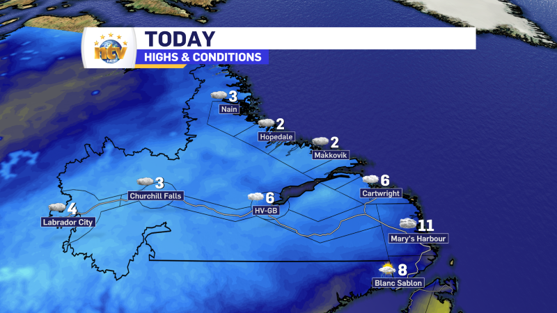
Showers and areas of light snow will persist across much of the Big Land, with highs of 3° to 6°. Not much more in the way of snow will accumulate on Thursday.

Friday’s Forecast
Newfoundland will see a risk of showers in the afternoon, with highs in the middle teens. Some inland locations will creep into the upper teens. Skies will be mostly cloudy, turning cloudy as the showers become more widespread late in the day.
Coastal Labrador will see skies remaining cloudy, with decreasing clouds the rule for the west in the afternoon. Highs range from 5° east to 10° in the west.
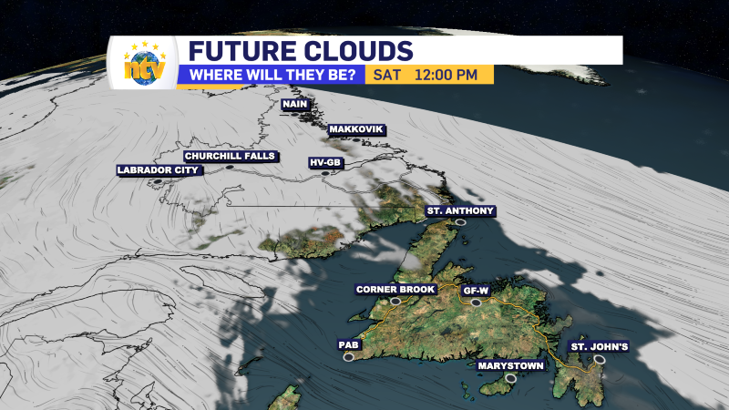
Saturday’s Forecast
Cloudy to mainly cloudy on the Island, with highs near 10°. Sunny in Labrador with highs in the middle to upper teens.
Sunday’s Forecast
A chance of rain for the eastern thrid of the Island, while the western two-thrids look dry and mostly cloudy. HIghs of 9° east and onto the GNP, while central, southern and western areas climb to 15°.
Monday’s Forecast
Cloudy to mostly cloudy across the Province, with highs of 12° to 16°.
-
NTV Weather Update | May 16, 2025
May 2-4 Long Weekend Weather Outlook: Mostly Mild and Manageable The unofficial kickoff to summer…