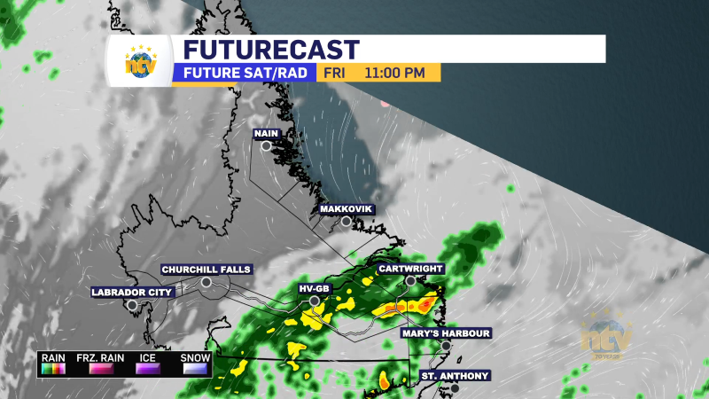
An area of low pressure will move across Labrador overnight and that will drive some rain across the Big Land and into western sections of the Island along a cold front. There may even be some isolated thunderstorms as well. Areas of central and eastern Newfoundland will see showers arrive late, but that will be about it. Lows will be in the middle teens for most of the Province, except in northern Labrador, where it will be closer to 6°.

Friday will see morning rain and/or showers over the West Coast of the Island and even into Central and much of the South Coast. Those will end as the rain moves east and the skies will clear in the afternoon. Areas of eastern and northeastern Newfoundland will remain mainly cloudy, with scattered showers for the last day of the work week. Coastal Labrador will be the same, however sun and cloud return to the west.
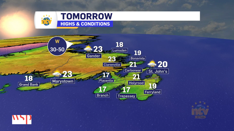
Highs on the Island will be in the upper teens to middle 20s and it may be a little humid too. Labrador will see highs ranging from 10° in the north to 18° in Goose Bay and southeast coast and closer to the lower teens in the west.

Rainfall amounts will be locally significant in parts of southeastern Labrador and along the South/West Coasts of the Island where heavy downpours move through overnight into early Friday morning. Beyond that, widespread significant rainfall isn’t expected.

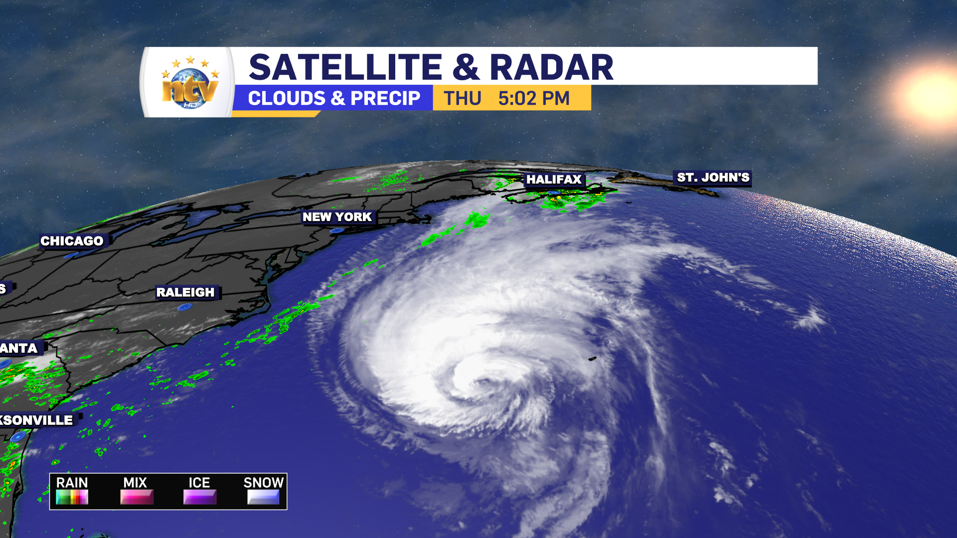
The weekend will see some showers on the Island Saturday, while clouds will be on the increase in Labrador during the afternoon. Rain and showers will move in Sunday, as what’s left of Hurricane Lee approaches the region. The remnant low of Lee will move past the Island on Monday. At this point, while heavy rain and breezy conditions will accompany the low, widespread severe impacts aren’t expected in NL.
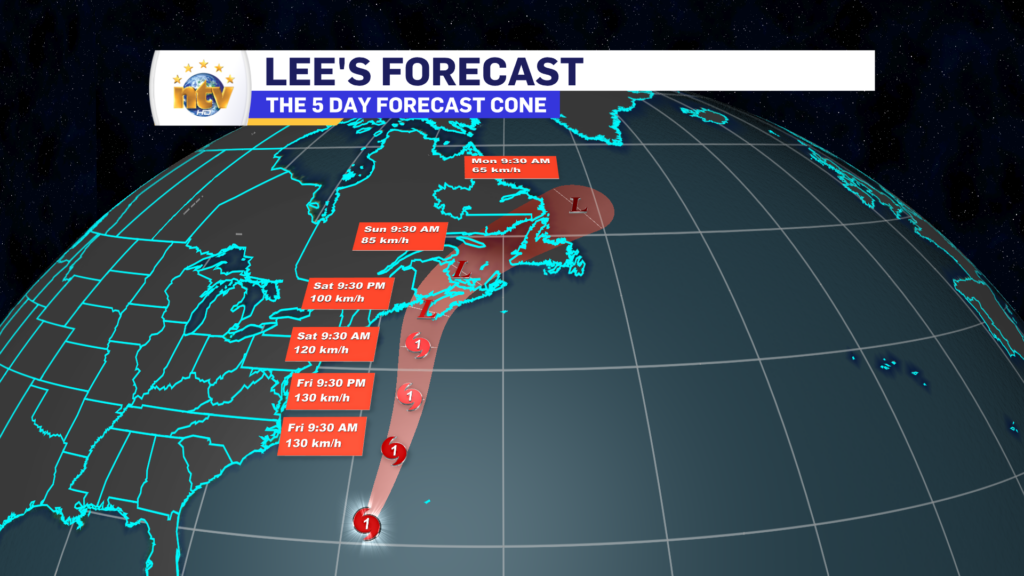
Our neighbors in the Maritime Provinces, particularly in parts of western Nova Scotia and New Brunswick will not be so lucky. Hurricane and tropical storm force wind gusts (100 to 120 km/h) will be felt for a large area where Tropical Storm and Hurricane Watches are now in effect. 3
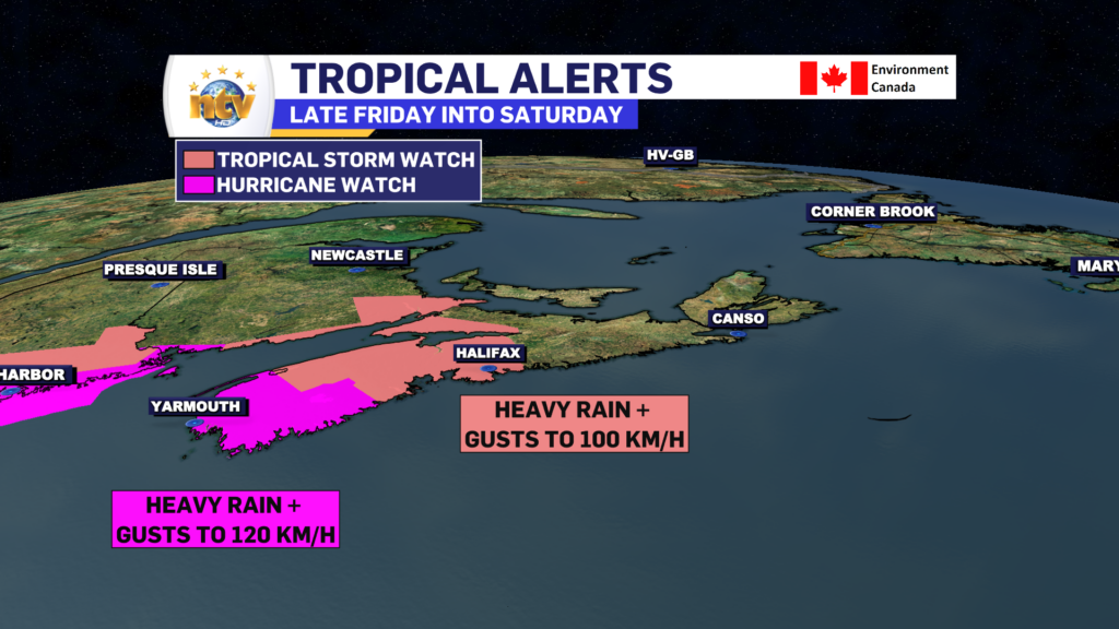
Along with that will come some very heavy rainfall Friday night into early Sunday, with some parts of western Nova Scotia and New Brunswick seeing as much as 150 mm of rain. There will also be some coastal flooding due to high waves and storm surges along the coast of Nova Scotia and into parts of the Bay of Fundy.

While I’m not currently expecting widespread storm surge in Newfoundland, I do expect some high waves to move past the southern shorelines Sunday night into early Monday. This may result is some tidal flooding at high tide Sunday night and early Monday morning. Particularly for low-lying areas from the Connagire Peninsula to the southeast Avalon (Cape Race).


