Heavy rain and humidity has parts of Newfoundland under weather alerts into Tuesday

Ryan Harding, NTV Weather Centre
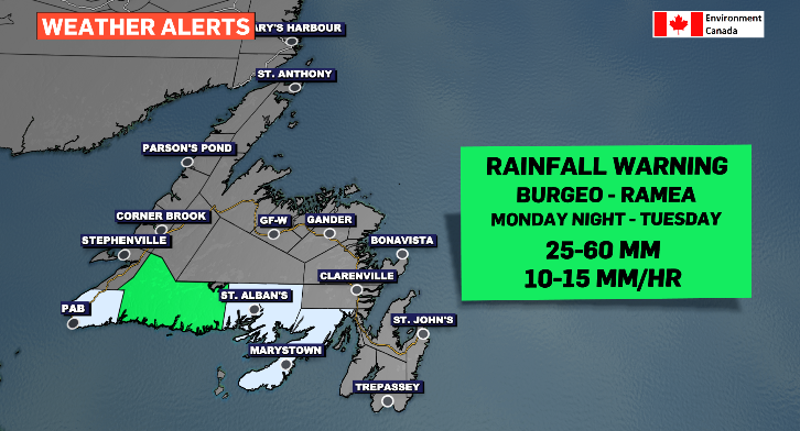
Periods of heavy rain moving across island Tuesday
Picking up as a starting point on the southwest coast of Newfoundland through the overnight, periods of heavy rain spends Tuesday moving west to east lasting into Wednesday morning for the far east of the Avalon Peninsula.
Before and after the rain, there are some sunny breaks to be had. The south-facing side of the island will see prolonged periods of fog thanks to a southwest wind.
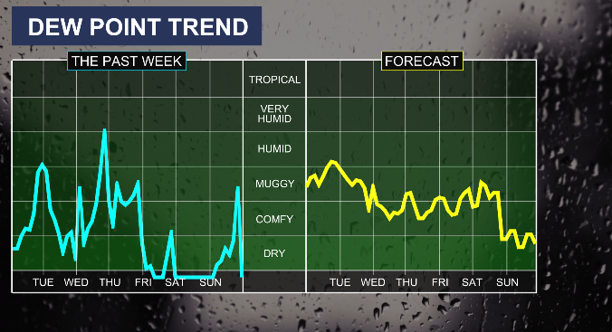
Due to the high humidity expected for Tuesday, it’s likely to see some isolated areas see higher than anticipated totals as warm, moist, air has a tendency to produce random increases in rainfall in spurts as well as increase the potential for thundershowers.
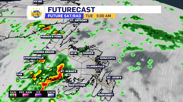
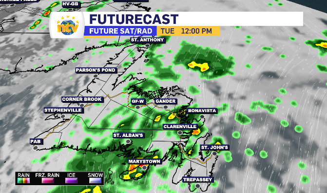
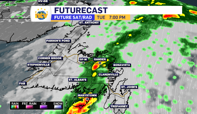
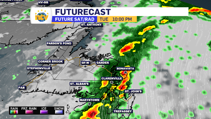
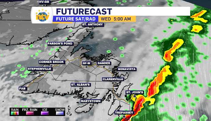
Anticipated rain totals for Newfoundland Tuesday
Southwest Coast: 20-40 mm
South Coast: 30-70 mm
West Coast: 10-20 mm
Northern Peninsula: 5-10 mm
Baie Verte Peninsula: 10-15 mm
Fogo/Twillingate: 10-20 mm
Central: 10-30 mm
Kittiwake Coast: 15-30 mm
Connaigre Peninsula: 20-50 mm
Burin Peninsula: 20-50+ mm
Bonavista Peninsula: 15-25 mm
South Avalon: 20-45 mm
North Avalon: 15-25 mm
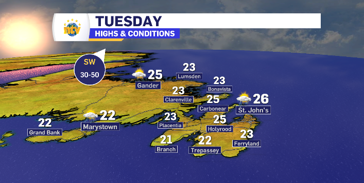
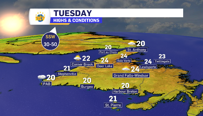
Daytime highs for Newfoundland and Labrador Tuesday:
With the added humidity Tuesday, the following base temperatures are likely to feel anywhere from 8-11 degrees warmer, pushing much of the island into feeling like over the 30 degree mark.
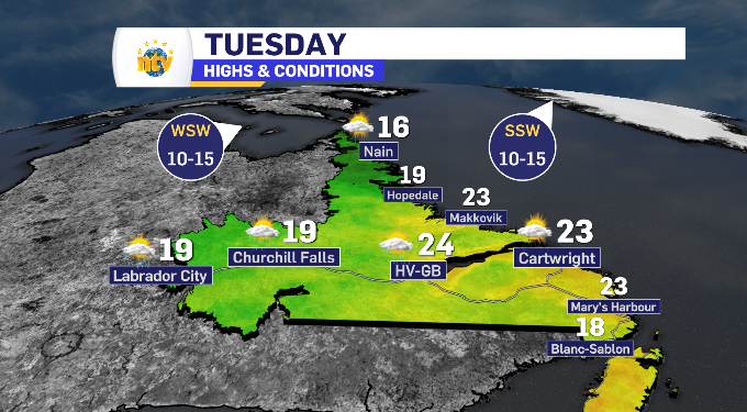
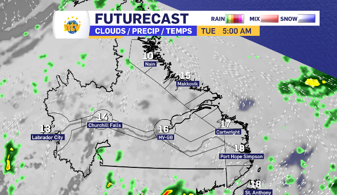
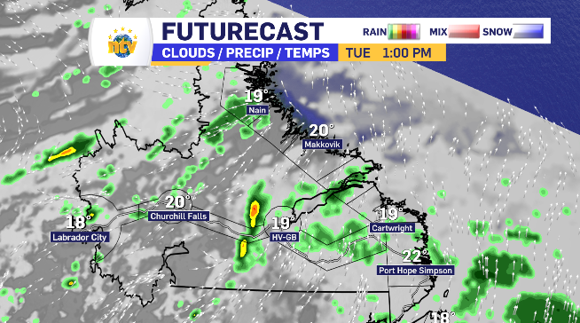
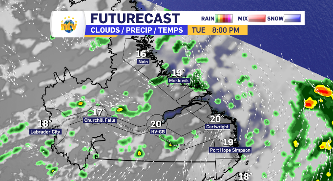
Cloud breaks across Labrador Tuesday with scattered light showers
Labrador looks to start Tuesday under a blanket of clouds.
As the day rolls on, those clouds break open offering periods of sunshine. However, the remaining clouds do hold the chance to carry light showers across each region.
In Happy Valley-Goose Bay specifically, those showers have the opportunity to be accompanied by some thundershowers.\