Heavy rain across Labrador fuels periods of rain and increased wind across Newfoundland Tuesday

Ryan Harding, NTV Weather Centre
Rain with a stronger wind front moves west to east across Island Tuesday
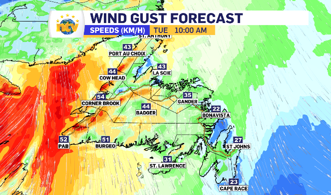
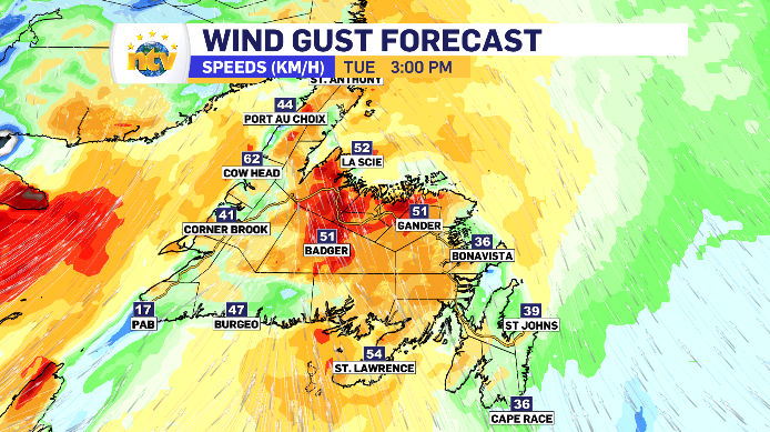
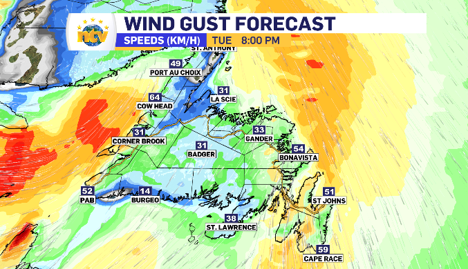
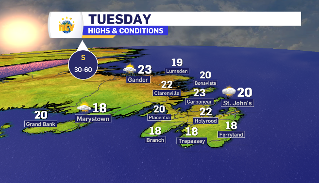
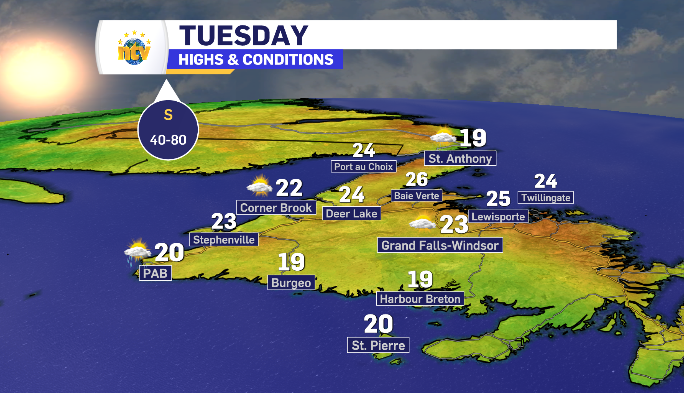
Tuesday brings a thin band of rain that looks to drop 5-10 mm quickly on most regions of Newfoundland. There is an increase south wind gusting 40-60 km/h in front of the rain, arriving a few hours earlier than the rain itself.
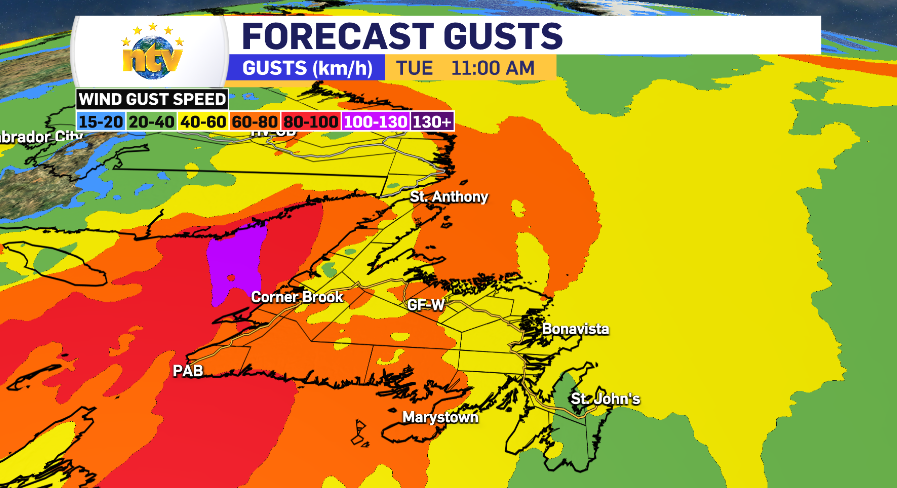
Along the south and west coastlines, the chance is there to reach 80+ km/h and it’s gustiest.
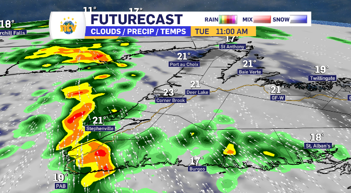
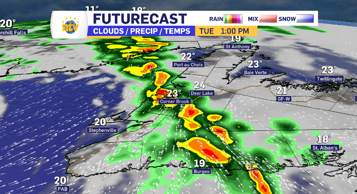
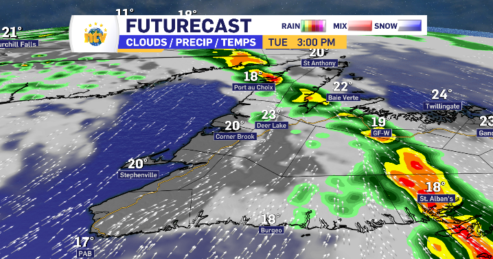
The rain is right behind it, moving in a thin line, in the exact same patter and relative time frame as the wind. The high end of the 5-10 mm range is reserved for communities further south on it’s path.
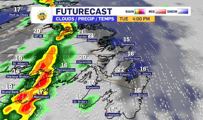
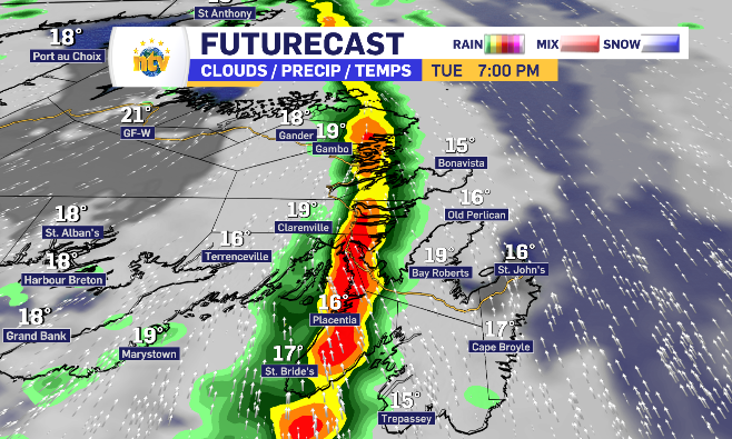
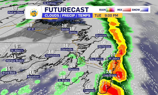
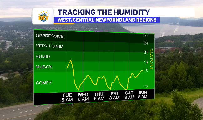
The humidity that the West Coast and Central regions have had building over the past 48-hours is prevalent Tuesday morning, adding anywhere from five to eight degrees to the ‘feels like’ temperature, however, that humidity breaks with the rain passing through.
Newfoundland and Labrador daytime highs for Tuesday
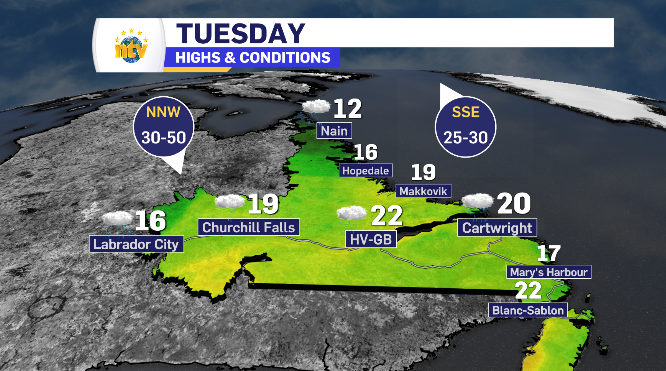
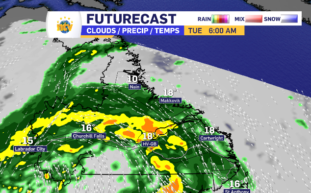
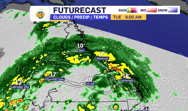
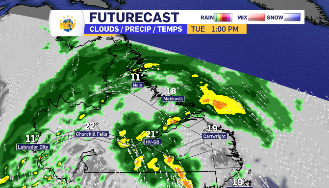
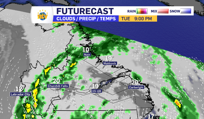
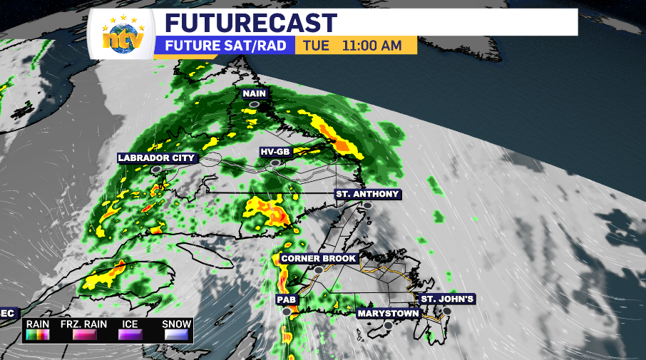
Labrador’s rain cycles through entire region Tuesday, dropping varrying totals
All of Newfoundland’s rain is byway of Labrador as the system’s tail brushes across the island, dropping the most significant totals in across The Big Land.
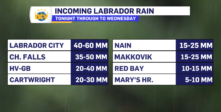
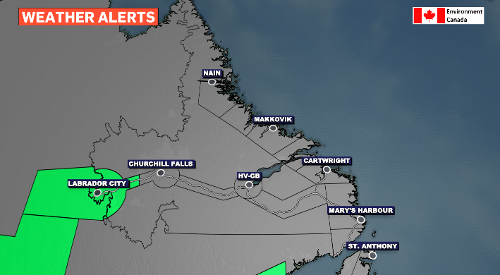
Continuing to fall in Labrador West most consistently since Monday evening, a rainfall warning is in place for Labrador City specifically, which is anticipating the highest totals.
First thing Tuesday morning, Labrador almost in it’s entirety is experiencing rain. The arch of a low-pressure system slowly takes shape through the morning, giving Happy Valley-Goose Bay a late morning relief from the heaviest rainfall.
As the rain clings to the coastline and remains in Labrador West, a south wind brings the return to a more consistent rain for Happy Valley-Goose Bay through the early afternoon to top up the region’s totals.
By nightfall, the rain is limited to light for Labrador West and the North Coast.